Browse / United States / Alaska / Nondalton
Nondalton
Alaskacity

Nondalton
Total population
103
Median home value
$88,200
Bachelor's+
Median income
$57,500
Demographic figures from US Census Bureau · ACS 5-year estimates. Overview below cites Wikipedia and may reference a different year.
City facts
Facts from Wikidata (CC0).
Overview
Nondalton is a town on the west shore of Six Mile Lake in the Lake and Peninsula Borough, Alaska, United States. At the 2020 census, the population was 133, down from 164 in 2010.
Read more on WikipediaHistory & geography
History
Nondalton is an Athabascan Indian (Tanaina and Iliamna) village. The name means "lake after lake" in their language: the village is situated along one of a line of lakes. Nondalton was first recorded in 1909. The village was originally located on the north shore of Six Mile Lake, but was moved to the present location in 1940, due to the depletion of wood and the growth of mud flats. Subsistence hunting and fishing are the major economic activities. Government is by tribal council. There is a food store with a post office attached, a state-certified public school providing pre-kindergarten through 12th grade instruction, an outpatient medical clinic with family social services, a maintained Russian Orthodox church, a fishing lodge, and a water purification plant. Uncertified water is usually piped to most houses; septic tanks are used for sewage; and electric power and telephone service is available. Nondalton is on a boil drinking water notice indefinitely. Nondalton is isolated: there are no highways or roads connecting it to other villages. The primary means of access and egress to the village is by airplane: a privately owned airport for single-engine craft services the village. Among the issues affecting the village at the start of the 21st century is the proposed Pebble Mine site to the west and in the vicinity of nearby Lake Iliamna, likely to be mining copper, gold and molybdenum porphyry in the late 2020s. There are potential impacts on fishing grounds. In addition, access to the community by land could be eased by a bridge over the Newhalen River, which would ease connection to the communities of Iliamna and Newhalen. There is a road along the Newhalen River to connect the communities, and it was later partially tarmaced, but the bridge was never…
Geography
Nondalton is located at (59.967015, -154.851636). According to the United States Census Bureau, the village has a total area of , of which is land and (4.57%) is water.
Excerpted from the corresponding Wikipedia article (CC BY-SA).
Demographics & economy
Race & ethnicity
Source: US Census Bureau — American Community Survey, 5-year estimates.
Geography
Coordinates & boundaries from the US Census TIGER/Line shapefiles.
Climate
Air quality
Industrial & pollution facilities
Natural hazard risk
Health (adults)
Age-adjusted prevalence estimates from CDC PLACES (latest release).
Walkability
Amenities nearby
Wildlife & biodiversity
Schools
Largest nearby schools
- Nondalton SchoolOther · Nondalton · 19 students · 4.8:1 ratio
Public K–12 schools within ~10 mi from Urban Institute Education Data Portal (NCES Common Core of Data, 2022).
Earthquake history
Photos
Sights & places nearby
Notable people from here
Nearby places in Alaska
- Pedro Bay28.7 mi away · pop. 14
- Pope-Vannoy Landing31.5 mi away
- Levelock94.9 mi away
- King Salmon103.8 mi away · pop. 323
- Nikolaevsk113.7 mi away · pop. 245
- Happy Valley115.6 mi away · pop. 775
- Seldovia116 mi away · pop. 202
- Ninilchik119.7 mi away · pop. 965
- Portage Creek123.1 mi away · pop. 1
- Cohoe124.4 mi away · pop. 1,598
- Kasilof127.2 mi away · pop. 313
- Salamatof129.2 mi away · pop. 1,149
Geography & sun
Elevation, sunrise/sunset and daylight from Open-Meteo. Solar climatology from NASA POWER.
Nearby airports
Public attention
Pageview totals from the Wikimedia Pageviews API.
Books about Nondalton

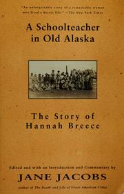

Search results from Open Library.
Recent natural events nearby
Ground air-quality sensors
Recently spotted species
Nearest stream gauge
Events
Gallery
Sources
- • Wikipedia
- • US Census Bureau (ACS 5-year estimates)
- • Wikidata
- • NCES via Urban Institute Education Data Portal
- • CDC PLACES
- • Open-Elevation
- • Open-Meteo / sunrise-sunset.org
- • Wikipedia Pageviews API
- • Open Library