Browse / United States / Alaska / Point Hope
Point Hope
Alaskacity
Total population
832
Median home value
$167,000
Bachelor's+
Median income
$74,844
Founded
1966
Demographic figures from US Census Bureau · ACS 5-year estimates. Overview below cites Wikipedia and may reference a different year.
- High Surf Advisory · MinorHigh Surf Advisory issued October 5 at 2:51PM AKDT until October 9 at 4:00AM AKDT by NWS Fairbanks AK
Source: NOAA National Weather Service.
City facts
Facts from Wikidata (CC0).
Overview
Point Hope is a city in North Slope Borough, Alaska, United States. At the 2010 census the population was 674, down from 757 in 2000. In the 2020 Census, the population rose to 830.
Read more on WikipediaHistory & geography
History
Before any modern settlement, the Ipiutak lived here. The descriptive Inuit name of the place, "Tikarakh" or "Tikiġaq", commonly spelled "Tiagara", means "forefinger". It was recorded as "Tiekagagmiut" in 1861 by P. Tikhmeniev Wich of the Russian Hydrographic Department and on Russian Chart 1495 it became "Tiekaga". This ancient village site was advantageous, because the protrusion of Point Hope into the sea brought the whales close to the shore. At Tikigaq, they built semi-subterranean houses using mainly whalebone and driftwood. Point Hope is one of the oldest continually occupied sites in North America. While some of the earlier dwellings have been lost to erosion as the point shrinks, it still provides valuable information to archaeologists on how early Eskimos survived in their harsh environment. The Tikigaq site according to Helge Larsen is, "by far the most extensive and complete one-period site yet discovered and described in the entire circumpolar region." The first recorded Europeans to sight this cape were Russian explorers Mikhail Vasiliev and Gleb Shishmaryov of the Imperial Russian Navy on the ships Otkrietie and Blagonamierennie. Vasiliev and Shishmaryov named this landhead Mys Golovnina, after Vice Admiral Vasily Golovnin (1776–1831). The cape at Point Hope was renamed by Captain Frederick William Beechey of the Royal Navy, who wrote on August 2, 1826: "I named it Point Hope in compliment to Sir William Johnstone Hope". According to Archdeacon Stuck Hope was from a "well-known house long connected with the sea". Noel Wien made the first flight here in August 1927. Point Hope residents successfully opposed Project Chariot in 1962. The project would have involved buried thermonuclear detonations some from the village to create a deep-water…
Geography
Point Hope is located in the Point Hope landhead, at the northwestern end of the Lisburne Peninsula, on the Chukchi Sea coast, southwest of Cape Lisburne, Arctic Slope at (68.347052, -166.762917). It is just above the Arctic Circle. According to the United States Census Bureau, the city has a total area of , of which, of it is land and of it (1.09%) is water. In December 2017, The New York Times profiled Point Hope, reporting that "a surprising, and bittersweet, side effect of global warming" would soon bring Point Hope "one of the fastest internet connections in America".
Excerpted from the corresponding Wikipedia article (CC BY-SA).
Demographics & economy
Race & ethnicity
Source: US Census Bureau — American Community Survey, 5-year estimates.
Geography
Coordinates & boundaries from the US Census TIGER/Line shapefiles.
Climate
Current forecast
Forecast for Point Hope, AK from NOAA NWS API.
Air quality
Industrial & pollution facilities
Natural hazard risk
Health (adults)
Age-adjusted prevalence estimates from CDC PLACES (latest release).
Walkability
Amenities nearby
Wildlife & biodiversity
Schools
Earthquake history
Most recent
- M 2.5 — 2026-07-1258 km NNE of Point Hope, Alaska
- M 3.9 — 2026-01-2585 km WSW of Kivalina, Alaska
- M 2.8 — 2025-12-1096 km S of Point Hope, Alaska
- M 2.9 — 2025-03-2764 km SSW of Point Hope, Alaska
- M 3.3 — 2025-03-1372 km SSW of Point Hope, Alaska
- M 2.8 — 2025-03-1375 km SSW of Point Hope, Alaska
Events from the USGS Earthquake Catalog (global) (FDSN Event Web Service).
Photos
Sights & places nearby
Notable people from here
People born within ~10 km, from Wikidata (CC0). Click any name for their Wikipedia article.
Geography & sun
Elevation, sunrise/sunset and daylight from Open-Meteo. Solar climatology from NASA POWER.
Nearby airports
Public attention
Pageview totals from the Wikimedia Pageviews API.
Books about Point Hope
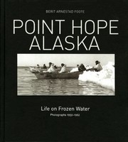
Search results from Open Library.
Recent natural events nearby
Ground air-quality sensors
Recently spotted species
Nearest stream gauge
Events
Gallery
Sources
- • Wikipedia
- • US Census Bureau (ACS 5-year estimates)
- • NOAA National Weather Service
- • Wikidata
- • USGS Earthquake Catalog (global feed)
- • CDC PLACES
- • Open-Elevation
- • Open-Meteo / sunrise-sunset.org
- • Wikipedia Pageviews API
- • Open Library