Browse / United States / Arkansas / Damascus
Damascus
Arkansastown

Damascus
Total population
348
Median home value
$165,000
Bachelor's+
Median income
$57,500
Demographic figures from US Census Bureau · ACS 5-year estimates. Overview below cites Wikipedia and may reference a different year.
City facts
Facts from Wikidata (CC0).
Overview
Damascus is a town in Faulkner and Van Buren counties of central Arkansas, United States. The population was 382 as of the 2020 Census.
Read more on WikipediaHistory & geography
History
Damascus is a town located in the Ozark foothills on a plateau surrounded by clear streams along U.S. Highway 65 on the county line between Faulkner and Van Buren counties. It is most known for its proximity to the Titan II missile base that operated from 1963 until 1980, when a missile explosion killed one person and injured twenty-one. Damascus is home to three Baptist churches, a Church of Christ that was built in 1917, and a Methodist church that was built in 1947. Damascus is also near the Gus Blass Scout Reservation, a Boy Scout Camp of 3,000 acres maintained by the Quapaw Area Council. Construction began on a Titan II missile base north of Damascus in 1961; the site became active on December 18, 1963. During routine maintenance in a Titan II silo, an Air Force repairman dropped a heavy wrench socket, which rolled off a work platform and fell toward the bottom of the silo. The socket bounced and struck the missile, causing a leak from a pressurized fuel tank. The missile complex and the surrounding area were evacuated and a team of specialists was called in from Little Rock Air Force Base, the missile's main support base. About hours after the initial puncture, fuel vapors within the silo ignited and exploded. The explosion fatally injured one member of the team. Twenty-one other USAR personnel were injured. The missile's re-entry vehicle, which contained a nuclear warhead, was recovered intact. There was no radioactive contamination. Damascus was the site of a nuclear "Broken Arrow" incident on September 18–19, 1980 when a Titan II ICBM exploded NNE of the town, although no radiation was spread as a result of the explosion. An extensive description of the Damascus accident can be found in Eric Schlosser's 2013 book: Command and Control: Nuclear Weapons, the…
Geography
According to the United States Census Bureau, the town has a total area of , all land.
Excerpted from the corresponding Wikipedia article (CC BY-SA).
Demographics & economy
Race & ethnicity
Source: US Census Bureau — American Community Survey, 5-year estimates.
Geography
Coordinates & boundaries from the US Census TIGER/Line shapefiles.
Climate
Current forecast
Forecast for Damascus, AR from NOAA NWS API.
Air quality
Industrial & pollution facilities
Natural hazard risk
Health (adults)
Age-adjusted prevalence estimates from CDC PLACES (latest release).
Walkability
Amenities nearby
Wildlife & biodiversity
Schools
Earthquake history
Photos
Sights & places nearby
Notable people from here
Nearby places in Arkansas
Geography & sun
Elevation, sunrise/sunset and daylight from Open-Meteo. Solar climatology from NASA POWER.
Nearby airports
Public attention
Pageview totals from the Wikimedia Pageviews API.
Books about Damascus
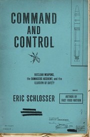


Search results from Open Library.
Recent natural events nearby
Ground air-quality sensors
Recently spotted species
Nearest stream gauge
Events
Gallery
Sources
- • Wikipedia
- • US Census Bureau (ACS 5-year estimates)
- • NOAA National Weather Service
- • Wikidata
- • CDC PLACES
- • Open-Meteo / sunrise-sunset.org
- • Wikipedia Pageviews API
- • Open Library