Browse / United States / Arkansas / Marmaduke
Marmaduke
Arkansascity

Marmaduke
Total population
1,240
Founded
1909
Demographic figures from US Census Bureau · ACS 5-year estimates. Overview below cites Wikipedia and may reference a different year.
City facts
Facts from Wikidata (CC0).
Overview
Marmaduke is a city in Greene County, Arkansas, United States. The population was 1,212 in 2020.
Read more on WikipediaHistory & geography
History
The town of Marmaduke was named for Confederate Major General John Sappington Marmaduke, remembered for the Poison Spring massacre and who later served as governor of Missouri. Marmaduke was said to have established a camp for his soldiers near the site of the present town. The Texas and St. Louis Railroad was built through the area in 1882. Marmaduke was incorporated on August 2, 1909, and, by 1914, had expanded to include two drugstores, three banks, three restaurants, a Methodist and a Southern Baptist church, two barber shops, a hotel, a boarding house, and two dime stores. The primary employers at the time were a sawmill, a lumber mill, a stave mill, and large and cut timber distributors. Current industry includes the Anchor plastics company and the American Railcar Company. The community was severely damaged by a severe tornado on April 2, 2006. At least half of the town was reported to have been destroyed or even flattened, and nearly every structure received some degree of damage. No one was killed in Marmaduke, but at least 50 people were injured, some seriously. In 2009, a major ice storm came across the northern part of Arkansas, causing the village, together with other regions, to lose electricity for a few weeks. Since then, the town has almost fully recovered.
Geography
Marmaduke is located in northeastern Greene County. U.S. Route 49 passes through the center of Marmaduke, leading northeast to Piggott and southwest to Paragould, the Greene County seat. Arkansas Highway 34 crosses US 49 in the center of town; it leads east to Arkansas Highway 139 at Fritz and west to Lafe. The city has a total area of , all land. Marmaduke is in the northern part of the Arkansas Delta physical region and sits just east of Crowley's Ridge. The Missouri state line, following the St. Francis River, is to the east.
Excerpted from the corresponding Wikipedia article (CC BY-SA).
Demographics & economy
Geography
Coordinates & boundaries from the US Census TIGER/Line shapefiles.
Climate
Current forecast
Forecast for Marmaduke, AR from NOAA NWS API.
Air quality
Industrial & pollution facilities
Natural hazard risk
Health (adults)
Age-adjusted prevalence estimates from CDC PLACES (latest release).
Walkability
Amenities nearby
Wildlife & biodiversity
Schools
Earthquake history
Most recent
- M 2.63 — 2026-08-046 km ENE of Steele, Missouri
- M 2.93 — 2026-06-3014 km SSW of Williamsville, Missouri
- M 2.64 — 2026-05-2912 km E of Williamsville, Missouri
- M 2.64 — 2026-05-158 km NW of Tiptonville, Tennessee
- M 4 — 2026-04-231 km WNW of Cooter, Missouri
- M 2.84 — 2026-03-023 km NW of Marston, Missouri
Events from the USGS Earthquake Catalog (global) (FDSN Event Web Service).
Photos
Sights & places nearby
Notable people from here
People born within ~10 km, from Wikidata (CC0). Click any name for their Wikipedia article.
Nearby places in Arkansas
Geography & sun
Elevation, sunrise/sunset and daylight from Open-Meteo. Solar climatology from NASA POWER.
Nearby airports
Public attention
Pageview totals from the Wikimedia Pageviews API.
Books about Marmaduke

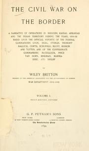
Search results from Open Library.
Recent natural events nearby
- Wildfire Pine Tree Rd, Union, ArkansasWildfires · 2026-08-20 · 241 mi
Wildfires, storms and other events from NASA EONET (last 12 months, within 250 mi).
Ground air-quality sensors
Recently spotted species
Nearest stream gauge
Events
Gallery
Sources
- • Wikipedia
- • NOAA National Weather Service
- • Wikidata
- • USGS Earthquake Catalog (global feed)
- • CDC PLACES
- • Open-Meteo / sunrise-sunset.org
- • Wikipedia Pageviews API
- • Open Library
- • NASA EONET