Browse / Austria / Upper Austria / Braunau am Inn
Braunau am Inn
Upper Austriatown

Braunau am Inn
Total population
16,380
Demographic figures from Statistik Austria. Overview below cites Wikipedia and may reference a different year.
City facts
Sister cities
Facts from Wikidata (CC0).
Overview
Braunau am Inn is a town in Upper Austria on the border with the German state of Bavaria. It is the birthplace of Adolf Hitler, who lived there until the age of three.
Read more on WikipediaHistory & geography
History
While the abbey of Ranshofen was already mentioned in the course of the deposition of Tassilo III, Duke of Bavaria, in 788, Braunau itself first appeared as Prounaw in an 1120 deed. The Innviertel region then was part of the Duchy of Bavaria. Braunau received town rights in 1260, one of the first in present-day Austria. It became a fortress town and important trading route junction, dealing with the salt trade and with ship traffic on the Inn. As a major Bavarian settlement, the town played an outstanding role in the Bavarian uprising against the Austrian occupation during the War of the Spanish Succession, when it hosted the Braunau Parliament, a provisional Bavarian Parliament in 1705 headed by Georg Sebastian Plinganser (born 16 April 1680 in Pfarrkirchen; died 7 May 1738 in Augsburg). The Late Gothic Braunau parish church dedicated to Saint Stephen was built from 1439 to 1466, replacing an older chapel. Its high spire is one of the tallest in Austria and the town's landmark. The remains of the fortress today house a museum and parts of the former town walls can still be seen. Another museum is housed in refurbished 18th-century public baths. Within 40 years, Braunau changed hands three times: In 1779, it became an Austrian town under the terms of the Treaty of Teschen, which settled the War of the Bavarian Succession. During the War of the Third Coalition, the Nuremberg bookseller Johann Philipp Palm was arrested at the Braunau fortress by French troops and executed for high treason by personal order of Napoleon in 1806. Under the terms of the 1809 Treaty of Schönbrunn, Braunau became Bavarian again in 1809. In 1816, during reorganisation of Europe after the Napoleonic Wars at the Congress of Vienna, the Kingdom of Bavaria ceded the town to the Austrian Empire…
Geography
The town is on the lower river Inn below its confluence with the Salzach, where it forms the border with the German state of Bavaria, halfway on the road between the state capital Linz and the Bavarian capital Munich, about north of Salzburg. Braunau is connected by bridges over the Inn with its Bavarian counterpart Simbach am Inn. A traditional port of entry, all border controls have been abolished since the implementation of the Schengen Agreement by Austria in 1997. The town gave its name to the administrative district (). As of 2025, Braunau am Inn has a population of 17,604. The municipality of Braunau am Inn consists of the following cadastral communities: Braunau am Inn, Osternberg, and Ranshofen; while further subdivided into populated places (with population in brackets as of 1 January 2022). * Aching (22) * Au (11) * Blankenbach (105) * Braunau am Inn (4308) * Braunau Neustadt (2037) * Gasteig (30) * Haiden (91) * Haselbach (2940) * Himmellindach (178) * Höft (12) * Laab (3069) * Lach (96) * Lindach (19) * Maierhof (114) * Neue Heimat (1015) * Oberrothenbuch (24) * Osternberg (502) * Ranshofen (2372) * Roith (21) * Scheuhub (400) * Tal (89) * Unterrothenbuch (31) Braunau am Inn has a borderline humid continental climate (Dfb) with warm summers and fairly cold winters. The month with the lowest monthly mean temperature is January, at −0.4°C, which is just below the 0.0°C isotherm required for the town to be classified as having a continental rather than an oceanic climate. Precipitation is relatively evenly spread throughout the year, despite a notable uptick during the summer months. Frost and snowfall are very common during the winter months, though significant or deep snow accumulation has become rarer in recent decades. The nearest GeoSphere…
Excerpted from the corresponding Wikipedia article (CC BY-SA).
Geography
Coordinates & boundaries from the US Census TIGER/Line shapefiles.
Climate
Air quality
Walkability
Amenities nearby
Wildlife & biodiversity
Earthquake history
Photos
Sights & places nearby
Notable people from here


People born within ~10 km, from Wikidata (CC0). Click any name for their Wikipedia article.
Geography & sun
Elevation, sunrise/sunset and daylight from Open-Meteo. Solar climatology from NASA POWER.
Nearby airports
Public attention
Pageview totals from the Wikimedia Pageviews API.
Books about Braunau am Inn
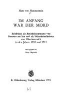
Search results from Open Library.
Recent natural events nearby
Ground air-quality sensors
Recently spotted species
Events
Gallery
Official Identifiers
Statistik Austria
- GKZ
- 40404
- Population (Wikidata)
- 17,095
- Wikidata
- Q131128
Gemeindekennziffer via Wikidata P964
Sources
- • Wikipedia
- • Wikidata
- • Open-Meteo / sunrise-sunset.org
- • Wikipedia Pageviews API
- • Open Library
- • Statistik Austria — Gemeindekennziffer via Wikidata P964