Browse / Austria / Lower Austria / Klosterneuburg
Klosterneuburg
Lower Austriatown

Klosterneuburg
Total population
26,816
Demographic figures from Statistik Austria. Overview below cites Wikipedia and may reference a different year.
City facts
Sister cities
Facts from Wikidata (CC0).
Overview
Klosterneuburg is a town in the Tulln District of the Austrian state of Lower Austria. Frequently abbreviated to Kloburg by locals, it has a population of about 27,500. The Stift Klosterneuburg, which was established in 1114 and soon after given to the Augustinians, is of particular historical importance.
Read more on WikipediaHistory & geography
History
Archaeological findings denote a settlement of the area already during the Neolithic period. In the Roman era (1st to 5th centuries), a fort of the Danubian limes stood at the site of Klosterneuburg on the northwestern border of the Pannonia. After Charlemagne had defeated the Avars, a Carolingian settlement in the newly established Avar March recorded as Omundesdorf may correspond to the site of the town. Klosterneuburg itself was first mentioned as Nivvenburc (Neuburg, "New Castle") in an 1108 deed. In 1113 it became the residence[after Melk] of the Babenberg margrave Leopold III, the later patron saint of Austria. In 1114 Leopold, son-in-law of the Salian emperor Henry IV by his marriage with Agnes of Wailingen, had a princely castle erected together with a collegiate church on a hill rising directly from the banks of the Danube, and the 1683 Battle of Vienna whereas the fortified "Obere Stadt" was successfully defended in both cases. In the 18th century Emperor Charles VI, who could not prevail in the War of the Spanish Succession, set up plans to rebuild the Klosterneuburg monastery complex modelled on the Escorial. The construction of the Baroque buildings began in 1730; however, it did not survive an initial phase. After the Austrian defeat in the 1805 Battle of Austerlitz, the town was occupied by Napoleonic troops until 1809. A winemaker's town during the 19th century, Klosterneuburg developed to a recreational and residential area of Austrian officials working in the nearby capital. During the Anschluss of Austria to Nazi Germany from 1938, Klosterneuburg was incorporated as the 26th district of "Greater Vienna", which was reversed with the establishment of Wien-Umgebung District in 1954. At the end of 2016 Wien-Umgebung District was dissolved and…
Geography
Klosterneuburg is located on the Danube, immediately north of the Austrian capital Vienna, from which it is separated by the Kahlenberg and Leopoldsberg hills of the Vienna Woods range. It has been separated from its twin city of Korneuburg on the opposite bank of the Danube since the river changed course during the Late Middle Ages. The towns are connected by a reaction ferry link which runs during daylight hours from Spring to late Autumn. The municipal area comprises the northern tip of the Donauinsel as well as the high Mt. Exelberg and its telecommunication tower. On the site of a former pioneer school of the Austrian Army Austrian Bundesheer are a variety of buildings due to be developed into a 12-hectare new town quarter by 2030. Klosterneuburg is also the centre of a wine growing area, with several esteemed vintners, numerous Heuriger wine taverns and the Federal Institute for Viticulture and Pomology Weinbauschule, where Fritz Zweigelt bred the Zweigelt and Blauburger red wine grapes. Due to its hilly location, Klosterneuburg consists of several geographical areas within the cadastral communities of Klosterneuburg-Stadt, Maria Gugging, , , , , and . Its town centre has two main shopping areas - the Stadtplatz/Niedermarkt and the Rathausplatz - which are separated by a steep hill. The town is tightly linked to the Austrian capital and is thought to be home to some of Lower Austria's most affluent citizens . It has direct access to Vienna via the Klosterneuburger Straße highway (B14), the Vienna S-Bahn network running on the Emperor Franz Joseph Railway line (S40) from Franz-Josefs-Bahnhof to Tulln, and along the EV6 The Rivers cycle route. The town is the site of light industry and, while not belonging to Vienna, has almost the feel of a suburb. From 1938…
Excerpted from the corresponding Wikipedia article (CC BY-SA).
Geography
Coordinates & boundaries from the US Census TIGER/Line shapefiles.
Climate
Air quality
Walkability
Amenities nearby
Wildlife & biodiversity
Earthquake history
Photos
Sights & places nearby
Notable people from here


People born within ~10 km, from Wikidata (CC0). Click any name for their Wikipedia article.
Nearby places in Lower Austria
- Bisamberg2.5 mi away · pop. 4,110
- Korneuburg2.7 mi away
- Klein-Engersdorf3.5 mi away · pop. 615
- Flandorf4 mi away · pop. 401
- Königsbrunn5.1 mi away · pop. 605
- Tresdorf5.5 mi away · pop. 626
- Seebarn6 mi away · pop. 227
- Enzersfeld6.1 mi away · pop. 1,079
- Gerasdorf bei Wien6.7 mi away · pop. 9,069
- Rückersdorf6.7 mi away · pop. 625
- Wolfpassing6.7 mi away · pop. 888
- Putzing am See7 mi away
Geography & sun
Elevation, sunrise/sunset and daylight from Open-Meteo. Solar climatology from NASA POWER.
Nearby airports
Public attention
Pageview totals from the Wikimedia Pageviews API.
Books about Klosterneuburg
Search results from Open Library.
Recent natural events nearby
Ground air-quality sensors
Recently spotted species
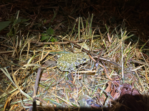
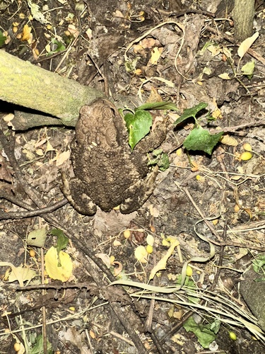
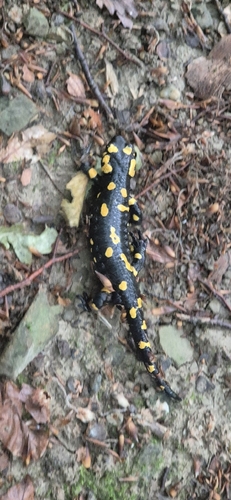
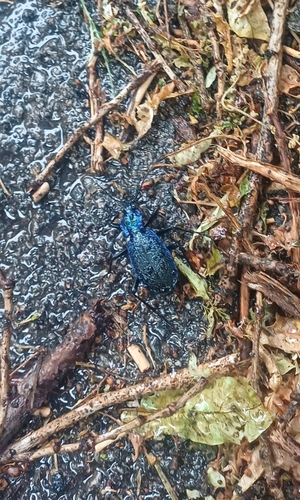

Research-grade observations from iNaturalist (within ~15 mi).
Events
Gallery
Geotagged photos within ~6 miles of Klosterneuburg, from Wikimedia Commons contributors.
 0.1 mi
 0.1 mi
 0.1 mi
 0.1 mi
 0.1 mi
 0.1 mi
 0.1 mi
 0.1 mi
 0.1 mi
 0.1 mi
 0.1 mi
 0.1 mi
 0.1 mi
 0.1 mi
 0.1 mi
 0.1 mi
 0.1 mi
 0.1 mi
 0.1 mi
 0.1 mi
 0.1 mi
_Statue_Johannes_Nepomuk.JPG) 0.1 mi
0.1 mi_2015-07-25-094.jpg) 0.1 mi
0.1 mi_2015-07-25-091.jpg) 0.1 mi
0.1 miPhotos via Wikimedia Commons — see each image page for license & attribution.
Official Identifiers
Statistik Austria
- GKZ
- 32144
- Population (Wikidata)
- 27,058
- Wikidata
- Q487522
Gemeindekennziffer via Wikidata P964
Sources
- • Wikipedia
- • Wikimedia Commons
- • Wikidata
- • iNaturalist
- • Open-Meteo / sunrise-sunset.org
- • Wikipedia Pageviews API
- • Open Library
- • Statistik Austria — Gemeindekennziffer via Wikidata P964