Browse / Australia / New South Wales / Adelong
Adelong
New South Walestown

Adelong
Total population
856
Founded
1836
Demographic figures from Australian Bureau of Statistics. Overview below cites Wikipedia and may reference a different year.
City facts
Facts from Wikidata (CC0).
Overview
Adelong is a small town in the Riverina region of New South Wales, Australia, on the banks of the Adelong Creek. Adelong sits on the Snowy Mountains Highway and is a part of the Snowy Valleys Council. At the 2021 census, Adelong had an urban population of 856.
Read more on WikipediaHistory & geography
History
The area now known as Adelong lies on the traditional lands of the Wiradjuri people. In 1852 during the Australian Gold Rush, gold was discovered at Upper Adelong. Records around the time indicated a yield of 198 kg of precious metals. In 1855 Adelong was declared a gold field. The Adelong township, which was first established in 1836, came alive when in 1857 William Willams discovered a gold bearing reef ore on Charcoal Hill. Alluvial mining and panning along the Adelong Creek was followed by mines being staked in the surrounding hills and water and steam powered stamper batteries were located along the creek to crush and process the hard pyritic quartz ore. These included the heritage-listed Adelong Falls Gold Workings. There were a number of deep quartz reef mines at Adelong, including the Great Victoria Mine. The gold ran out in the first part of the 20th century and the pastoral industry became the principal activity. This was mainly Merino sheep and beef cattle, and continues now. Over the last 20 years a tourist industry has developed because of the pleasant scenery and gold mining history. During the gold rush many Chinese people worked in the mines, a lot of whom died and were buried in a special portion of the Adelong cemetery. One or two elderly Chinese and Indians still lived in Adelong in the 1950s. A community named Cornishtown existed about a mile to the west of Adelong until the 1940s.
Excerpted from the corresponding Wikipedia article (CC BY-SA).
Geography
Coordinates & boundaries from the US Census TIGER/Line shapefiles.
Climate
Air quality
Walkability
Amenities nearby
Wildlife & biodiversity
Most-observed species
- Australian MagpieGymnorhina tibicen (Latham, 1802) · Aves596
- Superb FairywrenMalurus cyaneus (Ellis, 1782) · Aves541
- GalahEolophus roseicapilla (Vieillot, 1817) · Aves436
- Crimson RosellaPlatycercus elegans (Gmelin, 1788) · Aves369
- Sulphur-crested CockatooCacatua galerita (Latham, 1790) · Aves366
- Gray FantailRhipidura albiscapa Gould, 1840 · Aves351
- Maned DuckChenonetta jubata (Latham, 1801) · Aves318
- Laughing KookaburraDacelo novaeguineae (Hermann, 1783) · Aves312
Citizen-science & research observations from the Global Biodiversity Information Facility (GBIF).
Earthquake history
Most recent
- M 3.7 — 2012-04-1936 km ENE of Tumut, Australia
- M 2.6 — 2007-04-2935 km W of Yass, Australia
- M 2.9 — 2005-01-0235 km W of Duffy, Australia
- M 2.8 — 2004-09-2130 km SSW of Boorowa, Australia
- M 3.9 — 2004-02-2816 km SSE of Junee, Australia
- M 3.3 — 2003-07-1115 km WNW of Cootamundra, Australia
Events from the USGS Earthquake Catalog (global) (FDSN Event Web Service).
Photos
Sights & places nearby
Notable people from here


People born within ~10 km, from Wikidata (CC0). Click any name for their Wikipedia article.
Nearby places in New South Wales
Geography & sun
Elevation, sunrise/sunset and daylight from Open-Meteo. Solar climatology from NASA POWER.
Nearby airports
Public attention
Pageview totals from the Wikimedia Pageviews API.
Books about Adelong
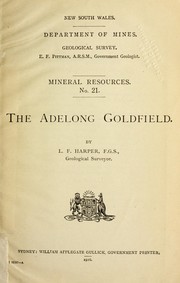
Search results from Open Library.
Recent natural events nearby
Ground air-quality sensors
Recently spotted species
Events
Gallery
Sources
- • Wikipedia
- • Wikidata
- • USGS Earthquake Catalog (global feed)
- • GBIF (Global Biodiversity Information Facility)
- • Open-Meteo / sunrise-sunset.org
- • Wikipedia Pageviews API
- • Open Library