Browse / Australia / Northern Territory / Borroloola
Borroloola
Northern Territoryvillage

Borroloola
Total population
755
Demographic figures from Australian Bureau of Statistics. Overview below cites Wikipedia and may reference a different year.
City facts
Facts from Wikidata (CC0).
Overview
Borroloola is a town in the Northern Territory of Australia. It is located on the McArthur River, about 50 km (31 mi) upstream from the Gulf of Carpentaria.
Read more on WikipediaHistory & geography
History
Garrwa (also known as Garawa) is a language of the Gulf region, taking in the localities of Borroloola and Westmoreland. The Garrwa language region takes in the landscape of the Roper Gulf Regional Council and the Doomadgee Shire Council. The Garrwa name for the town is Burrulula. The 'Coast Track' follows the path of cattle drovers of the late 19th century as they moved herds from north-west Queensland to stock the new stations of the Northern Territory and the Kimberley. The drovers, in turn, followed a well-worn Aboriginal path. Tony Roberts writes how the local tribes went from almost total isolation from European Australians in 1870, to a decimated collection of displaced and defeated groups, over a single decade. Entire tribes such as the Wilangarra, including women, children and babies were massacred, and most adult males were killed, by police and quasi-police groups, and by drovers and station workers involved in the cattle droves of that era. Borroloola was declared a town on 10 September 1885. In the local Indigenous languages of Yanyuwa, Garrwa, Marra, Gudanji and Binbingka, Borroloola would be written as Burrulula. The name belongs to a small lagoon just to the east of the present day caravan park. The name originally Borrolooloo, translates borrow women, name of the lagoon and associated with the Hill Kangaroo. It was at this site that the Hill Kangaroo Ancestral Being (Nangurrbuwala) danced his ceremonies. The white-barked gum trees in the area are said to be his body decorations as they flew from his body as he danced. Other Indigenous names in the area of Borroloola are Wurrarawala (Trig Hill) this hill is associated with the backbone of the Hill Kangaroo Ancestor. Bunubunu (Rocky Creek), this creek is associated with a File Snake Ancestor.…
Excerpted from the corresponding Wikipedia article (CC BY-SA).
Geography
Coordinates & boundaries from the US Census TIGER/Line shapefiles.
Climate
Air quality
Walkability
Amenities nearby
Wildlife & biodiversity
Earthquake history
Events from the USGS Earthquake Catalog (global) (FDSN Event Web Service).
Photos
Sights & places nearby
Notable people from here

People born within ~10 km, from Wikidata (CC0). Click any name for their Wikipedia article.
Nearby places in Northern Territory
Geography & sun
Elevation, sunrise/sunset and daylight from Open-Meteo. Solar climatology from NASA POWER.
Nearby airports
Public attention
Pageview totals from the Wikimedia Pageviews API.
Books about Borroloola
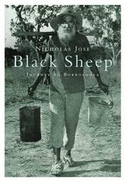

Search results from Open Library.
Recent natural events nearby
Ground air-quality sensors
Recently spotted species
Events
Gallery
Sources
- • Wikipedia
- • Wikidata
- • USGS Earthquake Catalog (global feed)
- • Open-Meteo / sunrise-sunset.org
- • Wikipedia Pageviews API
- • Open Library