Browse / Australia / Northern Territory / Daly River
Daly River
Northern Territoryvillage

Daly River
Total population
350
Air quality index
Demographic figures from Australian Bureau of Statistics. Overview below cites Wikipedia and may reference a different year.
City facts
Overview
Daly River is a town adjacent to the Daly River in the Northern Territory of Australia. At the 2006 census, Daly River had a population of 468. The town is part of the Victoria Daly Region local government area. The area is popular for recreational fishing, being regarded as one of the best places to catch barramundi in Australia.
Read more on WikipediaHistory & geography
History
The traditional owners of the area are the Mulluk-Mulluk people who live both in Nauiyu and at Wooliana downstream from the community. European settlement of Daly River began in 1865 with the arrival of Boyle Travers Finniss, the first Premier of South Australia and the first Government Resident of the Northern Territory. Finniss named the river after Sir Dominick Daly, the Governor of South Australia, since the Northern Territory was at that time part of South Australia. The region lay untouched by Europeans until 1882 when copper was discovered. Daly River town was the scene of some particularly bloody exchanges between the local Aborigines and the miners. In 1884 three miners were killed. The miners in the town wreaked vengeance on the local Aborigines out of proportion to the perceived crime. A year later, probably aware of the tensions in the area, the Society of Jesus order of the Roman Catholic Church established a mission in the town, introducing Christianity and farming techniques to the local Aboriginal population. The original mission endured until 1899, when following a significant flood the missionaries were withdrawn. In 1954, contact between traditional Malak Malak elders and the then bishop of Darwin led to the mission being reestablished. In 1955, the church purchased of land and the Missionaries of the Sacred Heart helped to establish a school and a clinic for the community. The mission was later renamed Nauiyu and with the exception of the church, convent, school and associated residences transferred to community ownership. Due to the influence of the mission in the town, 75% percent of the population identify as Roman Catholics. Through the twentieth century there were a number of attempts to settle the town without real success. In 1911…
Excerpted from the corresponding Wikipedia article (CC BY-SA).
Geography
Coordinates & boundaries from the US Census TIGER/Line shapefiles.
Climate
10-year averages from ERA5 reanalysis (Open-Meteo).
Air quality
Current readings from Open-Meteo Air Quality API (Copernicus CAMS European reanalysis).
Walkability
Amenities nearby
Wildlife & biodiversity
Most-observed species
- BluestemAndropogon gayanus Kunth · Liliopsida551
- saltwater crocodileCrocodylus porosus Schneider, 1801 · Crocodylia349
- Freshwater crocodileCrocodylus johnsoni Krefft, 1873 · Crocodylia232
- Bar-shouldered DoveGeopelia humeralis (Temminck, 1821) · Aves85
- Whistling KiteHaliastur sphenurus (Vieillot, 1818) · Aves76
- Green OrioleOriolus flavocinctus (King, 1826) · Aves72
- Spangled DrongoDicrurus bracteatus Gould, 1843 · Aves70
- White-gaped HoneyeaterStomiopera unicolor (Gould, 1843) · Aves66
Citizen-science & research observations from the Global Biodiversity Information Facility (GBIF).
Earthquake history
Events from the USGS Earthquake Catalog (global) (FDSN Event Web Service).
Photos
Sights & places nearby
Notable people from here

People born within ~10 km, from Wikidata (CC0). Click any name for their Wikipedia article.
Nearby places in Northern Territory
- Emu Point37.8 mi away
- Eva Valley48.2 mi away
- Peppimenarti49.5 mi away · pop. 185
- Channel Point Community55.3 mi away
- Bynoe65.5 mi away
- Dundee Beach71.7 mi away
- Livingstone78.5 mi away · pop. 1,038
- Noonamah81.4 mi away · pop. 483
- Manthathpe86.1 mi away
- Bees Creek86.3 mi away · pop. 1,000
- Koolpinyah86.4 mi away
- Coolalinga88 mi away
Geography & sun
Elevation, sunrise/sunset and daylight from Open-Meteo. Solar climatology from NASA POWER.
Nearby airports
Public attention
Pageview totals from the Wikimedia Pageviews API.
Books about Daly River
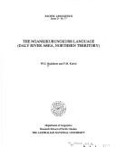


Search results from Open Library.
Recent natural events nearby
Ground air-quality sensors
Recently spotted species
Events
Gallery
Sources
- • Wikipedia
- • Open-Meteo (ERA5 reanalysis)
- • Wikidata
- • Open-Meteo Air Quality (CAMS)
- • USGS Earthquake Catalog (global feed)
- • GBIF (Global Biodiversity Information Facility)
- • Open-Meteo / sunrise-sunset.org
- • Wikipedia Pageviews API
- • Open Library