Browse / Australia / New South Wales / Mossgiel
Mossgiel
New South Waleshamlet

Mossgiel
Total population
41
Air quality index
Demographic figures from Australian Bureau of Statistics. Overview below cites Wikipedia and may reference a different year.
City facts
Overview
Mossgiel is a location in New South Wales, Australia, in Carrathool Shire. It was a township on the coach route between the Lachlan and Darling Rivers, 50 km southeast of Ivanhoe near the junction with the road to Hillston. The settlement experienced a steady decline during the 20th century. Nowadays Mossgiel township consists of one house and a community hall.
Read more on WikipediaHistory & geography
History
In about 1864 the Desailly brothers (Francis and George) established 'Mossgiel' and 'Booligal' stations. 'Mossgiel' run was a back block station so a great effort was required to provide water for stock. The Desaillys employed a large cohort of men to fence, dig tanks and sink wells, "and imported the first centrifugal pump and steam engine in the Riverina". Water raised by whims and by the steam-driven pump was fed into iron troughs at each well. In about October 1868 Thomas Grace and John Kilbride began a coach service between Booligal and towns on the Darling River, extending as far as Mount Murchison township (Wilcannia). In late 1868 Robert Riordan built a hotel at Mossgiel (on the coach route to the Darling). He was granted a publican's license for the Mossgiel Hotel in February 1869. At about the same time it was reported that George Williamson, the proprietor of the Post-office Store at Booligal, was "about to put up a large general store at Mossgiel". In December 1869 William Carter was granted a hotel license for the Wool-pack Hotel at Mossgiel. In January 1870 a post-office was established at Mossgiel with J. Herbert Taylor as postmaster. By December 1872 a blacksmith, William Barns, and a saddler, J. J. Allen, had started businesses in the township. In April 1873 the Hay Police Court refused an application by Henry Jonsen for a publican's license at Mossgiel on the grounds that "there are two [hotels] already there and no town whatever, only the Mossgiel station". It was added: "The drinking there is said to be fearful". In 1878 Isadore Galland opened a "large and commodious store" at Mossgiel selling "Grocery, Drapery, Boots, &c., &c.". Galland also had "two hawker's waggons constantly on the road with a large and varied supply of goods". A…
Excerpted from the corresponding Wikipedia article (CC BY-SA).
Geography
Coordinates & boundaries from the US Census TIGER/Line shapefiles.
Climate
Air quality
Current readings from Open-Meteo Air Quality API (Copernicus CAMS European reanalysis).
Walkability
Amenities nearby
Wildlife & biodiversity
Most-observed species
- African BoxthornLycium ferocissimum Miers · Magnoliopsida15
- Australian KestrelFalco cenchroides Vigors & Horsfield, 1827 · Aves13
- Gray TealAnas gracilis Buller, 1869 · Aves12
- Magpie-larkGrallina cyanoleuca (Latham, 1802) · Aves11
- EmuDromaius novaehollandiae (Latham, 1790) · Aves11
- fairy grassSporobolus caroli Mez · Liliopsida11
- Australian MagpieGymnorhina tibicen (Latham, 1802) · Aves10
- Black KiteMilvus migrans (Boddaert, 1783) · Aves10
Citizen-science & research observations from the Global Biodiversity Information Facility (GBIF).
Earthquake history
Events from the USGS Earthquake Catalog (global) (FDSN Event Web Service).
Photos
Sights & places nearby
Notable people from here
Nearby places in New South Wales
Geography & sun
Elevation, sunrise/sunset and daylight from Open-Meteo. Solar climatology from NASA POWER.
Nearby airports
Public attention
Pageview totals from the Wikimedia Pageviews API.
Books about this place
Recent natural events nearby
Ground air-quality sensors
Recently spotted species
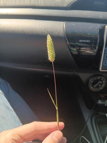
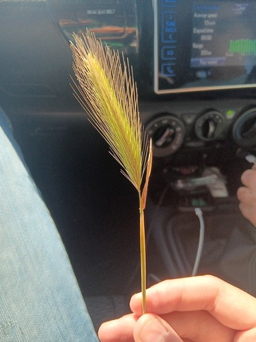
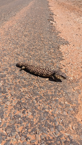
Research-grade observations from iNaturalist (within ~15 mi).
Events
Gallery
Official Identifiers
ABS — Australian Bureau of Statistics
- ASGS 2021
- SAL12751
- Population (Wikidata)
- 26
- Wikidata
- Q6916657
ASGS 2021 ID via Wikidata P10112
Sources
- • Wikipedia
- • Wikidata
- • Open-Meteo Air Quality (CAMS)
- • USGS Earthquake Catalog (global feed)
- • GBIF (Global Biodiversity Information Facility)
- • iNaturalist
- • Open-Elevation
- • Open-Meteo / sunrise-sunset.org
- • Wikipedia Pageviews API
- • ABS — Australian Bureau of Statistics — ASGS 2021 ID via Wikidata P10112