Browse / Australia / New South Wales / Newcastle
Newcastle
New South Walescity

Newcastle
Total population
348,539
Founded
1804
Air quality index
Demographic figures from Australian Bureau of Statistics. Overview below cites Wikipedia and may reference a different year.
City facts
Sister cities
Facts from Wikidata (CC0).
Overview
Newcastle, also known as Greater Newcastle, is a large metropolitan area and the second-most-populous such area of New South Wales, Australia. It includes the cities of Newcastle and Lake Macquarie and it is the hub of the Lower Hunter region, which includes most parts of the cities of Newcastle, Lake Macquarie, Maitland, Cessnock, and Port Stephens Council. Newcastle is also known by its colloquial nickname, Newy. A Newcastle resident can also be known as a Novocastrian.
Read more on WikipediaHistory & geography
History
Newcastle and the lower Hunter Region were traditionally occupied by the Awabakal and Worimi Aboriginal people, who called the area Malubimba. Based on Aboriginal-language references documented in maps, sketches and geological descriptions, eight landmarks have been officially dual-named by the NSW Geographic Names Board with their traditional Aboriginal names. They include Nobbys Head also known as Whibayganba; Flagstaff Hill also known as Tahlbihn; Pirate Point also known as Burrabihngarn; Port Hunter also known as Yohaaba; Hunter River (South Channel) also known as Coquun; Shepherds Hill also known as Khanterin; Ironbark Creek also known as Toohrnbing and Hexham Swamp also known as Burraghihnbihng. Over a year later, in September 1797, Lieutenant John Shortland explored the area and named the Hunter River. This was largely accidental, as he had been sent to the region in search of a number of convicts who had seized a vessel called Cumberland while it was sailing from Sydney Cove. Lieutenant Shortland entered what he later described as "a very fine river", which he named after New South Wales' Governor John Hunter. He returned with reports of the deep-water port and the area's abundant resources of coal and cedar. Over the next two years, influential colonists like Simeon Lord and James Underwood sent vessels and workers to the region to extract the valuable coal and cedarwood. Some of these workers skirmished with local Awabakal men, and an armed party under Henry Hacking was dispatched to investigate, which resulted in the shooting of several Aboriginal people. Coal mined from the area was the New South Wales colony's first export. The first consignment, consisting of 34 convicts and a military guard, arrived at the Hunter River on 27 March 1804 in three…
Geography
Newcastle is on the southern bank of the Hunter River mouth. The northern side is dominated by sand dunes, swamps and multiple river channels. A "green belt" protecting plant and wildlife flanks the city from the west (Watagan Mountains) around to the north where it meets the coast just north of Stockton. Urban development is mainly restricted to the hilly southern bank. The small town of Stockton sits opposite central Newcastle at the river mouth and is linked by ferry. Road access between Stockton and central Newcastle is via the Stockton Bridge, a distance of . Much of the city is undercut by the coal measures of the Sydney sedimentary basin, and what were once numerous coal-mining villages located in the hills and valleys around the port have merged into a single urban area extending southwards to Lake Macquarie. The Greater Newcastle area is situated right between the Central Coast and Mid North Coast regions, with the Central Coast bordering in the south and the Mid North Coast bordering in the north as well as other Hunter local government areas (outside of Newcastle) bordering in the west and north-west. Newcastle has several public parks including King Edward Park, which was designated in 1863. Features of the park include coastal views, a sunken garden and a Victorian rotunda. Newcastle has a humid subtropical climate (Cfa) that is typical of the Australian east coast. Precipitation is heaviest in late autumn and early winter, while the second half of the year is slightly drier on average. The climate is generally moderated by the Pacific Ocean to the east. Summers are mostly warm and humid with periods of very dry and hot weather occasionally due to hot west to north-westerly winds, which can bring temperatures in excess of . The highest recorded…
Excerpted from the corresponding Wikipedia article (CC BY-SA).
Geography
Coordinates & boundaries from the US Census TIGER/Line shapefiles.
Climate
Air quality
Current readings from Open-Meteo Air Quality API (Copernicus CAMS European reanalysis).
Walkability
Amenities nearby
Wildlife & biodiversity
Most-observed species
- Australian MagpieGymnorhina tibicen (Latham, 1802) · Aves11,501
- Rainbow LorikeetTrichoglossus haematodus (Linnaeus, 1771) · Aves10,182
- Noisy MinerManorina melanocephala (Latham, 1801) · Aves9,391
- Australian RavenCorvus coronoides Vigors & Horsfield, 1827 · Aves9,339
- Masked LapwingVanellus miles (Boddaert, 1783) · Aves8,509
- Magpie-larkGrallina cyanoleuca (Latham, 1802) · Aves8,429
- Superb FairywrenMalurus cyaneus (Ellis, 1782) · Aves7,705
- Welcome SwallowHirundo neoxena Gould, 1842 · Aves7,453
Citizen-science & research observations from the Global Biodiversity Information Facility (GBIF).
Earthquake history
Most recent
- M 5.1 — 2025-04-2218 km SW of Singleton, Australia
- M 3.2 — 2012-09-1033 km ESE of Blue Bay, Australia
- M 3.3 — 2010-03-118 km NE of Hawks Nest, Australia
- M 2.8 — 2004-05-1523 km ENE of Dungog, Australia
Events from the USGS Earthquake Catalog (global) (FDSN Event Web Service).
Photos
Sights & places nearby
Notable people from here


People born within ~10 km, from Wikidata (CC0). Click any name for their Wikipedia article.
Nearby places in New South Wales
- Mulbring17.5 mi away · pop. 366
- Tomalpin19.4 mi away
- Kitchener24.4 mi away · pop. 554
- Paterson24.5 mi away · pop. 345
- Half Moon Brush27.8 mi away
- Wallaby Gully27.9 mi away
- Pelton28 mi away · pop. 86
- Paxton28.9 mi away · pop. 1,160
- Puxtys Hollow29.6 mi away
- Mootai29.8 mi away
- Kealys Bight32.3 mi away
- Alison34.3 mi away · pop. 95
Geography & sun
Elevation, sunrise/sunset and daylight from Open-Meteo. Solar climatology from NASA POWER.
Nearby airports
Public attention
Pageview totals from the Wikimedia Pageviews API.
Books about Newcastle
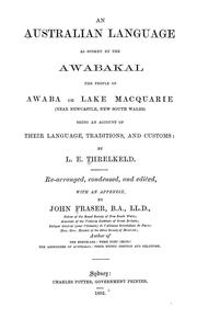
Search results from Open Library.
Recent natural events nearby
Ground air-quality sensors
Recently spotted species
Events
Gallery
Geotagged photos within ~6 miles of Newcastle, from Wikimedia Commons contributors.
.jpg) 0 mi
0 mi.jpg) 0 mi
0 mi.jpg) 0 mi
0 mi.jpg) 0 mi
0 mi_(cropped).jpg) 0 mi
0 mi.jpg) 0 mi
0 mi 0 mi
0 mi 0 mi
0 mi_(marki)_2018-09-04_03H42M57S852.jpg) 0 mi
0 mi_(marki)_2018-09-04_03H43M00S883.jpg) 0 mi
0 mi_(marki)_2018-09-04_03H43M04S065.jpg) 0 mi
0 mi_(marki)_2018-09-04_03H43M07S290.jpg) 0 mi
0 mi_(marki)_2018-09-04_03H43M10S450.jpg) 0 mi
0 mi_(marki)_2018-09-04_03H43M13S648.jpg) 0 mi
0 mi_(marki)_2018-09-04_03H43M16S832.jpg) 0 mi
0 mi_(marki)_2018-09-04_03H43M19S983.jpg) 0 mi
0 mi_(marki)_2018-09-04_03H43M23S070.jpg) 0 mi
0 mi_(marki)_2018-09-04_03H43M29S398.jpg) 0 mi
0 mi_(marki)_2018-09-04_03H43M26S288.jpg) 0 mi
0 mi_(marki)_2018-09-04_03H43M32S663.jpg) 0 mi
0 mi_(marki)_2018-09-04_03H43M38S916.jpg) 0 mi
0 mi_(marki)_2018-09-04_03H43M35S803.jpg) 0 mi
0 mi 0.1 mi
 0.1 mi
Photos via Wikimedia Commons — see each image page for license & attribution.
Sources
- • Wikipedia
- • Wikimedia Commons
- • Wikidata
- • Open-Meteo Air Quality (CAMS)
- • USGS Earthquake Catalog (global feed)
- • GBIF (Global Biodiversity Information Facility)
- • Open-Meteo / sunrise-sunset.org
- • Wikipedia Pageviews API
- • Open Library