Browse / United States / Arizona / Oro Valley
Oro Valley
Arizonatown

Oro Valley
Total population
48,162
Median home value
$475,700
Bachelor's+
Median income
$107,117
Founded
1974
Demographic figures from US Census Bureau · ACS 5-year estimates. Overview below cites Wikipedia and may reference a different year.
City facts
Facts from Wikidata (CC0).
Overview
Oro Valley, incorporated in 1974, is a suburban town located 6 miles (9.7 km) north of Tucson, Arizona, United States, in Pima County. According to the 2020 census, the population of the town is 47,070, an increase from 29,700 in 2000. Dubbed the "Upscale Tech Mecca" of Southern Arizona by the Arizona Daily Star, Oro Valley is home to over 10 high tech firms and has a median household income nearly 50% higher than the U.S. median. The town is located approximately 110 miles (180 km) southeast of Phoenix, the state capital.
Read more on WikipediaHistory & geography
History
The area of Oro Valley has been inhabited discontinuously for nearly two thousand years by various groups of people. The Hohokam lived in the Honeybee Village in the foothills of the Tortolita Mountains on Oro Valley's far north side around AD 450 and continuously inhabited the village for nearly 800 years. Hohokam artifacts continue to be discovered in the Honeybee Village and studied by archaeologists around the globe. Early in the 16th century, Native American tribes, including the Apache, arrived in the Southern Arizona area, including Oro Valley. These tribes inhabited the region only a few decades prior to the arrival of Spanish conquistadors like Francisco Coronado. In the beginning of the late 16th century, the Spanish established forts in the area, including the Tucson Presidio in 1775. Beginning in the 19th century after the Mexican–American War and subsequent Gadsden Purchase, Americans increasingly settled in the Arizona Territory. Following the Civil War and several Army efforts to pacify the Apaches, settlers ventured north from Tucson to settle Oro Valley. In 1869, Francisco Romero, who was from a Hispanic family tracing its Tucson roots to the early nineteenth century, established a ranch in the present-day Catalina State Park. He constructed ranch buildings on the foundations of Hohokam ruins in the park. Romero lived there intermittently from 1869 to his death in 1905. Members of the Romero family occupied land in that same area until 1930. In 1874, George Pusch, a German immigrant, established a cattle ranch in Oro Valley that was unique for utilizing a steam pump to provide water, eventually popularizing Pusch's property as the Steam Pump Ranch. The steam pump was one of only two in the Arizona Territory. Pusch and his family visited frequently…
Geography
Oro Valley is located at (32.4212, −110.9760) in the middle of the Cañada del Oro Valley. Oro Valley sits at an average elevation of above sea level. According to the United States Census Bureau, the town has a total area of , of which is land and (0.31%) is water. The topography of Oro Valley is distinguished by the Cañada del Oro riverbed bisecting the town. The eastern banks of the Cañada del Oro rise dramatically to the Santa Catalina Mountains. The western banks of the Cañada del Oro rise more gradually to a plateau and the foothills of the Tortolita Mountains farther north. Notable geographic features include Pusch Ridge (peak elevation: 5,366 ft.), Pusch Ridge Wilderness Area, Santa Catalina Mountains (peak elevation: 9,157 ft.), Cañada del Oro, and Tortolita Mountains (peak elevation: 4,696 ft.). The oldest park in Oro Valley is James D. Kriegh Park (formerly Dennis Weaver Park); the park includes an Olympic-sized swimming pool, recreational fields, and racquetball courts. Other major parks in Oro Valley include Cañada del Oro Riverfront Park, which features tennis and basketball courts, recreational fields, walking trails, and connections to equestrian trails along the Cañada del Oro wash, and West Lambert Lane Park, a nature park with a number of hiking trails in Cañada Hills. Naranja Park is the largest park with 213 acres in the middle of town. The park contains four multi-sport fields, a playground, a dog park, an archery range, and multiple walking trails. It is also home to the Sonoran Desert Flyers, an organization dedicated to radio control model aircraft. The park recently underwent a $25 million expansion that added four new multi-sport fields, six pickleball courts, two basketball courts, a splash pad, a BMX track, and a…
Excerpted from the corresponding Wikipedia article (CC BY-SA).
Demographics & economy
Race & ethnicity
Source: US Census Bureau — American Community Survey, 5-year estimates.
Geography
Coordinates & boundaries from the US Census TIGER/Line shapefiles.
Climate
Current forecast
Forecast for Oro Valley, AZ from NOAA NWS API.
Air quality
Industrial & pollution facilities
Natural hazard risk
Health (adults)
Walkability
Amenities nearby
Wildlife & biodiversity
Most-observed species
- Mourning DoveZenaida macroura (Linnaeus, 1758) · Aves70,724
- Gila WoodpeckerMelanerpes uropygialis (S.F.Baird, 1854) · Aves67,287
- VerdinAuriparus flaviceps (Sundevall, 1850) · Aves64,250
- House FinchHaemorhous mexicanus (P.L.Statius Müller, 1776) · Aves62,306
- Abert's TowheeMelozone aberti (S.F.Baird, 1852) · Aves55,163
- Lesser GoldfinchSpinus psaltria (Say, 1822) · Aves52,617
- Gambel's QuailCallipepla gambelii (Gambel, 1843) · Aves44,772
- Anna's HummingbirdCalypte anna (R.Lesson, 1829) · Aves40,842
Citizen-science & research observations from the Global Biodiversity Information Facility (GBIF).
Schools
Earthquake history
Most recent
- M 2.5 — 2026-03-159 km SSE of Tat Momoli, Arizona
- M 2.6 — 2025-08-0914 km ENE of Willow Canyon, Arizona
- M 3.1 — 2023-09-2821 km E of Tanque Verde, Arizona
- M 2.8 — 2010-09-1314 km WNW of Kearny, Arizona
Events from the USGS Earthquake Catalog (global) (FDSN Event Web Service).
Photos
Sights & places nearby
Notable people from here
Nearby places in Arizona
Geography & sun
Elevation, sunrise/sunset and daylight from Open-Meteo. Solar climatology from NASA POWER.
Nearby airports
Public attention
Pageview totals from the Wikimedia Pageviews API.
Books about Oro Valley


Search results from Open Library.
Recent natural events nearby
- Wildfire Butte, Gila, ArizonaWildfires · 2026-08-03 · 89 mi
- Wildfire Paddy Creek, Apache, ArizonaWildfires · 2026-08-25 · 113 mi
- Prescribed Fire D6 Wallow West Unit 6 RX, Apache, ArizonaWildfires · 2026-09-13 · 130 mi
- Prescribed Fire D7 Morgan Unit 5 RX, Navajo, ArizonaWildfires · 2026-09-14 · 134 mi
- Prescribed Fire D7 Brushy Mtn South RX, Apache, ArizonaWildfires · 2026-09-14 · 136 mi
- Prescribed Fire D7 Rhoton Seep RX, Apache, ArizonaWildfires · 2026-09-14 · 138 mi
- Prescribed Fire D2 Dye RX, Coconino, ArizonaWildfires · 2026-09-17 · 139 mi
- Prescribed Fire D7 Apprentice RX, Apache, ArizonaWildfires · 2026-09-14 · 139 mi
Wildfires, storms and other events from NASA EONET (last 12 months, within 250 mi).
Ground air-quality sensors
Recently spotted species


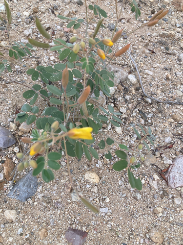

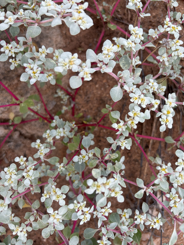
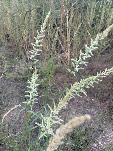
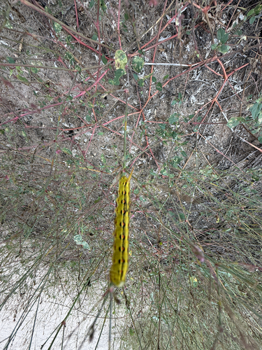
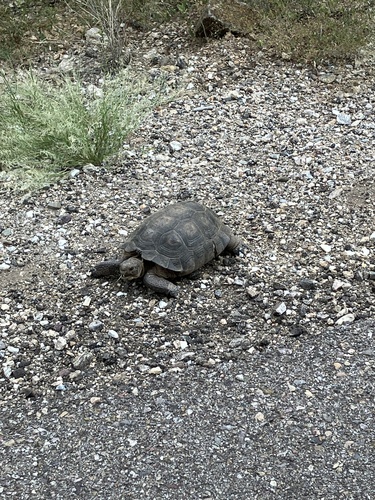
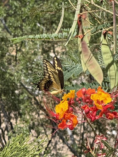
Research-grade observations from iNaturalist (within ~15 mi).
Nearest stream gauge
Events
Gallery
Sources
- • Wikipedia
- • US Census Bureau (ACS 5-year estimates)
- • NOAA National Weather Service
- • Wikidata
- • USGS Earthquake Catalog (global feed)
- • GBIF (Global Biodiversity Information Facility)
- • iNaturalist
- • Open-Meteo / sunrise-sunset.org
- • Wikipedia Pageviews API
- • Open Library
- • NASA EONET