Browse / United States / Arizona / Prescott
Prescott
Arizonacity

Prescott
Total population
47,400
Median home value
$564,100
Bachelor's+
Median income
$70,874
Founded
1881
Demographic figures from US Census Bureau · ACS 5-year estimates. Overview below cites Wikipedia and may reference a different year.
- Wind Advisory · ModerateWind Advisory issued October 15 at 11:45PM MST until October 16 at 6:00PM MST by NWS Flagstaff AZ
Source: NOAA National Weather Service.
City facts
Sister cities
Facts from Wikidata (CC0).
Overview
Prescott is a city in and the county seat of Yavapai County, Arizona, United States. As of 2020 Census, the city's population was 45,827.
Read more on WikipediaHistory & geography
History
Prescott was originally inhabited by the indigenous Yavapai, who had split off from Patayan groups around 1300 AD. The first recorded European contact with the Yavapai was made by Spaniard Antonio de Espejo in 1583, who was looking for gold. Until the 1860s, there was no permanent European presence. The territory was explored by the Walker Party in 1862 and 1863. Walker and his men discovered gold at Hassayampa Creek, just south of Prescott, in 1863. Further gold was struck at nearby Lynx Creek, Weaver Creek, and Big Bug. With the backing of Ohio railroad magnates, the Arizona Organic Act establishing the Arizona Territory was pushed through in February 1863. The land was now open to settlers. Fort Whipple was established the same year near present day Chino Valley. The fort was also made the territorial capital. The fort was moved to more mountainous terrain south the next year. Prescott was incorporated in 1881. The capital was returned to Prescott in 1877 by the 9th Arizona Territorial Legislature. The capital was finally moved to Phoenix on February 4, 1889, by the 15th Arizona Territorial Legislature. The three Arizona Territory capitals reflected the changes in political influence of different regions of the territory as they grew and developed. Prescott also holds a place in the larger history of the American southwest. Both Virgil Earp (brother of Wyatt Earp) and Doc Holliday lived in Prescott before their now infamous gunfight at the O.K. Corral. Virgil Earp lived in Prescott starting in 1878 as a constable/watchman. Doc Holliday was there for a while in the summer of 1880 and even appears in the 1880 census records. Whiskey Row in downtown Prescott boasts many historic buildings, including The Palace, Arizona's oldest restaurant and bar. Many other…
Geography
Prescott is west-northwest of the State of Arizona's geographic center. According to the United States Census Bureau, the city has a total area of , of which is land and is water. Prescott is considered part of North Central Arizona, sitting just north of the Bradshaw Mountains and east of the Sierra Prieta range. The Granite Dells, often called ‘The Dells’, lies just north of the Prescott city center and is known for its large boulder outcroppings of granite that have eroded into a spectacular appearance of bumpy rock features. Within 'The Dells' are Watson and Willow Lakes, which are two small, man-made reservoirs. Here a number of hiking trails connect to the Peavine Trail. The Peavine National Recreation Trail follows what was the former rail bed of the Santa Fe, Prescott and Phoenix Railway. This railroad traveled from Prescott to Phoenix through the Granite Dells. The "Peavine" got its name from the winding portion of this railroad that twists and curves, resembling the vine on which peas grow. The Peavine trail connects to the Iron King Trail, which was the route of the old Prescott and Eastern Railroad through the Granite Dells. Other lakes include Lynx, Granite Basin and Goldwater, all surrounding different areas of this rustic community. Goldwater Lake, by Goldwater Park, is from downtown Prescott, has of water surface, and is a popular destination for park recreation and picnic facilities. Lynx Lake is another lake close to Prescott in tall ponderosa pines, and gets some 125,000 visitors every year. This lake offers visitors recreational activities, boating, camping, fishing, hiking, mountain biking, picnicking and a small, seasonal restaurant with a view of the lake. Finally, there is the smallest of the natural lakes with of surface water at…
Excerpted from the corresponding Wikipedia article (CC BY-SA).
Demographics & economy
Race & ethnicity
Source: US Census Bureau — American Community Survey, 5-year estimates.
Geography
Coordinates & boundaries from the US Census TIGER/Line shapefiles.
Climate
Current forecast
Forecast for Prescott, AZ from NOAA NWS API.
Air quality
Industrial & pollution facilities
Natural hazard risk
Health (adults)
Age-adjusted prevalence estimates from CDC PLACES (latest release).
Walkability
Amenities nearby
Wildlife & biodiversity
Most-observed species
- House FinchHaemorhous mexicanus (P.L.Statius Müller, 1776) · Aves9,302
- Common RavenCorvus corax Linnaeus, 1758 · Aves8,507
- Mourning DoveZenaida macroura (Linnaeus, 1758) · Aves7,809
- Lesser GoldfinchSpinus psaltria (Say, 1822) · Aves7,736
- Spotted TowheePipilo maculatus Swainson, 1827 · Aves7,492
- MallardAnas platyrhynchos Linnaeus, 1758 · Aves7,303
- White-breasted NuthatchSitta carolinensis Latham, 1790 · Aves5,582
- American CootFulica americana Gmelin, 1789 · Aves5,361
Citizen-science & research observations from the Global Biodiversity Information Facility (GBIF).
Schools
Earthquake history
Most recent
- M 2.5 — 2025-08-0339 km SSW of Bagdad, Arizona
- M 2.5 — 2025-04-1514 km N of Clarkdale, Arizona
- M 2.6 — 2023-08-149 km WSW of Williams, Arizona
- M 3.8 — 2023-07-232 km E of Chino Valley, Arizona
- M 2.9 — 2021-07-1827 km SW of Valle, Arizona
- M 2.7 — 2020-12-2728 km SW of Valle, Arizona
Events from the USGS Earthquake Catalog (global) (FDSN Event Web Service).
Photos
Sights & places nearby
Notable people from here
Geography & sun
Elevation, sunrise/sunset and daylight from Open-Meteo. Solar climatology from NASA POWER.
Nearby airports
Public attention
Pageview totals from the Wikimedia Pageviews API.
Books about Prescott



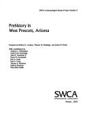
Search results from Open Library.
Recent natural events nearby
- Wildfire Campwood, Yavapai, ArizonaWildfires · 2026-08-23 · 37 mi
- Prescribed Fire McCRAKEN RX-WRD CY26, Coconino, ArizonaWildfires · 2026-10-01 · 38 mi
- Prescribed Fire Newman Piles RX, Coconino, ArizonaWildfires · 2026-10-14 · 54 mi
- Prescribed Fire Walker Hill Piles RX, Coconino, ArizonaWildfires · 2026-09-28 · 59 mi
- Prescribed Fire KENDRICK RX-WRD CY26, Coconino, ArizonaWildfires · 2026-10-01 · 64 mi
- Prescribed Fire D2 Vincent RX, Coconino, ArizonaWildfires · 2026-09-17 · 85 mi
- Prescribed Fire D2 Dye RX, Coconino, ArizonaWildfires · 2026-09-17 · 88 mi
- Prescribed Fire D7 Morgan Unit 5 RX, Navajo, ArizonaWildfires · 2026-09-14 · 135 mi
Wildfires, storms and other events from NASA EONET (last 12 months, within 250 mi).
Ground air-quality sensors
Recently spotted species
Nearest stream gauge
Live readings from USGS NWIS · measured 2026-10-16 11:30 UTC.
Events
Gallery
Sources
- • Wikipedia
- • US Census Bureau (ACS 5-year estimates)
- • NOAA National Weather Service
- • Wikidata
- • USGS Earthquake Catalog (global feed)
- • USGS NWIS (water data)
- • GBIF (Global Biodiversity Information Facility)
- • CDC PLACES
- • Open-Meteo / sunrise-sunset.org
- • Wikipedia Pageviews API
- • Open Library
- • NASA EONET