Browse / Burkina Faso / Nord / Ouonon
Ouonon
Nordvillage
Total population
1,626
Air quality index
Demographic figures from INSD Burkina Faso. Overview below cites Wikipedia and may reference a different year.
City facts
Overview
Found in Nord, Burkina Faso, Ouonon is classified as a village in public datasets. Its coordinates of 13.045°, -2.124° place it in the tropical zone of the northern hemisphere. Around 1,626 people are recorded as living there in the most recent open data. Solar-resource estimates put the area at about 2,186 kWh/m² of solar irradiance per year with sunshine for roughly 86% of daylight hours. Climatically, locations at this latitude tend to experience warm temperatures throughout the year with pronounced wet and dry seasons. Open-data panels below dive into population trends, climate normals, environmental indicators and nearby places.
Summary composed automatically from structured open data on this page. See our Terms for details.
History & geography
Geography
Coordinates & boundaries from the US Census TIGER/Line shapefiles.
Climate
Air quality
Current readings from Open-Meteo Air Quality API (Copernicus CAMS European reanalysis).
Walkability
Amenities nearby
Wildlife & biodiversity
Most-observed species
- Castor-oil-PlantRicinus communis L. · Magnoliopsida2
- Benghal DayflowerCommelina benghalensis L. · Liliopsida1
- Siamese CassiaSenna siamea (Lam.) H.S.Irwin & Barneby · Magnoliopsida1
- Combretum glutinosum Perr. ex DC.Combretum glutinosum Perr. ex DC. · Magnoliopsida1
Citizen-science & research observations from the Global Biodiversity Information Facility (GBIF).
Earthquake history
Events from the USGS Earthquake Catalog (global) (FDSN Event Web Service).
Photos
Sights & places nearby
Notable people from here
Nearby places in Nord
- Gomponsom4 mi away · pop. 1,458
- Pougyango4.9 mi away · pop. 1,247
- Sibèga8.3 mi away
- Tougo11.1 mi away · pop. 4,251
- Tampouya12.8 mi away · pop. 419
- Gollo13.2 mi away · pop. 849
- Dakoré15.3 mi away
- Tindila18.6 mi away · pop. 1,621
- Lantaga20.6 mi away
- Waaga22 mi away
- Sékéba22.1 mi away
- Kasséba-Samo22.5 mi away · pop. 2,675
Geography & sun
Elevation, sunrise/sunset and daylight from Open-Meteo. Solar climatology from NASA POWER.
Nearby airports
Public attention
Books about this place
Recent natural events nearby
Ground air-quality sensors
Recently spotted species
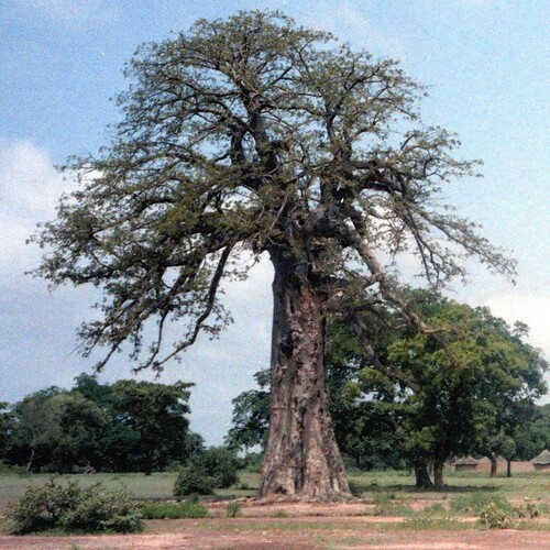
Research-grade observations from iNaturalist (within ~15 mi).
Events
Gallery
Sources
- • Wikidata
- • Open-Meteo Air Quality (CAMS)
- • USGS Earthquake Catalog (global feed)
- • GBIF (Global Biodiversity Information Facility)
- • iNaturalist
- • Open-Meteo / sunrise-sunset.org