Browse / Burkina Faso / Nord / Samba
Samba
Nordvillage
Total population
4,241
Demographic figures from INSD Burkina Faso. Overview below cites Wikipedia and may reference a different year.
City facts
Overview
Samba is a village in Nord, Burkina Faso. Census-style estimates put the resident count near 4,241. On the world map it falls within the Western Hemisphere, specifically at 12.669°, -2.382°. Open solar datasets indicate about 2,129 kWh/m² of solar irradiance per year, combined with sunshine for roughly 83% of daylight hours. Based on its tropical position, residents likely encounter warm temperatures throughout the year with pronounced wet and dry seasons. Continue scrolling for population, climate, environmental and points-of-interest data drawn from public sources.
Summary composed automatically from structured open data on this page. See our Terms for details.
History & geography
Geography
Coordinates & boundaries from the US Census TIGER/Line shapefiles.
Climate
Air quality
Walkability
Amenities nearby
Wildlife & biodiversity
Earthquake history
Photos
Sights & places nearby
Notable people from here
Nearby places in Nord
- Koussana4.8 mi away · pop. 1,056
- Pilimpikou8.6 mi away · pop. 6,750
- Bastioua10.1 mi away · pop. 1,101
- Tindila12.7 mi away · pop. 1,621
- Lantaga14.4 mi away
- Waaga17.7 mi away
- Korro19.5 mi away · pop. 1,709
- Gollo20.8 mi away · pop. 849
- Gaon21.1 mi away · pop. 428
- Bagaré22.5 mi away · pop. 2,438
- Dargou25.1 mi away
- Boussou27.6 mi away · pop. 2,937
Geography & sun
Elevation, sunrise/sunset and daylight from Open-Meteo. Solar climatology from NASA POWER.
Nearby airports
Public attention
Books about Samba
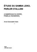
Search results from Open Library.
Recent natural events nearby
Ground air-quality sensors
Recently spotted species
Events
Gallery
Sources
- • Wikidata
- • Open-Meteo / sunrise-sunset.org
- • Open Library