Browse / Bulgaria / Haskovo / Ostar Kamak
Ostar Kamak
Haskovovillage
No image yet
Elevation215 m
Land area28.65 km²
Coordinates41.89°, 25.85°
Demographic figures from NSI Bulgaria. Overview below cites Wikipedia and may reference a different year.
Loading additional data from public sources…0 / 11
CensusWikipediaWeatherPlacesPeopleEnvironmentHealth & SchoolsRelatedGeography & CultureLive MonitoringEvents & Gallery
0% completeCity facts
Elevation
215 m
Area
28.65 km²
Facts from Wikidata (CC0).
Overview
Ostar kamak is a village in the municipality of Harmanli, in Haskovo Province, in southern Bulgaria.
Read more on WikipediaHistory & geography
Geography
Latitude
41.8884
Longitude
25.8509
Water area
—
Coordinates & boundaries from the US Census TIGER/Line shapefiles.
Climate
Air quality
Walkability
Amenities nearby
Wildlife & biodiversity
Earthquake history
Photos
Sights & places nearby
Notable people from here
T
Todor Kolev
Bulgarian footballer (born 1942)
S
Stefan Botev
Bulgarian weightlifter
I
Ivan Karayotov
Bulgarian archaeologist and historian
Z
Zdravko Todorov
Bulgarian footballer
D
Dimitar Marashliev
Bulgarian footballer (1947-2018)
A
Artin Poturlyan
Armenian-Bulgarian composer
T
Todor Todorov
Bulgarian association football player
V
Valko Vasilev
G
Gencho Stoev
Bulgarian writer

Georgi Kostov
G
Georgi Petrov
Bulgarian politician
G
Gruycho Dochev
Bulgarian singer

Delcho Kotsev

Dimitar Hadzhiyanev
Bulgarian actor (1922-2005)
E
Emil Petrov
Bulgarian film and literary critic, literary critic and film critic
People born within ~10 km, from Wikidata (CC0). Click any name for their Wikipedia article.
Nearby places in Haskovo
Geography & sun
Avg solar (kWh/m²/day)
4.14
Annual solar (kWh/m²)
1,510
Elevation, sunrise/sunset and daylight from Open-Meteo. Solar climatology from NASA POWER.
Nearby airports
Public attention
Wikipedia views (last 30 days)
10
Avg daily Wikipedia views
0
Attention level
Obscure
Pageview totals from the Wikimedia Pageviews API.
Books about this place
Recent natural events nearby
Ground air-quality sensors
Recently spotted species
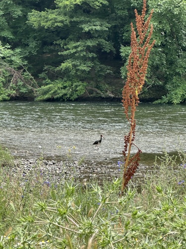
Black Stork
Ciconia nigra
Seen 2026-06-16
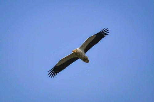
Egyptian Vulture
Neophron percnopterus
Seen 2026-05-17
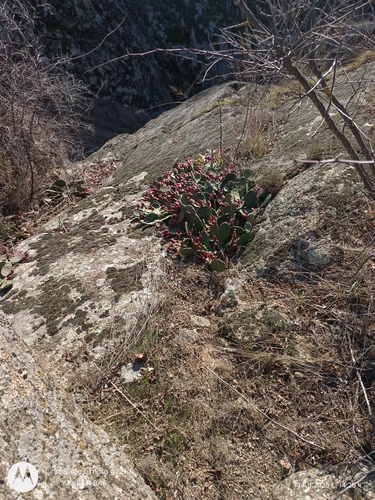
low pricklypear
Opuntia humifusa
Seen 2025-11-14
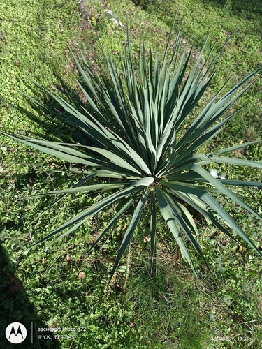
moundlily yucca
Yucca gloriosa
Seen 2025-11-14
Research-grade observations from iNaturalist (within ~15 mi).
Events
Gallery
Sources
- • Wikipedia
- • Wikidata
- • iNaturalist
- • Open-Meteo / sunrise-sunset.org
- • Wikipedia Pageviews API