Browse / Brazil / Goiás / Americano do Brasil
Americano do Brasil
Goiásvillage
Total population
5,259
Demographic figures from IBGE. Overview below cites Wikipedia and may reference a different year.
City facts
Overview
Americano do Brasil, a small village in Goiás, Brazil, forms part of the country's settled landscape. On the world map it falls within the Western Hemisphere, specifically at -16.252°, -49.981°. It is home to roughly 5,259 residents. The location receives about 2,006 kWh/m² of solar irradiance per year and sunshine for roughly 79% of daylight hours. Based on its tropical position, residents likely encounter warm temperatures throughout the year with pronounced wet and dry seasons. Read on for charts and tables covering demographics, climate, hazards, schools, wildlife and other open-data indicators for Americano do Brasil.
Summary composed automatically from structured open data on this page. See our Terms for details.
History & geography
Geography
Coordinates & boundaries from the US Census TIGER/Line shapefiles.
Climate
Air quality
Walkability
Amenities nearby
Wildlife & biodiversity
Most-observed species
- Ornate Hawk-EagleSpizaetus ornatus (Daudin, 1800) · Aves5
- Pleroma papyriferum (Pohl ex Naudin) TrianaPleroma papyriferum (Pohl ex Naudin) Triana · Magnoliopsida2
- Burnished-buff TanagerStilpnia cayana (Linnaeus, 1766) · Aves1
- Brazilian tapirTapirus terrestris (Linnaeus, 1758) · Mammalia1
- Sensitive plant, Sensitive Grass, Humble Plant, Sleepy plant, Sleeping grass, Shy plant, Shameplant, Shame Bush, Shame Face, Shame Lady, Shame Weed, Shameful plant, Dead-and-awake, Live-and-die, Mimosa, Action plant, Touch-me-notMimosa pudica L. · Magnoliopsida1
- Freya nigrotaeniata (Mello-Leitão, 1945)Freya nigrotaeniata (Mello-Leitão, 1945) · Arachnida1
- Sugar apple, SweetsopAnnona squamosa L. · Magnoliopsida1
- Guava, Common guava, Yellow guava, Lemon guavaPsidium guajava L. · Magnoliopsida1
Citizen-science & research observations from the Global Biodiversity Information Facility (GBIF).
Earthquake history
Events from the USGS Earthquake Catalog (global) (FDSN Event Web Service).
Photos
Sights & places nearby
Notable people from here
Nearby places in Goiás
- Congomé7.7 mi away
- Anicuns14.5 mi away · pop. 18,503
- Lobeira15.3 mi away
- Itaberaí19.7 mi away · pop. 44,734
- Nazário23.7 mi away · pop. 8,189
- Goiás24.1 mi away · pop. 24,071
- Ferreiro24.8 mi away
- Calcilândia25 mi away
- Turvânia26.9 mi away · pop. 4,480
- Taquaral de Goiás28.6 mi away · pop. 4,026
- Santa Amália28.9 mi away
- Santa Bárbara de Goiás29.3 mi away · pop. 6,149
Geography & sun
Elevation, sunrise/sunset and daylight from Open-Meteo. Solar climatology from NASA POWER.
Nearby airports
Public attention
Pageview totals from the Wikimedia Pageviews API.
Books about Americano do Brasil
Search results from Open Library.
Recent natural events nearby
Ground air-quality sensors
Recently spotted species
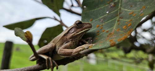

Research-grade observations from iNaturalist (within ~15 mi).
Events
Gallery
Official Identifiers
IBGE — Brazilian Institute of Geography and Statistics
- IBGE code
- 5200852
- UF
- GO
- Mesorregião
- Centro Goiano
- Microrregião
- Anicuns
servicodados.ibge.gov.br
Sources
- • Wikidata
- • USGS Earthquake Catalog (global feed)
- • GBIF (Global Biodiversity Information Facility)
- • iNaturalist
- • Open-Meteo / sunrise-sunset.org
- • Wikipedia Pageviews API
- • Open Library
- • IBGE — Brazilian national statistics, via servicodados.ibge.gov.br (official municipal code, UF, mesorregião, microrregião, region)
- • IBGE — Brazilian Institute of Geography and Statistics — servicodados.ibge.gov.br