Browse / Brazil / Bahia / Bom Jesus da Lapa
Bom Jesus da Lapa
Bahiacity

Bom Jesus da Lapa
Total population
65,550
Founded
1923
Demographic figures from IBGE. Overview below cites Wikipedia and may reference a different year.
City facts
Facts from Wikidata (CC0).
Overview
Bom Jesus da Lapa is a municipality in Bahia, Brazil located 796 kilometres (495 mi) from the state capital. The population as of 2022 was recorded at 65,550 according to the Brazilian Institute of Geography and Statistics. The city covers a total area of 4,115.5 square kilometres (1,589.0 mi2) along the banks of the São Francisco River. Its economy is based on agriculture, commerce, tourism and fishing. The current mayor is Eures Ribeiro Pereira. It is the site of the Roman Catholic Diocese of Bom Jesus da Lapa.
Read more on WikipediaHistory & geography
History
It is one of the older towns in Brazil being founded in 1693. It did not reach the status of city until 1923. The name means "Good Jesus of the Grotto." This might relate to a nearby cavern that naturally had "church-like" structures so was converted to a chapel. The chapel began in the seventeenth century and is a significant pilgrimage site in Brazil.
Excerpted from the corresponding Wikipedia article (CC BY-SA).
Geography
Coordinates & boundaries from the US Census TIGER/Line shapefiles.
Climate
Air quality
Walkability
Amenities nearby
Wildlife & biodiversity
Earthquake history
Photos
Sights & places nearby
Notable people from here
Geography & sun
Elevation, sunrise/sunset and daylight from Open-Meteo. Solar climatology from NASA POWER.
Nearby airports
Public attention
Pageview totals from the Wikimedia Pageviews API.
Books about Bom Jesus da Lapa
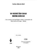
Search results from Open Library.
Recent natural events nearby
Ground air-quality sensors
Recently spotted species
Events
Gallery
Official Identifiers
IBGE — Brazilian Institute of Geography and Statistics
- IBGE code
- 2903904
- UF
- BA
- Mesorregião
- Vale São-Franciscano da Bahia
- Microrregião
- Bom Jesus da Lapa
servicodados.ibge.gov.br
Sources
- • Wikipedia
- • Wikidata
- • Open-Meteo / sunrise-sunset.org
- • Wikipedia Pageviews API
- • Open Library
- • Wikidata SPARQL (CC0) — population, area, elevation, inception, head of government, Commons image
- • IBGE — Brazilian national statistics, via servicodados.ibge.gov.br (official municipal code, UF, mesorregião, microrregião, region)
- • IBGE — Brazilian Institute of Geography and Statistics — servicodados.ibge.gov.br