Browse / Brazil / Bahia / Brumado
Brumado
Bahiatown

Brumado
Total population
70,510
Founded
1877
Demographic figures from IBGE. Overview below cites Wikipedia and may reference a different year.
City facts
Facts from Wikidata (CC0).
Overview
Brumado is a Brazilian municipality in the interior of Bahia, in the Northeast region of the country, precisely in the Center-South mesoregion of the State, in the homonymous microregion to the do municipality name, to the do 555 kilometers from Salvador, state capital. Its territorial area is 2 207,612 square kilometers, the headquarters's area occupying 2 174 square kilometers, have altitude of 454 meters. According to data from the Brazilian Institute of Geography and Statistics (IBGE), in 2023 its population was estimated at 70 268 inhabitants. The Human Development Index (HDI) is 0.656 (average).
Read more on WikipediaHistory & geography
History
There are several theories about the origin of the name Brumado. According to Teodoro Fernandes Sampaio, the name "Brumado" comes from the expression Tupi language: Itimbopira (Y-timbó-pyra), which means misty, covered in fog, but according to José Dias, former priest of the city, the name originates from the Serra das Éguas, when the morning fog descends from it covering the city. Another theory says that the origin of the name Brumado is attributed to the word bromine - a word that at the time of mining on the Rio Brumado was used by garimpeiros and bandeirantes to distinguish loss or deceit, mystification or disappearance of gold in the mining site that supposedly had an abundance of that ore. In the 18th century, captain Francisco de Souza Meira and his team left the captaincy of Minas Gerais (current state of Minas Gerais), crossing the Brumado river, advancing along the right bank until reaching the mouth of the Do Antônio river, arriving to the indigenous territory, Tupinambas fierce, and between them a great fight took place, close to the area where today is the headquarters of the Brumado Municipality. It was the first part taken and received the name "Conquista", later he founded a farm called Das Éguas Serra. Although these Indians strongly resisted the attacks of the captain and his group, they gradually dispersed, disturbed by the presence of white men. In 1962, the districts of Santa Bárbara dos Casados, Olhos d'Água and São Pedro would have their toponyms changed to Ubiraçaba, Itaquaraí and Aracatu, respectively. From 1967 to 1970, the mayor was elected doctor Juracy Pires Gomes, with the support of partner Armindo dos Santos Azevedo. In his mandate important works were carried out, such as the new city hall, the new municipal market, the city's first…
Geography
The Brumado municipality is located in the Center South (or Southwest) of Bahia, in the region known geographically as the Polygon of the Droughts, in Serra Geral, under the coordinates: 14° 12' 13", south latitude; 41° 39' 55" west longitude, at 454 meters altitude and is 555 kilometers southwest of Salvador. The urban area covers an area of 2 174 square kilometers. There is no information if there is a point higher than the Das Éguas Saw peak, probably this is the highest point of the municipality, with 1 100 meters. The municipality limits with Livramento de Nossa Senhora and Dom Basilio, to the north; Rio de Contas, Ituaçu and Tanhaçu, to the northeast; Aracatu, to the east; Rio do Antônio and Lagoa Real, to the west; Malhada de Pedras to the southwest and the Caraíbas to the south. Its micro-region has a homonymous name. The urbanization rate is 69.86%, population density is 29.01 inhabitants per square kilometer. There are also level areas, which are flat and / or wavy forms, which make the transition between the upper and lower areas, forming species of stairs. Also has flat and flat relief shapes. In general, the Brumadian relief is quite rugged, slightly undulating and presents erosions due to the floods, favorable characteristics for biodiversity, contributing to a wide variety of species, both in flora and fauna. The Brumado municipality is part of the De Contas River basin and of the Do Antônio River sub-basin, which also includes the municipalities: Caculé, Rio do Antônio, Licínio de Almeida, Guajeru and Malhada de Pedras. The main drains of the Do Contas River basin are: Brumado River, São João River, Santa Maria Stream, Do Antônio River and Gavião River; The main tributaries of Antônio River are: Paiol River, Do Salto River and Do Quirino Stream. The…
Excerpted from the corresponding Wikipedia article (CC BY-SA).
Geography
Coordinates & boundaries from the US Census TIGER/Line shapefiles.
Climate
Air quality
Walkability
Amenities nearby
Wildlife & biodiversity
Most-observed species
- Sayaca TanagerThraupis sayaca (Linnaeus, 1766) · Aves6
- Black VultureCoragyps atratus (Bechstein, 1793) · Aves5
- Tropical KingbirdTyrannus melancholicus Vieillot, 1819 · Aves5
- Great KiskadeePitangus sulphuratus (Linnaeus, 1766) · Aves4
- Rufous HorneroFurnarius rufus (Gmelin, 1788) · Aves4
- Purple-throated EuphoniaEuphonia chlorotica (Linnaeus, 1766) · Aves4
- Picui Ground-DoveColumbina picui (Temminck, 1813) · Aves4
- Masked Water-TyrantFluvicola nengeta (Linnaeus, 1766) · Aves4
Citizen-science & research observations from the Global Biodiversity Information Facility (GBIF).
Earthquake history
Events from the USGS Earthquake Catalog (global) (FDSN Event Web Service).
Photos
Sights & places nearby
Notable people from here


People born within ~10 km, from Wikidata (CC0). Click any name for their Wikipedia article.
Nearby places in Bahia
Geography & sun
Elevation, sunrise/sunset and daylight from Open-Meteo. Solar climatology from NASA POWER.
Nearby airports
Public attention
Pageview totals from the Wikimedia Pageviews API.
Books about Brumado
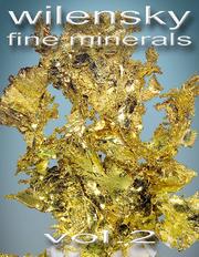
Search results from Open Library.
Recent natural events nearby
Ground air-quality sensors
Recently spotted species
Events
Gallery
Geotagged photos within ~6 miles of Brumado, from Wikimedia Commons contributors.
.jpg) 0.2 mi
0.2 mi.jpg) 0.4 mi
0.4 mi.jpg) 0.4 mi
0.4 mi 0.4 mi
 0.4 mi
 0.4 mi
 0.4 mi
 0.4 mi
 0.4 mi
.jpg) 0.4 mi
0.4 mi 0.4 mi
 0.4 mi
 0.4 mi
 0.4 mi
 0.4 mi
 0.4 mi
 0.4 mi
 0.4 mi
.jpg) 0.4 mi
0.4 mi 0.4 mi
.jpg) 0.4 mi
0.4 mi 0.4 mi
 0.4 mi
.jpg) 0.4 mi
0.4 miPhotos via Wikimedia Commons — see each image page for license & attribution.
Official Identifiers
IBGE — Brazilian Institute of Geography and Statistics
- IBGE code
- 2904605
- UF
- BA
- Mesorregião
- Centro Sul Baiano
- Microrregião
- Brumado
servicodados.ibge.gov.br
Sources
- • Wikipedia
- • Wikimedia Commons
- • Wikidata
- • USGS Earthquake Catalog (global feed)
- • GBIF (Global Biodiversity Information Facility)
- • Open-Meteo / sunrise-sunset.org
- • Wikipedia Pageviews API
- • Open Library
- • Wikidata SPARQL (CC0) — population, area, elevation, inception, head of government, Commons image
- • IBGE — Brazilian national statistics, via servicodados.ibge.gov.br (official municipal code, UF, mesorregião, microrregião, region)
- • IBGE — Brazilian Institute of Geography and Statistics — servicodados.ibge.gov.br