Browse / Brazil / Rio Grande do Sul / Caxias do Sul
Caxias do Sul
Rio Grande do Sulcity

Caxias do Sul
Total population
463,501
Founded
1890
Air quality index
Demographic figures from IBGE. Overview below cites Wikipedia and may reference a different year.
City facts
Facts from Wikidata (CC0).
Overview
Caxias do Sul is a Brazilian municipality in the state of Rio Grande do Sul. Located in the northeast of the state at an elevation of 817 meters, it is the largest city in the Serra Gaúcha region, the second most populous city in Rio Grande do Sul, surpassed only by the state capital Porto Alegre, and the 47th largest city in Brazil.
Read more on WikipediaHistory & geography
History
Before the arrival of Italian immigrants in the 19th century, the region was inhabited by indigenous Kaingang people, hence its former name: Campo dos Bugres. Tropeiros also passed through the area on their journeys between the south of the state and the central region of the country. The Jesuits attempted to establish some reductions, though without success. In the second half of the 19th century, due to the war of Italian unification, Italy faced severe social and economic crises, and impoverished farmers could no longer sustain themselves. During this period, the Brazilian imperial government decided to colonize uninhabited areas in the south of the country, encouraging immigration from Italy, following the success of a similar initiative with German settlers. The chosen area, then known as Fundos de Nova Palmira, consisted of unclaimed lands bordered by the Campos de Cima da Serra to the north and the German-colonized valley region to the south. In 1875, the first settlers, mostly from the Veneto region, arrived after enduring a grueling month-long crossing of the Atlantic Ocean on overcrowded ships, where deaths from disease and poor conditions were common. Initially, immigrants disembarked in Rio de Janeiro, where they remained in quarantine at the Immigrants' House. They then traveled by steamship to the South, arriving in Porto Alegre, where they were directed to the former Porto Guimarães, now the municipality of São Sebastião do Caí. From there, they ascended the serra, traversing a largely wild region, until reaching their destination: the area now known as Nova Milano. From 1876, they moved to the so-called Sede Dante, the future site of Caxias do Sul, the administrative center of the colony, the first to be demarcated in the region. They were received in…
Geography
Caxias do Sul is located in the state of Rio Grande do Sul. It is located at a longitude of 51º10'06 west and a latitude of 29º10'05 south. It belongs to the Northeast Rio Grande do Sul Mesoregion and the Caxias do Sul Microregion. According to the Siegfried Emanuel Heuser Foundation of Economics and Statistics, it has an area of , according to Municipal Government data, or according to the IBGE. It is from the state capital, Porto Alegre, and from Brasília, the federal capital. It borders the municipalities of São Marcos, Campestre da Serra, and Monte Alegre dos Campos to the north, Vale Real, Nova Petrópolis, Gramado, and Canela to the south, São Francisco de Paula to the east, and Flores da Cunha and Farroupilha to the west. The municipality of Caxias do Sul is located in the Atlantic Forest biome and is characterized by mixed ombrophilous forest vegetation. To the east, north, and northeast, the forest is interspersed with areas of low vegetation from the Campos de Cima da Serra, occurring in shallow soils. The landscape has been significantly altered due to agricultural and industrial activities and urban expansion, resulting in a substantial reduction in araucaria presence. The less rugged the terrain, the more extensive the patches of fields, and conversely, the more dynamic the terrain forms, the denser and more continuous the araucaria forests, especially at the headwaters of the main valleys. The lower valley areas are covered by a transitional slope forest, known as the Fig Tree Forest, with greater botanical diversity. The soils, formed over the basaltic layer, are generally very fertile. The city has an IBAMA office, and the Municipal Government implements and oversees extensive environmental legislation created by the Chamber. It maintains a…
Excerpted from the corresponding Wikipedia article (CC BY-SA).
Geography
Coordinates & boundaries from the US Census TIGER/Line shapefiles.
Climate
10-year averages from ERA5 reanalysis (Open-Meteo).
Air quality
Current readings from Open-Meteo Air Quality API (Copernicus CAMS European reanalysis).
Walkability
Amenities nearby
Wildlife & biodiversity
Most-observed species
- Rufous-collared SparrowZonotrichia capensis (P.L.S.Müller, 1776) · Aves821
- Rufous-bellied ThrushTurdus rufiventris Vieillot, 1818 · Aves687
- Southern LapwingVanellus chilensis (Molina, 1782) · Aves647
- Ruddy Ground-DoveColumbina talpacoti (Temminck, 1810) · Aves541
- White-tipped DoveLeptotila verreauxi Bonaparte, 1855 · Aves512
- Tropical ParulaSetophaga pitiayumi (Vieillot, 1817) · Aves453
- Rufous HorneroFurnarius rufus (Gmelin, 1788) · Aves435
- Rufous-browed PeppershrikeCyclarhis gujanensis (Gmelin, 1789) · Aves431
Citizen-science & research observations from the Global Biodiversity Information Facility (GBIF).
Earthquake history
Events from the USGS Earthquake Catalog (global) (FDSN Event Web Service).
Photos
Sights & places nearby
Notable people from here


People born within ~10 km, from Wikidata (CC0). Click any name for their Wikipedia article.
Nearby places in Rio Grande do Sul
- Vila Cristina9.8 mi away · pop. 1,847
- Fazenda Souza10.4 mi away · pop. 2,665
- Santa Lúcia do Piaí10.8 mi away · pop. 2,724
- Pedras Brancas11.8 mi away · pop. 2,000
- Nova Milano12.1 mi away · pop. 1,872
- Nova Pádua12.4 mi away · pop. 2,343
- Vale do Rio Caí13.5 mi away
- Seca14.2 mi away · pop. 2,113
- Nova Petrópolis14.9 mi away · pop. 23,300
- Nova Sardenha15 mi away · pop. 4,747
- São Marcos15.2 mi away · pop. 21,084
- Vale Real16.1 mi away · pop. 6,058
Geography & sun
Elevation, sunrise/sunset and daylight from Open-Meteo. Solar climatology from NASA POWER.
Nearby airports
Public attention
Pageview totals from the Wikimedia Pageviews API.
Books about Caxias do Sul

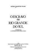
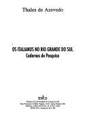
Search results from Open Library.
Recent natural events nearby
Ground air-quality sensors
Recently spotted species
Events
Gallery
Official Identifiers
IBGE — Brazilian Institute of Geography and Statistics
- IBGE code
- 4305108
- UF
- RS
- Mesorregião
- Nordeste Rio-grandense
- Microrregião
- Caxias do Sul
servicodados.ibge.gov.br
Sources
- • Wikipedia
- • Open-Meteo (ERA5 reanalysis)
- • Wikidata
- • Open-Meteo Air Quality (CAMS)
- • USGS Earthquake Catalog (global feed)
- • GBIF (Global Biodiversity Information Facility)
- • Open-Elevation
- • Open-Meteo / sunrise-sunset.org
- • Wikipedia Pageviews API
- • Open Library
- • Wikidata SPARQL (CC0) — population, area, elevation, inception, head of government, Commons image
- • IBGE — Brazilian national statistics, via servicodados.ibge.gov.br (official municipal code, UF, mesorregião, microrregião, region)
- • IBGE — Brazilian Institute of Geography and Statistics — servicodados.ibge.gov.br