Browse / Brazil / Goiás / Ipameri
Ipameri
Goiástown

Ipameri
Total population
25,548
Demographic figures from IBGE. Overview below cites Wikipedia and may reference a different year.
City facts
Facts from Wikidata (CC0).
Overview
Ipameri is a municipality and Latin Catholic bishopric in southeastern Goiás state, in Brazil. The population was 27,174 (2020) in a total area of 4,368.6 km2. It is a major producer of soybeans, corn and livestock.
Read more on WikipediaHistory & geography
History
The region of Ipameri was first settled by Europeans in the middle of the nineteenth century. The first houses were built along the banks of the Vai-Vem River, on the Fazenda Vai-Vem, belonging to Francisco José Dutra. According to legend this rancher was bitten by a poisonous snake and promised, if he were cured, to donate all the lands he could see from the heights of a hill called São Domingos to the Divine Holy Spirit. As he survived he donated all the lands which would make up the future municipality of Ipameri. The origin of the name of the first settlement, Vai-Vem" (It comes and goes), has two versions. One is that it refers to the comings and goings of the Indians (Xavantes and Caiapós), who crossed the river on a makeshift bridge, and another that the name refers to the stream seemed to zigzag. In 1845 Vai-Vem was made a district of Catalão, becoming a municipality in 1870, with the name "Entre-Rios". In 1904 the name was changed to Ipameri, from the Indigenous word "Ipau-meri", meaning entre-rios (in Portugues) or 'between the rivers'. In 1913 the first hydroelectric station in Goiás was built here. In 1915 a cinema was opened. The automobile appeared in 1914 and a newspaper was founded in 1917. In 1921 the first bank in the state opened its doors here. In 1922 a military base was built. In 1938 the main Catholic church, the Igreja Matriz do Divino Espírito Santo, was inaugurated. After the middle of the twentieth century the city began a period of decline, caused by the decadence of the national railroad system and the distance of the main national highways. Ipameri became known as the city that "already had", or "already was". The city began to prosper again the 1980s with rural electrification, mechanization of agriculture and paved highways leading to…
Excerpted from the corresponding Wikipedia article (CC BY-SA).
Geography
Coordinates & boundaries from the US Census TIGER/Line shapefiles.
Climate
Air quality
Walkability
Amenities nearby
Wildlife & biodiversity
Earthquake history
Photos
Sights & places nearby
Notable people from here
Nearby places in Goiás
- Engenheiro Raul Gonçalves8.4 mi away
- Urutaí18 mi away · pop. 3,553
- São Sebastião da União20.3 mi away
- Campo Alegre de Goiás25.7 mi away · pop. 7,422
- Pires Belo28.4 mi away
- Marimbondo30.6 mi away
- Catalão34 mi away · pop. 114,427
- Cavalheiro34.3 mi away
- Santa Cruz de Goiás35.2 mi away · pop. 3,002
- Marzagão36.6 mi away · pop. 2,758
- Cumari37.5 mi away · pop. 2,927
- Beira38.5 mi away
Geography & sun
Elevation, sunrise/sunset and daylight from Open-Meteo. Solar climatology from NASA POWER.
Nearby airports
Public attention
Pageview totals from the Wikimedia Pageviews API.
Books about this place
Recent natural events nearby
Ground air-quality sensors
Recently spotted species








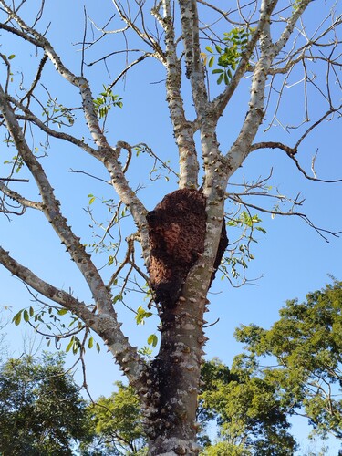
Research-grade observations from iNaturalist (within ~15 mi).
Events
Gallery
Official Identifiers
IBGE — Brazilian Institute of Geography and Statistics
- IBGE code
- 5210109
- UF
- GO
- Mesorregião
- Sul Goiano
- Microrregião
- Catalão
servicodados.ibge.gov.br
Sources
- • Wikipedia
- • Wikidata
- • iNaturalist
- • Open-Meteo / sunrise-sunset.org
- • Wikipedia Pageviews API
- • IBGE — Brazilian national statistics, via servicodados.ibge.gov.br (official municipal code, UF, mesorregião, microrregião, region)
- • IBGE — Brazilian Institute of Geography and Statistics — servicodados.ibge.gov.br