Browse / Brazil / Rio de Janeiro / Paraty
Paraty
Rio de Janeirotown

Paraty
Total population
45,243
Founded
1597
Demographic figures from IBGE. Overview below cites Wikipedia and may reference a different year.
City facts
Facts from Wikidata (CC0).
Overview
Paraty is a Brazilian municipality on the southern coast of the state of Rio de Janeiro. It is 258 kilometres from the state capital, the city of Rio de Janeiro. Alongside the Atlantic Ocean, the municipal area has an average altitude of just five metres above sea level. It covers 924.295 square kilometres and has an estimated population of 47,668, giving a population density of 48.95 inhabitants per square kilometre. According to an estimate by the Brazilian Institute of Geography and Statistics (IBGE) from 2014, it ranks 43rd among the municipalities of the state of Rio de Janeiro by population.
Read more on WikipediaHistory & geography
History
The village of Paraty was founded in 1597. It was established formally as a town by Portuguese colonists in 1667, in a region populated by the Guaianás Indians. The Guaianás people who lived where the city now stands called the entire area "Paraty". In the Tupi language "Paraty" means "river of fish". Even today the Brazilian Mullet (Mugil brasiliensis) still come back to spawn in the rivers that spill into the Bay of Paraty. When the region was colonized by the Portuguese, they adopted the Guaianás name for their new town. After the discovery of the world's richest gold mines in 1696 in the mountains of Minas Gerais, Paraty became an export port for gold to Rio de Janeiro and from there on to Portugal. The ensuing gold rush led to the construction of the "Caminho do Ouro" or "Gold Trail", a 1200 kilometer road, paved in steep areas with large stones, which connected Paraty to Diamantina via Ouro Preto and Tiradentes. Not only was it used to transport gold to Paraty, but it was also used to convey supplies, miners and African slaves by mule train over the mountains to and from the gold mining areas. Two sections of the Caminho do Ouro have been excavated near Paraty and are now a tourist destination for hiking. The Gold Trail fell into disuse because of attacks on the gold laden ships bound for Rio de Janeiro by pirates who frequented the islands and coves of the Bay of Angra dos Reis. Eventually a safer overland route from Minas Gerais to Rio de Janeiro was created because of these pirate raids. Finally, the gold itself began to run out in the late 18th century, and Paraty declined. The Gold Trail was submitted for inclusion on the World Heritage List in August 2004. Image:gold trail 5_cropped.jpg|Stones on the Gold Trail Image:gold trail 12_cropped.jpg|the Gold…
Geography
The town is located on the Bay of Ilha Grande, which is dotted with many tropical islands. Rising as high as 1,300 meters behind the town are tropical forests, mountains, and waterfalls. It is the southernmost and westernmost city in Rio de Janeiro state. Paraty is listed by IPHAN as a National Historic Landmark. More than 80% of its territory is protected by conservation units: *Cairuçu Environmental Protection Area, where the village of Trindade is located *Tamoios Ecological Station *Serra da Bocaina National Park *Baia de Paraty, Paraty Mirim and Saco do Mamanguá Environmental Protection Area *Juatinga Ecological Reserve Nearby is the Serra do Mar State Park of São Paulo. The municipality also includes an indigenous village and an Afro-Brazilian quilombo settlement. Paraty exhibits a tropical monsoon climate. Temperature lows range from , while highs range from . Its wettest month is January, with an average of 19 rainfall days. Sea temperatures remain consistently warm, ranging from .
Excerpted from the corresponding Wikipedia article (CC BY-SA).
Geography
Coordinates & boundaries from the US Census TIGER/Line shapefiles.
Climate
Air quality
Walkability
Amenities nearby
Wildlife & biodiversity
Earthquake history
Photos
Sights & places nearby
Notable people from here


People born within ~10 km, from Wikidata (CC0). Click any name for their Wikipedia article.
Nearby places in Rio de Janeiro
Geography & sun
Elevation, sunrise/sunset and daylight from Open-Meteo. Solar climatology from NASA POWER.
Nearby airports
Public attention
Pageview totals from the Wikimedia Pageviews API.
Books about Paraty
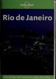

Search results from Open Library.
Recent natural events nearby
Ground air-quality sensors
Recently spotted species
Events
Gallery
Official Identifiers
IBGE — Brazilian Institute of Geography and Statistics
- IBGE code
- 3303807
- UF
- RJ
- Mesorregião
- Sul Fluminense
- Microrregião
- Baía da Ilha Grande
servicodados.ibge.gov.br
Sources
- • Wikipedia
- • Wikidata
- • Open-Meteo / sunrise-sunset.org
- • Wikipedia Pageviews API
- • Open Library
- • IBGE — Brazilian national statistics, via servicodados.ibge.gov.br (official municipal code, UF, mesorregião, microrregião, region)
- • IBGE — Brazilian Institute of Geography and Statistics — servicodados.ibge.gov.br