Browse / Brazil / Minas Gerais / Ponto Chique
Ponto Chique
Minas Geraisvillage

Ponto Chique
Total population
3,747
Demographic figures from IBGE. Overview below cites Wikipedia and may reference a different year.
City facts
Facts from Wikidata (CC0).
Overview
Ponto Chique is a municipality in the north of the Brazilian state of Minas Gerais. As of 2020, the population was 4,283 in a total area of 602 km2. It became a municipality in 1997.
Read more on WikipediaHistory & geography
Geography
Ponto Chique is located at an elevation of 476 meters on the right bank of the São Francisco River. It is connected by poor roads to Coração de Jesus. It belongs to the statistical microregion of Montes Claros. Neighboring municipalities are Ubaí, Ibiaí, Campo Azul, Buritizeiro, Coração de Jesus, Santa Fé de Minas and São Romão. Distances *Belo Horizonte: 459 km. *Cachoeira do Manteiga: 11 km. *Coração de Jesus: 72 km.
Excerpted from the corresponding Wikipedia article (CC BY-SA).
Geography
Coordinates & boundaries from the US Census TIGER/Line shapefiles.
Climate
Air quality
Walkability
Amenities nearby
Wildlife & biodiversity
Most-observed species
- TobaccoNicotiana tabacum L. · Magnoliopsida1
- Castor-oil-PlantRicinus communis L. · Magnoliopsida1
- Tropical Rat SnakeSpilotes pullatus (Linnaeus, 1758) · Squamata1
Citizen-science & research observations from the Global Biodiversity Information Facility (GBIF).
Earthquake history
Events from the USGS Earthquake Catalog (global) (FDSN Event Web Service).
Photos
Sights & places nearby
Notable people from here
Nearby places in Minas Gerais
- Cachoeira do Manteiga2.3 mi away
- Ribanceiras11.6 mi away
- Bentópolis de Minas17.8 mi away
- São Romão18.3 mi away · pop. 10,315
- Bom Jesus da Vereda23 mi away
- Ubaí30 mi away · pop. 11,708
- Santa da Pedra37.9 mi away
- Pintópolis40.1 mi away · pop. 7,084
- Paredão de Minas41.3 mi away
- Fernão Dias44.9 mi away
- Ponte dos Ciganos46.5 mi away
- Coração de Jesus46.9 mi away · pop. 25,377
Geography & sun
Elevation, sunrise/sunset and daylight from Open-Meteo. Solar climatology from NASA POWER.
Nearby airports
Public attention
Pageview totals from the Wikimedia Pageviews API.
Books about this place
Recent natural events nearby
Ground air-quality sensors
Recently spotted species
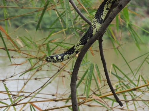
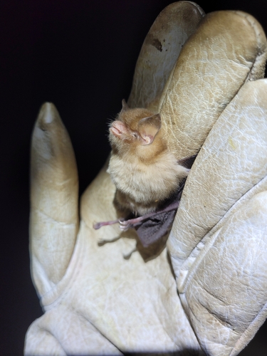
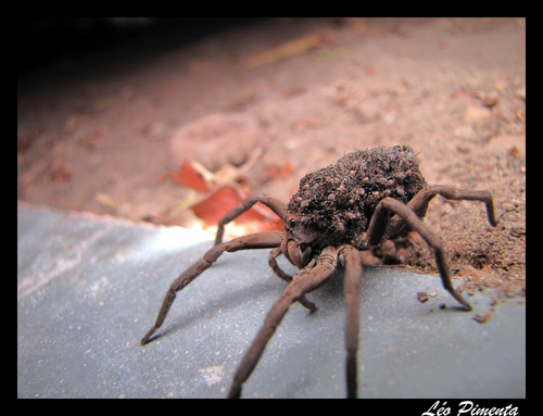
Research-grade observations from iNaturalist (within ~15 mi).
Events
Gallery
Official Identifiers
IBGE — Brazilian Institute of Geography and Statistics
- IBGE code
- 3152131
- UF
- MG
- Mesorregião
- Norte de Minas
- Microrregião
- Montes Claros
servicodados.ibge.gov.br
Sources
- • Wikipedia
- • Wikidata
- • USGS Earthquake Catalog (global feed)
- • GBIF (Global Biodiversity Information Facility)
- • iNaturalist
- • Open-Meteo / sunrise-sunset.org
- • Wikipedia Pageviews API
- • IBGE — Brazilian national statistics, via servicodados.ibge.gov.br (official municipal code, UF, mesorregião, microrregião, region)
- • IBGE — Brazilian Institute of Geography and Statistics — servicodados.ibge.gov.br