Browse / Brazil / Goiás / São Francisco de Goiás
São Francisco de Goiás
Goiásvillage

São Francisco de Goiás
Total population
6,378
Demographic figures from IBGE. Overview below cites Wikipedia and may reference a different year.
City facts
Facts from Wikidata (CC0).
Overview
São Francisco de Goiás is a municipality in central Goiás state, Brazil.
Read more on WikipediaHistory & geography
History
The site of the town was first inhabited by Europeans in 1740 by gold diggers looking for gold in the rivers. In 1911 the town was part of Jaraguá becoming a separate municipality in 1953.
Excerpted from the corresponding Wikipedia article (CC BY-SA).
Geography
Coordinates & boundaries from the US Census TIGER/Line shapefiles.
Climate
Air quality
Walkability
Amenities nearby
Wildlife & biodiversity
Most-observed species
- Toco ToucanRamphastos toco P.L.S.Müller, 1776 · Aves4
- peach-fronted conureAratinga aurea (Gmelin, 1788) · Aves4
- Picazuro PigeonPatagioenas picazuro (Temminck, 1813) · Aves4
- Red-legged SeriemaCariama cristata (Linnaeus, 1766) · Aves4
- Roadside HawkRupornis magnirostris (Gmelin, 1788) · Aves4
- Spot-backed PuffbirdNystalus maculatus (J.F.Gmelin, 1788) · Aves3
- white-eyed conureAratinga leucophthalma (Statius Muller, 1776) · Aves3
- Southern CaracaraCaracara plancus (J.F.Miller, 1777) · Aves3
Citizen-science & research observations from the Global Biodiversity Information Facility (GBIF).
Earthquake history
Events from the USGS Earthquake Catalog (global) (FDSN Event Web Service).
Photos
Sights & places nearby
Notable people from here
People born within ~10 km, from Wikidata (CC0). Click any name for their Wikipedia article.
Geography & sun
Elevation, sunrise/sunset and daylight from Open-Meteo. Solar climatology from NASA POWER.
Nearby airports
Public attention
Pageview totals from the Wikimedia Pageviews API.
Books about São Francisco de Goiás

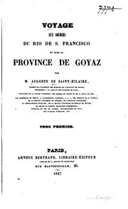
Search results from Open Library.
Recent natural events nearby
Ground air-quality sensors
Recently spotted species
Events
Gallery
Official Identifiers
IBGE — Brazilian Institute of Geography and Statistics
- IBGE code
- 5219902
- UF
- GO
- Mesorregião
- Centro Goiano
- Microrregião
- Anápolis
servicodados.ibge.gov.br
Sources
- • Wikipedia
- • Wikidata
- • USGS Earthquake Catalog (global feed)
- • GBIF (Global Biodiversity Information Facility)
- • Open-Meteo / sunrise-sunset.org
- • Wikipedia Pageviews API
- • Open Library
- • IBGE — Brazilian national statistics, via servicodados.ibge.gov.br (official municipal code, UF, mesorregião, microrregião, region)
- • IBGE — Brazilian Institute of Geography and Statistics — servicodados.ibge.gov.br