Browse / Brazil / Rio de Janeiro / Teresópolis
Teresópolis
Rio de Janeirocity

Teresópolis
Total population
165,123
Founded
1891
Demographic figures from IBGE. Overview below cites Wikipedia and may reference a different year.
City facts
Sister cities
Facts from Wikidata (CC0).
Overview
Teresópolis is a Brazilian municipality located in the interior of the state of Rio de Janeiro, approximately 94 km (58 mi) from the state capital. Situated in the Serra Fluminense, it forms part of the Intermediate Geographic Region of Petrópolis and has a total area of just over 770 km2 (300 sq mi), of which approximately 54 km2 (21 sq mi) is classified as urban area. +At an elevation of 871 m (2,858 ft), it is the highest municipality in the state. Its population was 165,123 according to the IBGE's 2022 census.
Read more on WikipediaHistory & geography
History
Before the first Portuguese arrived in the region of Magé in the 16th century, the territory was inhabited by Indigenous peoples belonging to the Timbira, Tamoio and Temiminó groups, who were associated with the tribe of Araribóia. These peoples were pejoratively called maracajás by their enemies. The higher elevations, corresponding to the present-day Serra dos Órgãos and thus to the area of Teresópolis, were also inhabited by the Guarani, as well as other groups associated with the mountainous regions of southeastern Brazil. The so-called Quilombo da Serra was also established in the region. It consisted of Indigenous people and escaped Africans who organized themselves into communities in the mountain forests and resisted colonial repression beginning in the mid-17th century. These communities were spread across extensive areas between the Serra dos Órgãos and adjacent river valleys, maintaining cooperative relationships and employing strategies of resistance in the face of colonial expansion. During the 18th century, several trails were opened up the mountains from Guapimirim, leading to the area where the neighborhood of Três Córregos is now located, in the Second District. One of these routes passed through the Maria da Prata Gorge (now within Três Picos State Park) and continued to Canoas. Another crossed the Soberbo and Garrafão areas (following a route close to that of BR-116, within Serra dos Órgãos National Park) and reached Boa Vista and Paquequer, an area corresponding to the present-day Alto neighborhood. The first official description of the region where Teresópolis now stands was made in 1788 by Baltazar Lisboa, then the juiz de fora of Rio de Janeiro, by order of the Minister and Secretary of State for Overseas Affairs. Considered one of the…
Geography
According to the 2010 Brazilian Census, the city has a population of 163,746 within a land area of 770,6 km2. The Serra dos Órgãos National Park is in the vicinity. Its predominant vegetation belongs to the Atlantic Forest type. The city is surrounded by forests and by well-known summits or peaks, because of which the city is known as the national capital of mountaineering. The most famous peaks are: * Peak of Pedra do Sino – * Peak of Pedra do Açu – * Peak of Agulha do Diabo – * Peak of Nariz do Frade – * Peak of Dedo de Deus – * Peak of Pedra da Ermitage – * Peak of Dedo de Nossa Senhora – Of these, Dedo de Deus ("God's finger") is the most famous. The municipality contains the Montanhas de Teresópolis Municipal Nature Park, created in 2009 to protect a large area of Atlantic Forest. The municipality contained the Floresta do Jacarandá Environmental Protection Area, but this was extinguished in 2013. It contains the Bacia dos Frades Environmental Protection Area, created in 1990. The municipality contains 20% of the Três Picos State Park, created in 2002. It contains part of the Central Rio de Janeiro Atlantic Forest Mosaic of conservation units, created in 2006. Teresópolis features a subtropical highland climate (Köppen climate classification: Cfb), with relatively cold and dry winters and mild and wet summers. The annual average temperature is 16 °C/60.8 °F. Teresópolis has one of the mildest climates in Brazil and this is one reason why the area has been chosen as Brazilian Football Confederation's training headquarters, hosting the Brazil national football team, located in Granja Comary.
Excerpted from the corresponding Wikipedia article (CC BY-SA).
Geography
Coordinates & boundaries from the US Census TIGER/Line shapefiles.
Climate
Air quality
Walkability
Amenities nearby
Wildlife & biodiversity
Earthquake history
Photos
Sights & places nearby
Notable people from here


People born within ~10 km, from Wikidata (CC0). Click any name for their Wikipedia article.
Geography & sun
Elevation, sunrise/sunset and daylight from Open-Meteo. Solar climatology from NASA POWER.
Nearby airports
Public attention
Pageview totals from the Wikimedia Pageviews API.
Books about Teresópolis
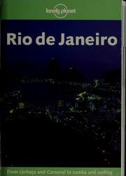

Search results from Open Library.
Recent natural events nearby
Ground air-quality sensors
Recently spotted species
Events
Gallery
Official Identifiers
IBGE — Brazilian Institute of Geography and Statistics
- IBGE code
- 3305802
- UF
- RJ
- Mesorregião
- Metropolitana do Rio de Janeiro
- Microrregião
- Serrana
servicodados.ibge.gov.br
Sources
- • Wikipedia
- • Wikidata
- • Open-Meteo / sunrise-sunset.org
- • Wikipedia Pageviews API
- • Open Library
- • Wikidata SPARQL (CC0) — population, area, elevation, inception, head of government, Commons image
- • IBGE — Brazilian national statistics, via servicodados.ibge.gov.br (official municipal code, UF, mesorregião, microrregião, region)
- • IBGE — Brazilian Institute of Geography and Statistics — servicodados.ibge.gov.br