Browse / Canada / Newfoundland and Labrador / Bay Roberts
Bay Roberts
Newfoundland and Labradortown

Bay Roberts
Total population
5,818
Demographic figures from Statistics Canada. Overview below cites Wikipedia and may reference a different year.
City facts
Facts from Wikidata (CC0).
Overview
Bay Roberts is a town located on the north shore of Conception Bay on the northeastern Avalon Peninsula in the province of Newfoundland and Labrador, Canada. As of 2016, the town's population is 6,012 and census agglomeration is 11,083. The growth of the local economy can be connected to the town's proximity to other major Newfoundland markets, by road and by water.
Read more on WikipediaHistory & geography
History
European fishermen visited Bay Roberts as early as the 16th century. Fishermen from Brittany and Normandy in what is today France fished the waters off the coast of Bay Roberts in the early 16th century and named the harbour Baie de Robert. They established onshore fishing rooms where they dried and salted codfish. The French fishermen came to the area because of its large harbour, and flat rock beaches which they used for curing fish. Most likely they started building fishing rooms near the end of Bay Roberts harbour in Bay Roberts East in such areas as Juggler's Cove. Then they moved to French's Cove and later to Mercer's Cove. Evidence of these European people can be found in community place names such as Priaulx Hill and in nearby names such as Spaniard's Bay and Port de Grave. By the late 16th century, Bay Roberts had become part of the English Shore. Some French, Spanish and Portuguese fishermen still visited the area but they were out numbered by fishermen from the English West Country. Over time, some of these West Country fishermen began to settle in the area. Seary's book Family Names of the Island of Newfoundland states that the families with the surname French arrived as long ago as 1634 and the Earles and the Badcocks arrived in the 1660s. In the 1675 census, Bay Roberts is called "Bay of Roberts." The Berry census of Newfoundland records only two planters in Bay Roberts. One was Anthony Varder who lived there with his wife and four children. The other one was a widow named Jane Clay. The 1677 census says between them they employed 19 servants, owned six boats and kept 34 cattle, 22 sheep and 13 hogs. Families such as the Parsons, Mercers and Bishops arrived later. These early settlers left behind archaeological evidence of their way of life. Clay…
Geography
The town is connected by Veterans' Memorial Highway to Route 1 (the Trans-Canada Highway) leading to all points in the province. St. John's, the capital city, is away. Argentia, the eastern terminal for Marine Atlantic's Gulf Ferry Service, is away. Local businesses have easy access to more than half of the province's population. As a result, the town is a centre for major transportation and distribution, providing services for the Avalon Peninsula and surrounding areas. With approximately 6,000 people, it is one of the larger towns in Newfoundland, and the largest on the Baccalieu Trail. The town has a provincially recognized museum called the Road to Yesterday, and the Shoreline Heritage Walk has been developed. The Shoreline Heritage Walk is a walking trail which passes through Juggler's Cove and French's Cove in Bay Roberts East and celebrates the early history of the town. Bay Roberts offers year-round shipping services through its large port, which is similar in size to the harbour in St. John's and can accommodate the largest of ships. It is protected from ocean storms by Fergus Island at its entrance. The bay and harbour have clear shorelines, without rocks or headland protrusions. As a result of its size and outstanding features, it has been approved for anchorage by marine insurance companies.
Excerpted from the corresponding Wikipedia article (CC BY-SA).
Geography
Coordinates & boundaries from the US Census TIGER/Line shapefiles.
Climate
Air quality
Walkability
Amenities nearby
Wildlife & biodiversity
Earthquake history
Photos
Sights & places nearby
Notable people from here


People born within ~10 km, from Wikidata (CC0). Click any name for their Wikipedia article.
Geography & sun
Elevation, sunrise/sunset and daylight from Open-Meteo. Solar climatology from NASA POWER.
Nearby airports
Public attention
Pageview totals from the Wikimedia Pageviews API.
Books about Bay Roberts
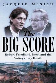
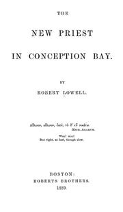
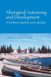
Search results from Open Library.
Recent natural events nearby
Ground air-quality sensors
Recently spotted species
Events
Gallery
Official Identifiers
StatCan — Statistics Canada
- SGC code
- 1001409
- Wikidata
- Q2892168
Standard Geographical Classification (SGC) via Wikidata P3012
Sources
- • Wikipedia
- • Wikidata
- • Open-Meteo / sunrise-sunset.org
- • Wikipedia Pageviews API
- • Open Library
- • StatCan — Statistics Canada — Standard Geographical Classification (SGC) via Wikidata P3012