Browse / United States / California / Big Pine
Big Pine
CaliforniaCDP

Big Pine
Total population
1,615
Median home value
$307,600
Bachelor's+
Median income
$67,583
Demographic figures from US Census Bureau · ACS 5-year estimates. Overview below cites Wikipedia and may reference a different year.
City facts
Facts from Wikidata (CC0).
Overview
Big Pine is a census-designated place (CDP) in Inyo County, California, United States. Big Pine is located approximately 15 miles (24 km) south-southeast of Bishop. Its population was 1,875 at the 2020 census, up from 1,756 at the 2010 census. The Big Pine Band of Owens Valley Paiute Shoshone Indians of the Big Pine Reservation bases their tribal headquarters here.
Read more on WikipediaHistory & geography
History
The Big Pine post office first opened in 1870, closed for a time during 1877, changed its name to Bigpine in 1895, and reverted to Big Pine in 1962. Big Pine has a significant geologic feature (an earthquake scarp) related to the 1872 Lone Pine earthquake. In 1958, the Owens Valley Radio Observatory was established just north of Big Pine. Matt Williams, a professional baseball player and manager, lived there for part of his life. Hollywood character actor Elisha Cook, Jr., known for such classic films as The Maltese Falcon and Shane, had a home in Big Pine and died there in 1995.
Geography
Big Pine is located in the Owens Valley of California between the Sierra Nevada and the White Mountains, just west of the Owens River upstream of its diversion into the Los Angeles Aqueduct. It lies on U.S. Route 395, the main north–south artery through the Owens Valley, connecting the Inland Empire to Reno, Nevada. US 395 also connects Big Pine to Los Angeles via State Route 14 through Palmdale. To the East, CA route 168 crosses the White Mountains over Westgard Pass to the basin and range province of Nevada, while Death Valley Road leads to Death Valley. The plaque beneath the young giant sequoia (pictured), referred to as the Roosevelt Pine, at the road junction says it was planted in 1913 to commemorate the opening of Westgaard Pass to auto traffic. The landmark giant sequoia was felled on September 28, 2020, after most of its foliage had died following its sole water source drying up in the 2017-18 drought. North from Westgaard Pass lies the Ancient Bristlecone Pine Forest, home to the oldest trees in the world. To the West, Glacier Lodge Road leads high up Big Pine Creek into the Sierra, to lakes, hiking trails, fishing, and rock climbing underneath the Palisades Range and the Palisade Glacier. According to the United States Census Bureau, the CDP has a total area of , over 99% of its land.
Excerpted from the corresponding Wikipedia article (CC BY-SA).
Demographics & economy
Race & ethnicity
Source: US Census Bureau — American Community Survey, 5-year estimates.
Geography
Coordinates & boundaries from the US Census TIGER/Line shapefiles.
Climate
Current forecast
Forecast for Big Pine, CA from NOAA NWS API.
Air quality
Industrial & pollution facilities
Natural hazard risk
Health (adults)
Walkability
Amenities nearby
Wildlife & biodiversity
Most-observed species
- Common RavenCorvus corax Linnaeus, 1758 · Aves1,393
- Yellow-rumped WarblerSetophaga coronata (Linnaeus, 1766) · Aves701
- Northern FlickerColaptes auratus (Linnaeus, 1758) · Aves698
- Bewick's WrenThryomanes bewickii (Audubon, 1827) · Aves618
- White-crowned SparrowZonotrichia leucophrys (J.R.Forster, 1772) · Aves583
- House FinchHaemorhous mexicanus (P.L.Statius Müller, 1776) · Aves575
- Song SparrowMelospiza melodia (A.Wilson, 1810) · Aves532
- Red-tailed HawkButeo jamaicensis (Gmelin, 1788) · Aves530
Citizen-science & research observations from the Global Biodiversity Information Facility (GBIF).
Schools
Earthquake history
Most recent
- M 2.55 — 2026-08-2513 km W of Round Valley, CA
- M 2.85 — 2026-08-2419 km SW of Toms Place, CA
- M 2.78 — 2026-08-2419 km SW of Toms Place, CA
- M 2.61 — 2026-08-1811 km SW of Round Valley, CA
- M 2.53 — 2026-08-1718 km SW of Toms Place, CA
- M 3.29 — 2026-08-1419 km SW of Toms Place, CA
Events from the USGS Earthquake Catalog (global) (FDSN Event Web Service).
Photos
Sights & places nearby
Notable people from here
Nearby places in California
Geography & sun
Elevation, sunrise/sunset and daylight from Open-Meteo. Solar climatology from NASA POWER.
Nearby airports
Public attention
Pageview totals from the Wikimedia Pageviews API.
Books about Big Pine

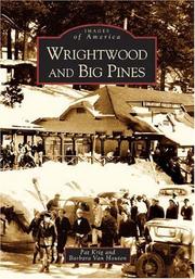
Search results from Open Library.
Recent natural events nearby
- Wildfire 4-May, Inyo, CaliforniaWildfires · 2026-07-25 · 11 mi
- Incident Complex CINDER COMPLEX, Inyo, CaliforniaWildfires · 2026-07-25 · 12 mi
- Wildfire 3-May, Inyo, CaliforniaWildfires · 2026-07-25 · 12 mi
- Wildfire ROCK, Inyo, CaliforniaWildfires · 2026-07-20 · 17 mi
- Wildfire MOUSE MEADOW, Nye, NevadaWildfires · 2026-07-24 · 118 mi
- Wildfire FIELDS, Merced, CaliforniaWildfires · 2026-07-23 · 120 mi
- Wildfire FISH, Kern, CaliforniaWildfires · 2026-07-27 · 132 mi
- Wildfire QUAIL SPRINGS, Lincoln, NevadaWildfires · 2026-07-25 · 143 mi
Wildfires, storms and other events from NASA EONET (last 12 months, within 250 mi).
Ground air-quality sensors
Recently spotted species
Nearest stream gauge
Events
Gallery
Sources
- • Wikipedia
- • US Census Bureau (ACS 5-year estimates)
- • NOAA National Weather Service
- • Wikidata
- • USGS Earthquake Catalog (global feed)
- • GBIF (Global Biodiversity Information Facility)
- • Open-Meteo / sunrise-sunset.org
- • Wikipedia Pageviews API
- • Open Library
- • NASA EONET