Browse / Canada / Quebec / Davidson
Davidson
Quebectown
Total population
1,025
Founded
1903
Demographic figures from Statistics Canada. Overview below cites Wikipedia and may reference a different year.
City facts
Facts from Wikidata (CC0).
Overview
Set in Quebec, Canada, Davidson is recorded in open geodata as a small town. The population stands at approximately 1,025. Geographically it lies in the northern hemisphere at a temperate latitude (45.870°, -76.768°). Its latitude implies a climate characterised by four distinct seasons with warm summers and cold winters. The location receives about 1,305 kWh/m² of solar irradiance per year and sunshine for roughly 51% of daylight hours. Additional figures on demographics, climate, geography and points of interest appear in the sections that follow, all drawn from open public datasets.
Summary composed automatically from structured open data on this page. See our Terms for details.
History & geography
History
In 1902 Colonel Andrew Duncan Davidson, an enthusiastic entrepreneur from Glencoe, Ontario, came to Saskatchewan in hopes of creating a 'midway' settlement between the cities of Regina and Saskatoon. With agriculture as one of his driving passions, Davidson, through the Saskatchewan Valley Land Company, purchased from the railway and the federal government in an area where the soil was particularly suitable for grain farming. Davidson organized a train route that travelled from Chicago to Saskatoon; making one stop in Davidson on the way. This train route brought American bankers, entrepreneurs and newspapermen in hopes of starting up new businesses in the area. With the expansion of the community underway, Davidson also managed to sell more than of land in the area. Within a short period of time, Davidson, which was declared the name of the community, was nicknamed the 'Midway Town' because of its central location. On 15 November 1906, Davidson was officially declared a town. During World War II the Royal Canadian Air Force built and operated RCAF Station Davidson as a component of the British Commonwealth Air Training Plan. The station was constructed on a site east of the town. This site should not be confused with Davidson Municipal Airport which is adjacent to the town, on the south end.
Geography
{| style="min-width:50em" | |}
Excerpted from the corresponding Wikipedia article (CC BY-SA).
Geography
Coordinates & boundaries from the US Census TIGER/Line shapefiles.
Climate
Air quality
Walkability
Amenities nearby
Wildlife & biodiversity
Most-observed species
- American CrowCorvus brachyrhynchos C.L.Brehm, 1822 · Aves2,294
- Blue JayCyanocitta cristata (Linnaeus, 1758) · Aves2,161
- Black-capped ChickadeePoecile atricapillus (Linnaeus, 1766) · Aves2,001
- American RobinTurdus migratorius Linnaeus, 1766 · Aves1,644
- American GoldfinchSpinus tristis (Linnaeus, 1758) · Aves1,572
- Common RavenCorvus corax Linnaeus, 1758 · Aves1,515
- Song SparrowMelospiza melodia (A.Wilson, 1810) · Aves1,382
- Red-winged BlackbirdAgelaius phoeniceus (Linnaeus, 1766) · Aves1,281
Citizen-science & research observations from the Global Biodiversity Information Facility (GBIF).
Earthquake history
Most recent
- M 4 — 2026-04-1421 km NNE of Shawville, Canada
- M 2.8 — 2023-07-0814 km NW of Saint-Boniface, Canada
- M 2.6 — 2023-07-0435 km ESE of Saint-Raphaël, Canada
- M 2.5 — 2022-05-10southern Ontario, Canada
- M 2.7 — 2020-02-0210 km WSW of Saint-Boniface, Canada
- M 2.9 — 2018-07-1917 km SW of Petawawa, Canada
Events from the USGS Earthquake Catalog (global) (FDSN Event Web Service).
Photos
Sights & places nearby
Notable people from here


People born within ~10 km, from Wikidata (CC0). Click any name for their Wikipedia article.
Nearby places in Quebec
- Fort-Coulonge2.5 mi away · pop. 1,377
- Île-du-Grand-Calumet12.8 mi away
- Chapeau15.1 mi away
- Otter Lake16.3 mi away
- Bristol27.8 mi away
- Danford Lake29.6 mi away
- Lac-des-Loups29.7 mi away
- Lac-Cayamant31 mi away
- Sainte-Cécile-de-Masham38.6 mi away
- Luskville43.2 mi away
- Wakefield43.4 mi away
- Saint-Aimé-du-Lac-des-Îles69.9 mi away
Geography & sun
Elevation, sunrise/sunset and daylight from Open-Meteo. Solar climatology from NASA POWER.
Nearby airports
Public attention
Pageview totals from the Wikimedia Pageviews API.
Books about Davidson
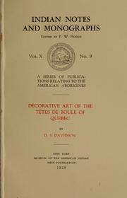


Search results from Open Library.
Recent natural events nearby
Ground air-quality sensors
Recently spotted species
Events
Gallery
Official Identifiers
StatCan — Statistics Canada
- SGC code
- 4711014
- Wikidata
- Q1427885
Standard Geographical Classification (SGC) via Wikidata P3012
Sources
- • Wikipedia
- • Wikidata
- • USGS Earthquake Catalog (global feed)
- • GBIF (Global Biodiversity Information Facility)
- • Open-Meteo / sunrise-sunset.org
- • Wikipedia Pageviews API
- • Open Library
- • StatCan — Statistics Canada — Standard Geographical Classification (SGC) via Wikidata P3012