Browse / Canada / Alberta / Elkwater
Elkwater
Albertavillage

Elkwater
Total population
84
Demographic figures from Statistics Canada. Overview below cites Wikipedia and may reference a different year.
City facts
Overview
Elkwater is an unincorporated community at the western edge of the Cypress Hills in southeastern Alberta, Canada, 65 kilometres (40 mi) southeast of Medicine Hat. The main access route is via Alberta Highway 41, which leads south from the Trans-Canada Highway.
Read more on WikipediaHistory & geography
Geography
Coordinates & boundaries from the US Census TIGER/Line shapefiles.
Climate
Air quality
Walkability
Amenities nearby
Wildlife & biodiversity
Earthquake history
Photos
Sights & places nearby
Notable people from here
Nearby places in Alberta
- Elkwater Hutterite Colony9.5 mi away
- Irvine20.5 mi away
- Manyberries25.8 mi away
- Murray Lake Hutterite Colony27.2 mi away
- Mayfield Hutterite Colony33.9 mi away
- Pendant d’Oreille41.3 mi away
- Sunrise Hutterite Colony42.7 mi away
- Winnifred Hutterite Colony44.1 mi away
- Rosedale Hutterite Colony44.3 mi away
- Baker Hutterite Colony47.3 mi away
- Shamrock Hutterite Colony47.9 mi away
- Bow Island51 mi away
Geography & sun
Elevation, sunrise/sunset and daylight from Open-Meteo. Solar climatology from NASA POWER.
Nearby airports
Public attention
Pageview totals from the Wikimedia Pageviews API.
Books about Elkwater
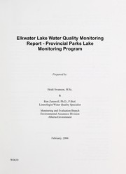
Search results from Open Library.
Recent natural events nearby
- Wildfire Middle Coulee, Chouteau, MontanaWildfires · 2026-08-02 · 137 mi
- Wildfire Camp Creek, Powell, MontanaWildfires · 2026-08-21 · 201 mi
- Wildfire Ant Park, Meagher, MontanaWildfires · 2026-07-31 · 203 mi
- Wildfire Skillet, Lincoln, MontanaWildfires · 2026-07-29 · 223 mi
- Wildfire Deer Creek, Lincoln, MontanaWildfires · 2026-08-20 · 241 mi
Wildfires, storms and other events from NASA EONET (last 12 months, within 250 mi).
Ground air-quality sensors
Recently spotted species
Events
Gallery
Sources
- • Wikipedia
- • Wikidata
- • Open-Meteo / sunrise-sunset.org
- • Wikipedia Pageviews API
- • Open Library
- • NASA EONET