Browse / Canada / Ontario / Embrun
Embrun
Ontariotown

Embrun
Total population
8,669
Founded
1845
Demographic figures from Statistics Canada. Overview below cites Wikipedia and may reference a different year.
City facts
Facts from Wikidata (CC0).
Overview
Embrun, is a community in the Canadian province of Ontario in the Eastern Ontario region. Embrun is also part of the National Capital Region. Embrun is part of the larger Russell Township in Prescott and Russell United Counties. In 2021, the population centre of Embrun had a total population of 8,680. This makes Embrun the largest community in the Township of Russell.
Read more on WikipediaHistory & geography
History
The first residents of Embrun settled the town in 1845. François Michel named the town in 1857 after Embrun, France. In the period from 1985 to 1995 Embrun's population doubled and an indoor shopping mall and business park opened. A second round of major growth occurred in the first few years of the 21st century. Between 2001 and 2006 Embrun was the fastest growing community in the 613 area code and the 8th fastest growing community in the entire province, having grown at a rate of 26.6%. This railway line continued operation until 1957, when a combination of pressures from the National Capital Commission, who wished to cut down on the number of railway lines through Ottawa in an effort to eliminate noise pollution, as well as from the Saint Lawrence Seaway project, which required the removal of the railway's bridge in Cornwall, caused the railway line to shut down. The last trains ran in February 1957, and in April CN purchased the railway track and proceeded to demolish it. Although some segments in Cornwall and Ottawa were retained, the line through Embrun was scrapped. A few decades later, the municipal government constructed a rail trail on the right of way, which remains in use to the present day.
Geography
Embrun has several distinct neighbourhoods. With the exception of the Lapointe & Town-Centre neighbourhoods (which have built onto each other as a result of infill development), each of the neighbourhoods are physically separated by open space, although much of this open space will likely be eliminated in the near future as the municipality pushes for more infill. The municipality has recently adopted smart growth principles to guide its future development. The official plan calls for densification and infill of existing urban land, rather than acquiring more rural land. A near-doubling of Embrun's population will be accomplished in the next 10–15 years with only two new neighbourhoods (both in land already designated as urban land use zones) being built. The rest of the population growth will be done by building housing units in the open spaces between existing neighbourhoods, and by eventually replacing single-family homes on some busier streets with apartments and condos. Through this plan, Embrun's population will increase from its current population of around 6,000 people to upwards of 10,000 people in 2021, with only a small amount of land to the west being added to the urban zone. Nonetheless, the two areas are distinct in the types of enterprises operating in them. Chantal Development is a rather quiet residential area in the Western part of Embrun. To the east of Chantal Development lies the town centre (officially called Centre-Ville). To the west lies the Business Park and the Industrial Park. There are several streets in the Chantal Development: Olympic Street, Domaine Street, Menard Street, Isabelle Street, Loiselle Street, Chantal Crescent, Promenade Boulevard, and Chateau Crescent. An infill subdivision is planned for the area and will be located…
Excerpted from the corresponding Wikipedia article (CC BY-SA).
Geography
Coordinates & boundaries from the US Census TIGER/Line shapefiles.
Climate
Air quality
Walkability
Amenities nearby
Wildlife & biodiversity
Earthquake history
Photos
Sights & places nearby
Notable people from here


People born within ~10 km, from Wikidata (CC0). Click any name for their Wikipedia article.
Nearby places in Ontario
Geography & sun
Elevation, sunrise/sunset and daylight from Open-Meteo. Solar climatology from NASA POWER.
Nearby airports
Public attention
Pageview totals from the Wikimedia Pageviews API.
Books about Embrun
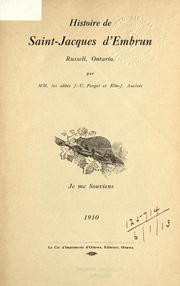
Search results from Open Library.
Recent natural events nearby
Ground air-quality sensors
Recently spotted species
Events
Gallery
Sources
- • Wikipedia
- • Wikidata
- • Open-Meteo / sunrise-sunset.org
- • Wikipedia Pageviews API
- • Open Library