Browse / Canada / Newfoundland and Labrador / Exploits
Exploits
Newfoundland and Labradorhamlet

Featured view
Exploits
Coordinates49.52°, -55.07°
Demographic figures from Statistics Canada. Overview below cites Wikipedia and may reference a different year.
Loading additional data from public sources…0 / 11
CensusWikipediaWeatherPlacesPeopleEnvironmentHealth & SchoolsRelatedGeography & CultureLive MonitoringEvents & Gallery
0% completeCity facts
Overview
Exploits was a community located on Burnt Island, Newfoundland, Canada. Its strategic location made it an ideal hub for sealing, fishing, and trading with Labrador. But by the late 1960s, the community had been largely resettled. Today, the community only consists of seasonal residents.
Read more on WikipediaHistory & geography
Geography
Latitude
49.5244
Longitude
-55.0676
Water area
—
Coordinates & boundaries from the US Census TIGER/Line shapefiles.
Climate
Air quality
Walkability
Amenities nearby
Wildlife & biodiversity
Earthquake history
Photos
Sights & places nearby
Notable people from here
Geography & sun
Avg solar (kWh/m²/day)
2.95
Annual solar (kWh/m²)
1,076
Elevation, sunrise/sunset and daylight from Open-Meteo. Solar climatology from NASA POWER.
Nearby airports
Public attention
Wikipedia views (last 30 days)
75
Avg daily Wikipedia views
3
Attention level
Obscure
Pageview totals from the Wikimedia Pageviews API.
Books about Exploits

Newfoundland birds
William A. Montevecchi · 1987
An assessment of the stocking of Atlantic salmon (Salmo salar L.) fry in the tributaries of the middle Exploits River, Newfoundland
M. F. O'Connell · 1983
Early European settlement and exploitation in Atlantic Canada
G. M. Story · 1982
Geology and mineral deposits of the bay of Exploits area
George Richard Heyl · 1936
By the sweat of my brow
John Kitchen · 2005

If gender mattered
Linda Archibald · 1999
River lords
Amy Louise Peyton · 1987
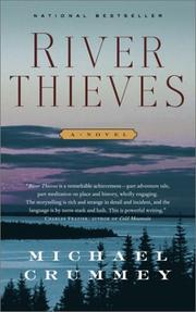
River thieves
Michael Crummey · 2001
Search results from Open Library.
Recent natural events nearby
Ground air-quality sensors
Recently spotted species
Events
Gallery
Sources
- • Wikipedia
- • Wikidata
- • Open-Meteo / sunrise-sunset.org
- • Wikipedia Pageviews API
- • Open Library