Browse / Canada / Alberta / Fort McMurray
Fort McMurray
Albertacity

Fort McMurray
Total population
66,573
Founded
1870
Demographic figures from Statistics Canada. Overview below cites Wikipedia and may reference a different year.
City facts
Facts from Wikidata (CC0).
Overview
Fort McMurray is an urban service area in the Regional Municipality of Wood Buffalo in Alberta, Canada. It is located in northeast Alberta, in the middle of the Athabasca oil sands, surrounded by boreal forest. It has played a significant role in the development of the national petroleum industry. The 2016 Fort McMurray wildfire led to the evacuation of its residents and caused widespread damage.
Read more on WikipediaHistory & geography
History
Before the arrival of Europeans in the late 18th century, the Cree were the dominant First Nations people in the Fort McMurray area. The Athabasca oil sands were known to the locals and the surface deposits were used to waterproof their canoes. During the fur trade, the location of Fort McMurray, west of Methye Portage, was an important junction on the fur trade route from eastern Canada to the Athabasca Country. In 1778, the first European explorer, Peter Pond, came to the region in search of furs, as the European demand for this commodity at the time was strong. Pond explored the region farther south along the Athabasca River and the Clearwater River, but chose to set up a trading post much farther north by the Athabasca River near Lake Athabasca. However, his post closed in 1788 in favour of Fort Chipewyan, now the oldest continuous settlement in Alberta. In 1790, the explorer Alexander MacKenzie made the first recorded description of the oil sands. By that time, trading between the explorers and the Cree was already occurring at the confluence of the Clearwater and Athabasca rivers. The Hudson's Bay Company and the North West Company were in fierce competition in this region. Fort McMurray was established there as a Hudson's Bay Company post by 1870, named for the Chief Factor William McMurray. It continued to operate as a transportation stopover in the decades afterwards. The Alberta and Great Waterways Railway arrived in 1915 complementing existing steamboat service. The community has played a significant role in the history of the petroleum industry in Canada. Oil exploration is known to have occurred in the early 20th century, but Fort McMurray's population remained small, no more than a few hundred people. By 1921, there was serious interest in…
Geography
Fort McMurray is northeast of Edmonton on Highway 63, about west of the Saskatchewan border, nestled in the boreal forest at the confluence of the Athabasca River, the Clearwater River, the Hangingstone River, and the Horse River. It sits at above sea level. Fort McMurray is the largest community in the Regional Municipality of Wood Buffalo. White spruce, trembling aspen, balsam poplar and white birch are the most prominent native trees in and around town. Black spruce and tamarack occur in poorly drained areas and jack pine may be seen on the driest sites. European aspen, blue spruce and sand cherry are among the exotic trees occasionally seen. With severe winters except during periods of warming chinook winds, mild to warm summers and only three months whose average temperature is higher than , Fort McMurray has a borderline subarctic climate (Köppen: Dfc), being just below the threshold of humid continental climate (Dfb), with May and September average temperature of . It falls into the Natural Resources Canada (NRC) Plant Hardiness Zone 3a. The community lies at a lower elevation than most other parts of Alberta, so under the right conditions it can be a "hot spot" for Alberta. Temperatures range from an average of in January, to in July. The average annual precipitation is and falls mainly in the summer months. Average annual snowfall is , The lowest temperature ever recorded was on February 1, 1917 and December 31, 1933. and Wood Buffalo Estates.
Excerpted from the corresponding Wikipedia article (CC BY-SA).
Geography
Coordinates & boundaries from the US Census TIGER/Line shapefiles.
Climate
Air quality
Walkability
Amenities nearby
Wildlife & biodiversity
Most-observed species
- Black-billed MagpiePica hudsonia (Sabine, 1823) · Aves2,640
- Common RavenCorvus corax Linnaeus, 1758 · Aves2,383
- Black-capped ChickadeePoecile atricapillus (Linnaeus, 1766) · Aves1,922
- Blue JayCyanocitta cristata (Linnaeus, 1758) · Aves1,373
- American RobinTurdus migratorius Linnaeus, 1766 · Aves1,372
- American CrowCorvus brachyrhynchos C.L.Brehm, 1822 · Aves1,250
- House SparrowPasser domesticus (Linnaeus, 1758) · Aves1,204
- White-throated SparrowZonotrichia albicollis (J.F.Gmelin, 1789) · Aves1,158
Citizen-science & research observations from the Global Biodiversity Information Facility (GBIF).
Earthquake history
Events from the USGS Earthquake Catalog (global) (FDSN Event Web Service).
Photos
Sights & places nearby
Notable people from here


People born within ~10 km, from Wikidata (CC0). Click any name for their Wikipedia article.
Nearby places in Alberta
- Clearwater Camp14.5 mi away
- Janvier South63.7 mi away · pop. 100
- Gardiner Camp68.3 mi away
- Wabasca-Desmarais107.4 mi away
- Chipewyan Camp - 201C119.3 mi away
- Amesbury121.6 mi away
- Fort Chipewyan137.6 mi away · pop. 852
- Dakin141.1 mi away
- Frains144.4 mi away
- Sarrail145 mi away
- Deep Creek Hutterite Colony145.4 mi away
- Donatville147.5 mi away
Geography & sun
Elevation, sunrise/sunset and daylight from Open-Meteo. Solar climatology from NASA POWER.
Nearby airports
Public attention
Pageview totals from the Wikimedia Pageviews API.
Books about Fort McMurray


Search results from Open Library.
Recent natural events nearby
Ground air-quality sensors
Recently spotted species
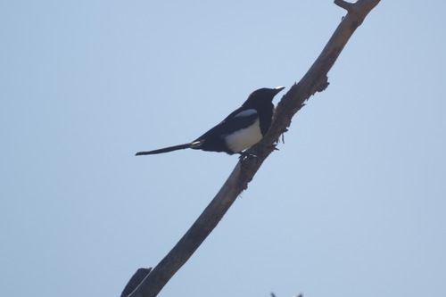
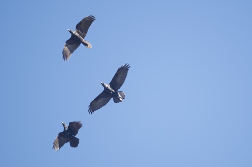
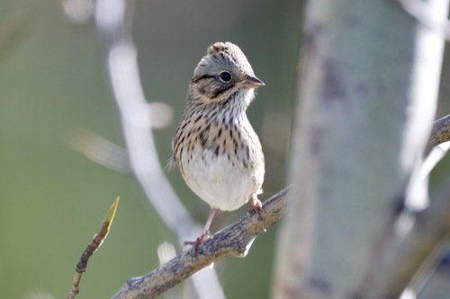
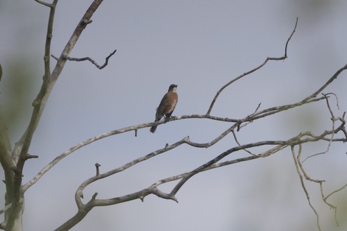
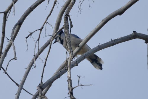
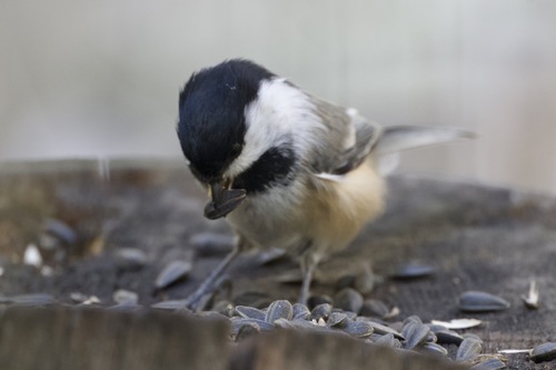
Research-grade observations from iNaturalist (within ~15 mi).
Events
Gallery
Sources
- • Wikipedia
- • Wikidata
- • USGS Earthquake Catalog (global feed)
- • GBIF (Global Biodiversity Information Facility)
- • iNaturalist
- • Open-Meteo / sunrise-sunset.org
- • Wikipedia Pageviews API
- • Open Library