Browse / Canada / British Columbia / Gabriola
Gabriola
British Columbiatown

Gabriola
Total population
4,045
Demographic figures from Statistics Canada. Overview below cites Wikipedia and may reference a different year.
City facts
Facts from Wikidata (CC0).
Overview
Gabriola Island is one of the Gulf Islands in the Strait of Georgia in British Columbia (BC), Canada. It is about 5 kilometres (3.1 mi) east of Nanaimo on Vancouver Island, to which it is linked by a 20-minute ferry service. It has a land area of about 57.6 square kilometres (22.2 sq mi) and a resident population of 4,500.
Read more on WikipediaHistory & geography
History
Gabriola is part of the traditional territory of the Snunéymux (of whose name the nearby city of Nanaimo was given an anglicized form). The earliest archeological record on Gabriola is a cave burial dated to about 1500 BC. The pre-contact population of Gabriola is difficult to estimate, but in mid-Marpole times—between about AD 1 and 1000—several thousand people lived in the village at Senewélets or more commonly known as, False Narrows, the site of today's El Verano Drive. Overall, there are over 200 archaeological sites on Gabriola and the isles near it. The island is famous for its petroglyphs, which, while commonly believed to be thousands of years old, are almost impossible to date. Because they are carved in relatively soft sandstone, they are eroding rapidly. In 1792, the island was again visited by a Spanish expedition, under Galiano and Valdés. Galiano and Valdés stayed at Pilot Bay for several days, to repair their vessels and explore the vicinity of what is now Nanaimo. They called the anchorage Cala del Descanso ("Cove of Rest"). Galiano stayed at the island for four days and while there, encountered several Indigenous people and engaged in limited trading. Galiano also found an abandoned First Nations village. While the Spanish explored and charted the Strait of Georgia, they left no permanent settlements. In 1827, fur traders of the Hudson's Bay Company established a post at Fort Langley on the Fraser River, but no Europeans settled in the Nanaimo area until the discovery of coal there in 1852. From the mid-1850s on, coal miners and ex-gold miners began to move to Gabriola, where they started farms to supply the growing population of Nanaimo. By 1874, 17 settlers were working the land on Gabriola, and two-thirds of those had First Nations wives and…
Geography
Gabriola, part of the Regional District of Nanaimo, is the most northerly of the Southern Gulf Islands in the Strait of Georgia between mainland BC to the east and Vancouver Island to the west. The Gulf Islands are an archipelago consisting of hundreds of islands of various sizes stretching from the San Juan Islands in the United States to the Northern Gulf Islands, north of Gabriola. The biggest of the Southern Gulf Islands are Gabriola Island, Galiano Island, Penelakut Island, North and South Pender Island, Saltspring Island, Saturna Island, Thetis Island, and Valdes Island. The Southern Gulf Islands consist mainly of former seabed sediments crumpled and gradually thrust upward by tectonic plate movement approximately ago. Subsequent periods of glaciation scraped away topsoil and some of the bedrock. During the peak of the Fraser Glaciation, ago, Gabriola was covered with ice up to thick. Though melting glaciers left deposits of sand, gravel, and boulders, the main rocks exposed on Gabriola's surface are sandstone and shale. Differential erosion of relatively soft shales and relatively hard sandstones helped create cliffs, points, and bays along Gabriola's shoreline. The topography varies from flat sandy beaches at sea level to forested hills rising to on Stoney Ridge in the centre of the island. Gabriola lies about east of Nanaimo, the second largest city on Vancouver Island, to which it is linked by BC Ferries. The ferry, which takes 20 minutes for the crossing, runs almost hourly from 6:15 a.m, starting at the Gabriola side, to about 11:00 p.m., from Nanaimo, daily. Residents of Gabriola who work or attend high school in Nanaimo use the ferry to commute. Gabriola may also be reached by float plane or small boat. Islands and islets near…
Excerpted from the corresponding Wikipedia article (CC BY-SA).
Geography
Coordinates & boundaries from the US Census TIGER/Line shapefiles.
Climate
Air quality
Walkability
Amenities nearby
Wildlife & biodiversity
Earthquake history
Photos
Sights & places nearby
Notable people from here
Geography & sun
Elevation, sunrise/sunset and daylight from Open-Meteo. Solar climatology from NASA POWER.
Nearby airports
Public attention
Pageview totals from the Wikimedia Pageviews API.
Books about Gabriola
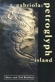

Search results from Open Library.
Recent natural events nearby
- Wildfire Electric, Whatcom, WashingtonWildfires · 2026-08-22 · 115 mi
- Wildfire Thunder Creek, Skagit, WashingtonWildfires · 2026-08-22 · 135 mi
- Wildfire SISI, Chelan, WashingtonWildfires · 2026-08-14 · 149 mi
- Wildfire KING, Kittitas, WashingtonWildfires · 2026-08-19 · 167 mi
- Wildfire GOAT, Kittitas, WashingtonWildfires · 2026-08-22 · 175 mi
Wildfires, storms and other events from NASA EONET (last 12 months, within 250 mi).
Ground air-quality sensors
Recently spotted species
Events
Gallery
Sources
- • Wikipedia
- • Wikidata
- • Open-Meteo / sunrise-sunset.org
- • Wikipedia Pageviews API
- • Open Library
- • NASA EONET