Browse / United States / California / Hopland
Hopland
CaliforniaCDP

Hopland
Total population
983
Median home value
$612,200
Bachelor's+
Median income
$91,786
Demographic figures from US Census Bureau · ACS 5-year estimates. Overview below cites Wikipedia and may reference a different year.
City facts
Facts from Wikidata (CC0).
Overview
Hopland is a census-designated place in Mendocino County, California, United States. It is located on the west bank of the Russian River, 13 miles (21 km) south-southeast of Ukiah, in the Sanel Valley, at an elevation of 502 feet (153 m). The population was 661 at the 2020 census, down from 756 at the 2010 census.
Read more on WikipediaHistory & geography
History
The Hopland Band of Pomo Indians, or Sho-Ka-Wah, are Central Pomo people who have lived in Hopland since "the beginning of time". The Sho-Ka-Wah lived their lives hunting, gathering, making, practicing spirituality and generally living their lives. Their main village, population 1,500, was called "Shanel". After the settlers came, they were forced to move, and then to move again. Today most of the Sho-Ka-Wah people live in the Hopland reservation east of Hopland. They have a gambling facility and other businesses to support their community. The community also engages in spirituality, dance traditions, and caring for the land. The settlement that became Hopland was originally called "Sanel". This began in 1868 when L.F. Long established the first hop farm some north, where the railroad station called Largo (Spanish for "long", after Samuel F. Long ) was later located. Downy mildew pushed hops out of the area completely by the late 1950s.
Geography
Hopland is in southeastern Mendocino County, along U.S. Route 101, which leads north-northwest to Ukiah, the county seat, and southeast to Santa Rosa, the Sonoma County seat. According to the United States Census Bureau, the Hopland CDP covers an area of , 98.65% of it land and 1.35% of it water. The Russian River flows southward through the eastern side of the community, separating the main village of Hopland from Old Hopland, also part of the CDP, on the eastern side of the river.
Excerpted from the corresponding Wikipedia article (CC BY-SA).
Demographics & economy
Race & ethnicity
Source: US Census Bureau — American Community Survey, 5-year estimates.
Geography
Coordinates & boundaries from the US Census TIGER/Line shapefiles.
Climate
Current forecast
Forecast for Hopland, CA from NOAA NWS API.
Air quality
Industrial & pollution facilities
Natural hazard risk
Health (adults)
Walkability
Amenities nearby
Wildlife & biodiversity
Schools
Earthquake history
Photos
Sights & places nearby
Notable people from here
Nearby places in California
- Lakeport11.5 mi away · pop. 5,113
- North Lakeport13.8 mi away
- Kelseyville15.3 mi away
- Nice17.8 mi away
- Philo18.8 mi away
- Cobb23.1 mi away · pop. 842
- Clearlake Oaks25 mi away · pop. 2,198
- Lower Lake27.7 mi away
- Cazadero30.5 mi away
- Manchester30.8 mi away · pop. 184
- Point Arena31.3 mi away
- Jenner35.2 mi away · pop. 18
Geography & sun
Elevation, sunrise/sunset and daylight from Open-Meteo. Solar climatology from NASA POWER.
Nearby airports
Public attention
Pageview totals from the Wikimedia Pageviews API.
Books about Hopland
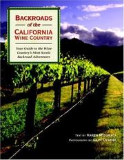

Search results from Open Library.
Recent natural events nearby
- Wildfire FELIZ, Mendocino, CaliforniaWildfires · 2026-08-01 · 3 mi
- Wildfire LUCAS, Lake, CaliforniaWildfires · 2026-09-10 · 19 mi
- Wildfire LUCAS, Lake, CaliforniaWildfires · 2026-09-10 · 19 mi
- Wildfire GANN, Calaveras, CaliforniaWildfires · 2026-08-03 · 140 mi
- Wildfire MP18, Humboldt, CaliforniaWildfires · 2026-08-07 · 153 mi
- Wildfire FLORISTON, Nevada, CaliforniaWildfires · 2026-09-16 · 168 mi
- Wildfire Bug, Lassen, CaliforniaWildfires · 2026-08-08 · 173 mi
- Wildfire Hawk, Washoe, NevadaWildfires · 2026-08-22 · 174 mi
Wildfires, storms and other events from NASA EONET (last 12 months, within 250 mi).
Ground air-quality sensors
Recently spotted species
Nearest stream gauge
Events
Gallery
Sources
- • Wikipedia
- • US Census Bureau (ACS 5-year estimates)
- • NOAA National Weather Service
- • Wikidata
- • Open-Meteo / sunrise-sunset.org
- • Wikipedia Pageviews API
- • Open Library
- • NASA EONET