Browse / Canada / British Columbia / Hudson's Hope
Hudson's Hope
British Columbiatown
Founded
1805
Demographic figures from Statistics Canada. Overview below cites Wikipedia and may reference a different year.
City facts
Facts from Wikidata (CC0).
Overview
Hudson's Hope is a district municipality in northeastern British Columbia, Canada, in the Peace River Regional District. Having been first settled along the Peace River in 1805, it is the third-oldest European-Canadian community in the province, although it was not incorporated until 1965. Most jobs in the economy are associated with the nearby W. A. C. Bennett Dam and Peace Canyon Dam, and timber logging.
Read more on WikipediaHistory & geography
History
Nomadic aboriginal Dene zaa tribes originally occupied the area. Alexander Mackenzie and his team of voyageurs became the first Europeans to travel through as they canoed westward along the Peace River in 1793. Simon Fraser followed in 1805 and established a North West Company fur-trading outpost, the Rocky Mountain Portage House, at the foot of the canyon directly across the river from the current townsite. This was the only significant portage site on the Peace River between Fort Chipewyan and Fort McLeod. The Hudson's Bay Company took control of the fort after merging with the North West Company in 1821 but abandoned it in 1823 after a massacre in the nearby Fort St. John outpost. The HBC opened a new trading post on the southern river banks in 1866 to compete against free traders coming in from the west. (Hudson's Bay Company Archives B.39/b/18 p. 57) Though its origins are unclear, the name Hudson's Hope was first recorded in 1868. Theories on its origin include an explorer named Hudson searching for the Northwest Passage, or a prospector named Henry Hudson searching for gold, or the use of the English and Scottish word hope, meaning a small enclosed valley. In 1899 the fort was moved to the townsite's present-day location on the north bank to better serve those portaging northwestwards. Much of the area was explored by prospectors and surveying crews as the Peace River Block was opened to mineral staking in 1908 and homestead claims in 1912. A permanent settlement was established in 1912 by a police officer, who was previously stationed in Fort St. John, and a friend from Victoria, who staked the first homestead. Others joined them as they travelled through Edmonton, Dunvegan, and Fort St. John to found the communities of Beryl Prairie and Lynx Creek.…
Geography
The main townsite is wide, long flat along the north bank of the Peace River, and the rural communities of Beryl Prairie, Lynx Creek, and Farrell Creek. The Peace River originates at the W.A.C. Bennett Dam from the Peace Reach Arm of Williston Lake and flows around the tall Portage Mountain and through Dinosaur Lake. The water is retained here for three days before being released to the Peace Canyon Dam. It flows northeastward past the townsite, and the rural communities of Lynx Creek and Farrell Creek, and eventually into the Arctic Ocean. The Hudson's Hope Suspension Bridge provides passage over the river near the town. The forested foothills of the Rocky Mountains, including Mount Johnson and the Two Ridge Mountain, dominate the area south of the Peace River. The foothills continue north of the river, passing into prairie land at Beryl Prairie. Dinosaur Lake is the deeply entrenched reservoir of the Peace Canyon Dam, having a surface area of and a volume of . The oligotrophic lake is fed by Williston Lake and 5 tributaries (Gething, Johnson, Moosebar, Starfish and Mogul creeks). }} Historically, winters have been very cold and snowy. However, since the filling of Williston Lake, the largest man-made lake in North America, the winters have been milder with an average January temperature of and annual snowfall of . The municipality has an average growing season of 135 days, the longest in northern BC, with an average July temperature of . With the dams, both the lakes and the river are isothermal at about .
Excerpted from the corresponding Wikipedia article (CC BY-SA).
Geography
Coordinates & boundaries from the US Census TIGER/Line shapefiles.
Climate
Air quality
Walkability
Amenities nearby
Wildlife & biodiversity
Earthquake history
Photos
Sights & places nearby
Notable people from here
Nearby places in British Columbia
- Oetco Flats38.2 mi away
- Baldonnel49 mi away
- Pine Valley50.1 mi away
- Rose Prairie53.8 mi away
- Peace View Hutterite Colony55.3 mi away
- Fellers Heights60.6 mi away
- South Peace Hutterite Colony63.8 mi away
- Mackenzie66.8 mi away
- Goodlow71.6 mi away
- Pink Mountain73.7 mi away
- Mackenzie Junction74.8 mi away
- Nig Creek80 mi away
Geography & sun
Elevation, sunrise/sunset and daylight from Open-Meteo. Solar climatology from NASA POWER.
Nearby airports
Public attention
Pageview totals from the Wikimedia Pageviews API.
Books about Hudson's Hope
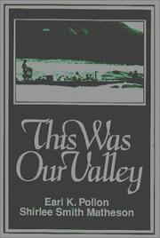
Search results from Open Library.
Recent natural events nearby
Ground air-quality sensors
Recently spotted species
Events
Gallery
Official Identifiers
StatCan — Statistics Canada
- SGC code
- 5955025
- Wikidata
- Q14874625
Standard Geographical Classification (SGC) via Wikidata P3012
Sources
- • Wikipedia
- • Wikidata
- • Open-Meteo / sunrise-sunset.org
- • Wikipedia Pageviews API
- • Open Library
- • StatCan — Statistics Canada — Standard Geographical Classification (SGC) via Wikidata P3012