Browse / Canada / British Columbia / Kitwanga
Kitwanga
British Columbiatown
Demographic figures from Statistics Canada. Overview below cites Wikipedia and may reference a different year.
City facts
Overview
Kitwanga is a town that lies in British Columbia, Canada. On the world map it falls within the Western Hemisphere, specifically at 55.100°, -128.068°. Detailed population figures are not currently catalogued in the open data sources we track. Based on its cool temperate position, residents likely encounter long cool seasons and short, mild summers. Open solar datasets indicate about 982 kWh/m² of solar irradiance per year, combined with sunshine for roughly 38% of daylight hours. Continue scrolling for population, climate, environmental and points-of-interest data drawn from public sources.
Summary composed automatically from structured open data on this page. See our Terms for details.
History & geography
Geography
Coordinates & boundaries from the US Census TIGER/Line shapefiles.
Climate
Air quality
Walkability
Amenities nearby
Wildlife & biodiversity
Most-observed species
- American CrowCorvus brachyrhynchos C.L.Brehm, 1822 · Aves55
- Common RavenCorvus corax Linnaeus, 1758 · Aves43
- American RobinTurdus migratorius Linnaeus, 1766 · Aves43
- Dark-eyed JuncoJunco hyemalis (Linnaeus, 1758) · Aves40
- Pine SiskinSpinus pinus (A.Wilson, 1810) · Aves38
- Yellow-rumped WarblerSetophaga coronata (Linnaeus, 1766) · Aves34
- Violet-green SwallowTachycineta thalassina (Swainson, 1827) · Aves30
- Bald EagleHaliaeetus leucocephalus (Linnaeus, 1766) · Aves28
Citizen-science & research observations from the Global Biodiversity Information Facility (GBIF).
Earthquake history
Events from the USGS Earthquake Catalog (global) (FDSN Event Web Service).
Photos
Sights & places nearby
Notable people from here
Nearby places in British Columbia
Geography & sun
Elevation, sunrise/sunset and daylight from Open-Meteo. Solar climatology from NASA POWER.
Nearby airports
Public attention
Pageview totals from the Wikimedia Pageviews API.
Books about Kitwanga
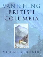

Search results from Open Library.
Recent natural events nearby
Ground air-quality sensors
Recently spotted species
Events
Gallery
Sources
- • Wikidata
- • USGS Earthquake Catalog (global feed)
- • GBIF (Global Biodiversity Information Facility)
- • Open-Meteo / sunrise-sunset.org
- • Wikipedia Pageviews API
- • Open Library