Browse / United States / California / Lompoc
Lompoc
Californiacity

Lompoc
Total population
43,646
Median home value
$472,900
Bachelor's+
Median income
$72,004
Founded
1888
Demographic figures from US Census Bureau · ACS 5-year estimates. Overview below cites Wikipedia and may reference a different year.
City facts
Sister cities
Facts from Wikidata (CC0).
Overview
Lompoc is a city in Santa Barbara County, California, United States. Located on the Central Coast, its population was 43,834 as of July 2021.
Read more on WikipediaHistory & geography
History
Before the Spanish conquest, the area around Lompoc was inhabited by the Chumash people. The Original Mission La Purísima was established in 1787 near what is now the southern edge of the city. Purisimeño, a Chumashan language, was spoken in the region during the mission period. After an earthquake destroyed the mission in 1812, it was moved to its present location northeast of the present city. After independence from the Spanish Empire, the First Mexican Empire was established in 1821. The Mexicans secularized the Spanish missions in 1833, and La Purisima Mission fell into ruins. In 1893, a diatomaceous earth mine, formerly owned by Johns Manville, World Mineral, and Celite corporation, now Imerys Inc., opened in the southern hills in Miguelito Canyon. It became (and still is) the largest marine diatomite mine in the world, and at one time was the largest employer in the valley. While owned by Johns Manville, the mine employed more than 900 people at its peak, and built housing for its employees onsite and in town; the houses in town are next to JM park, which the mine donated to the city. Another diatomaceous earth company, Grefco, operated here from the 1940s until 1998. The remnants of its mine at the northeast end of town were torn down in 2001. In 1909, the Sibyl Marston—at the time, the largest steam schooner built on the West Coast—sank nearby while carrying of lumber. Many Lompoc homes were built with lumber from the shipwreck. The wreckage can still be seen south of Surf Beach. The coastal branch of the Southern Pacific Railroad opened around 1900 and eventually replaced ship transportation. A paved road linked Lompoc to Buellton and the rest of California around 1920. In 1923, the Honda Point disaster, the U.S.'s largest peacetime naval accident,…
Geography
According to the United States Census Bureau, the city has an area of , 99.34% land and 0.66% water. Most of the city is in the valley of the Santa Ynez River, at an elevation of about 80–100 feet (25–30 meters). Expansion has been to the north, on higher ground known as Vandenberg Village, with elevations of 150–300 feet (50–100 meters). Like most rivers in Southern California, the Santa Ynez River has no surface flow most of the year. Underground flow in the sandy river bed recharges the aquifer beneath the city, from which nine wells (a tenth is planned) supply the city with water. Unlike many Southern California cities, Lompoc is not connected to the State Water Project. Lompoc has a cool Mediterranean climate (Köppen climate classification Csb), typical of coastal California. The city is mostly sunny, with an ocean breeze. Fog is common. Snow is virtually unknown. The highest recorded temperature was in 1987, and the lowest was in 1990.
Excerpted from the corresponding Wikipedia article (CC BY-SA).
Demographics & economy
Race & ethnicity
Source: US Census Bureau — American Community Survey, 5-year estimates.
Geography
Coordinates & boundaries from the US Census TIGER/Line shapefiles.
Climate
Current forecast
Forecast for Lompoc, CA from NOAA NWS API.
Air quality
Industrial & pollution facilities
Natural hazard risk
Health (adults)
Walkability
Amenities nearby
Wildlife & biodiversity
Most-observed species
- Bladder kelpMacrocystis pyrifera (L.) C.Agardh · Phaeophyceae2,691
- Turkey VultureCathartes aura (Linnaeus, 1758) · Aves2,355
- House FinchHaemorhous mexicanus (P.L.Statius Müller, 1776) · Aves2,157
- Red-tailed HawkButeo jamaicensis (Gmelin, 1788) · Aves1,976
- California/Woodhouse's Scrub-JayAphelocoma californica (Vigors, 1839) · Aves1,936
- Black PhoebeSayornis nigricans (Swainson, 1827) · Aves1,829
- Song SparrowMelospiza melodia (A.Wilson, 1810) · Aves1,521
- American CrowCorvus brachyrhynchos C.L.Brehm, 1822 · Aves1,490
Citizen-science & research observations from the Global Biodiversity Information Facility (GBIF).
Schools
Earthquake history
Most recent
- M 2.69 — 2026-10-057 km SE of Goleta, CA
- M 2.54 — 2026-08-1712 km SSW of Lompoc, CA
- M 2.66 — 2026-08-1712 km S of Lompoc, CA
- M 2.53 — 2026-08-167 km SW of Atascadero, CA
- M 2.53 — 2026-08-1412 km SSW of Lompoc, CA
- M 2.82 — 2026-08-0912 km SSW of Lompoc, CA
Events from the USGS Earthquake Catalog (global) (FDSN Event Web Service).
Photos
Sights & places nearby
Notable people from here


People born within ~10 km, from Wikidata (CC0). Click any name for their Wikipedia article.
Nearby places in California
Geography & sun
Elevation, sunrise/sunset and daylight from Open-Meteo. Solar climatology from NASA POWER.
Nearby airports
Public attention
Pageview totals from the Wikimedia Pageviews API.
Books about Lompoc

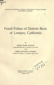

Search results from Open Library.
Recent natural events nearby
Ground air-quality sensors
Recently spotted species
Nearest stream gauge
Events
Gallery
Sources
- • Wikipedia
- • US Census Bureau (ACS 5-year estimates)
- • NOAA National Weather Service
- • Wikidata
- • USGS Earthquake Catalog (global feed)
- • GBIF (Global Biodiversity Information Facility)
- • Open-Meteo / sunrise-sunset.org
- • Wikipedia Pageviews API
- • Open Library