Browse / Canada / British Columbia / Lower Post
Lower Post
British Columbiavillage
Demographic figures from Statistics Canada. Overview below cites Wikipedia and may reference a different year.
City facts
Overview
Lower Post is an aboriginal community in the Stikine Region of far northern British Columbia, Canada, located on Highway 97, the Alaska Highway, approximately 15 miles southeast of Watson Lake, Yukon. Its historical mile designation is Mile 620. It is located near the confluence of the Dease and Liard Rivers.
Read more on WikipediaHistory & geography
History
Early fur traders named it Lower Post to distinguish between the upper and lower Liard trading posts. Lower Post, or Fort Liard (its original name), had been established by an American, Rufus Sylvester, in 1872. Four years later the Hudson's Bay Company took it over and a couple of years afterwards two of its officials brokered peace between the local Kaska Dena and a raiding party of two hundred Taku. Before Lower Post became a community, it served as a fishing spot, a crossing and a meeting place. Because many different indigenous people stopped here for trading, the community still has a diverse ethnic make-up today. In the early 1940s, it served as a stopover for scheduled airline passenger service between Whitehorse and Edmonton via Fort Nelson. One of the aboriginal languages spoken in Lower Post is Kaska, of which there are very few fluent speakers. There are no services provided at Lower Post, with residents using services at nearby Watson Lake, Yukon. Electricity is supplied by ATCO Electric Yukon as opposed to BC Hydro. The local school, Denetia School, is a K-7 elementary school that is British Columbia's most northern school and part of the School District 87 Stikine. The school currently operates as a one-room school focusing on outdoor experiential education called P.A.C.E.S. In 2011 it had a class of twelve students. In 2016, approximately 81 people lived in Lower Post, which is a decrease from the 2011 population of 105.
Excerpted from the corresponding Wikipedia article (CC BY-SA).
Geography
Coordinates & boundaries from the US Census TIGER/Line shapefiles.
Climate
Air quality
Walkability
Amenities nearby
Wildlife & biodiversity
Most-observed species
- Common RavenCorvus corax Linnaeus, 1758 · Aves204
- American CrowCorvus brachyrhynchos C.L.Brehm, 1822 · Aves191
- American RobinTurdus migratorius Linnaeus, 1766 · Aves152
- Short-billed GullLarus brachyrhynchus Richardson, 1831 · Aves138
- Dark-eyed JuncoJunco hyemalis (Linnaeus, 1758) · Aves131
- Red-necked GrebePodiceps grisegena (Boddaert, 1783) · Aves106
- Yellow-rumped WarblerSetophaga coronata (Linnaeus, 1766) · Aves94
- Violet-green SwallowTachycineta thalassina (Swainson, 1827) · Aves86
Citizen-science & research observations from the Global Biodiversity Information Facility (GBIF).
Earthquake history
Events from the USGS Earthquake Catalog (global) (FDSN Event Web Service).
Photos
Sights & places nearby
Notable people from here
People born within ~10 km, from Wikidata (CC0). Click any name for their Wikipedia article.
Geography & sun
Elevation, sunrise/sunset and daylight from Open-Meteo. Solar climatology from NASA POWER.
Nearby airports
Public attention
Pageview totals from the Wikimedia Pageviews API.
Books about Lower Post
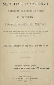

Search results from Open Library.
Recent natural events nearby
Ground air-quality sensors
Recently spotted species
Events
Gallery
Official Identifiers
StatCan — Statistics Canada
- SGC code
- 5957813
- Wikidata
- Q6693724
Standard Geographical Classification (SGC) via Wikidata P3012
Sources
- • Wikipedia
- • Wikidata
- • USGS Earthquake Catalog (global feed)
- • GBIF (Global Biodiversity Information Facility)
- • Open-Meteo / sunrise-sunset.org
- • Wikipedia Pageviews API
- • Open Library
- • StatCan — Statistics Canada — Standard Geographical Classification (SGC) via Wikidata P3012