Browse / United States / California / Morgan Hill
Morgan Hill
Californiacity

Morgan Hill
Total population
45,425
Median home value
$1,210,200
Bachelor's+
Median income
$163,920
Founded
1906
Air quality index
Demographic figures from US Census Bureau · ACS 5-year estimates. Overview below cites Wikipedia and may reference a different year.
City facts
Facts from Wikidata (CC0).
Overview
Morgan Hill is a city in Santa Clara County, California, United States, situated at the southern tip of Silicon Valley in the San Francisco Bay Area. As of the 2020 census, Morgan Hill had a population of 45,483. Morgan Hill is an affluent residential community, the seat of several high-tech companies, and a dining and recreational destination, owing to its luxury hospitality, wineries, and nature parks.
Read more on WikipediaHistory & geography
History
Prior to the arrival of Spanish colonists, Santa Clara Valley had been inhabited by the Tamien nation of Ohlone people for more than 6,000 years. In that area, the Matalan tribe lived in a hunter-gatherer society. Before the area was colonized as part of the Alta California province of the Viceroyalty of New Spain, the 1772 Spanish expedition led by Pedro Fages and Father Juan Crespí, the two explorers camped in the area around Morgan Hill alongside Llagas Creek. The location of their camp subsequently became a campsite for Spanish soldiers on their way from New Spain to Alta California. With the founding of Mission Santa Clara de Asís in 1777, the lands of present-day Morgan Hill were granted to the Roman Catholic Church. In 1850, Martin Murphy Sr.'s youngest son, Daniel Martin Murphy, married Maria Fisher, heiress of the neighboring Rancho Refugio de la Laguna Seca, thus combining the two estates. By 1870, the Murphy family had acquired around of the Morgan Hill area. In 1869, he founded the Malaguerra Winery, the oldest extant winery in Santa Clara Valley, which is listed on the National Register of Historic Places. In 1875, Tiburcio Vásquez, famed Californio bandido, robbed 21-Mile House; the Vásquez Oak that stands there today is named in his memory. In 1882, Daniel and Maria Murphy's daughter, Diana Helen Murphy, fell in love with Missouri businessman Hiram Morgan Hill. and others stating it was due to the religious differences with his family being Quaker and her family being Roman Catholic. By 1886, the family chose to live primarily at the Rancho Ojo del Agua de la Coche, as they jointly inherited around the estate. However, the move was temporary, as scandal caused by the marital complications of Hiram Morgan Hill's prominent socialite sister, Sarah…
Geography
Morgan Hill is approximately south of downtown San Jose, north of Gilroy, and inland from the Pacific coast. Lying in a roughly southern extension of the Santa Clara Valley, it is bounded by the Santa Cruz Mountains to the west and the Diablo Range to the east. At the valley floor, Morgan Hill lies at an elevation of about above MSL. According to the U.S. Census Bureau, the city encompasses an area of , all land. Although there are no natural lakes or ponds within the city limits, there are several flood-control and water storage reservoirs in the adjacent hills which are operated by the Santa Clara Valley Water District, with recreational activities such as boating, etc., administered by the Santa Clara County Department of Parks and Recreation. Morgan Hill is located within the seismically active San Francisco Bay region. The significant earthquakes in the region are generally associated with crustal movements along well-defined, active fault zones. The nearest known active faults are the San Andreas Fault, approximately southwest, and the Calaveras Fault, approximately northeast. Both faults have produced major earthquakes in the past, and have estimated maximum credible Richter magnitudes of 8.3 and 7.3, respectively. The 1984 Morgan Hill earthquake registered at a 6.2 magnitude. Within Morgan Hill's area are a number of lakes and reservoirs, including Anderson Lake (eastern Morgan Hill), Uvas Reservoir (west), Chesbro Reservoir (west), and Coyote Lake (south). The Sargent-Berrocal Fault, a potentially active fault, lies away from the sites and has an estimated maximum credible Richter magnitude of 7.4. The Coyote Creek Fault is located in Morgan Hill and is classified as potentially active as well. In addition, several unnamed faults traverse the…
Excerpted from the corresponding Wikipedia article (CC BY-SA).
Demographics & economy
Race & ethnicity
Source: US Census Bureau — American Community Survey, 5-year estimates.
Geography
Coordinates & boundaries from the US Census TIGER/Line shapefiles.
Climate
Current forecast
Forecast for Morgan Hill, CA from NOAA NWS API.
Air quality
Current readings from Open-Meteo Air Quality API (Copernicus CAMS European reanalysis).
Industrial & pollution facilities
Natural hazard risk
Health (adults)
Age-adjusted prevalence estimates from CDC PLACES (latest release).
Walkability
Amenities nearby
Wildlife & biodiversity
Most-observed species
- Turkey VultureCathartes aura (Linnaeus, 1758) · Aves11,541
- California/Woodhouse's Scrub-JayAphelocoma californica (Vigors, 1839) · Aves11,195
- Anna's HummingbirdCalypte anna (R.Lesson, 1829) · Aves10,192
- American CrowCorvus brachyrhynchos C.L.Brehm, 1822 · Aves9,557
- Acorn WoodpeckerMelanerpes formicivorus (Swainson, 1827) · Aves9,505
- House FinchHaemorhous mexicanus (P.L.Statius Müller, 1776) · Aves9,095
- Red-tailed HawkButeo jamaicensis (Gmelin, 1788) · Aves8,815
- Black PhoebeSayornis nigricans (Swainson, 1827) · Aves8,744
Citizen-science & research observations from the Global Biodiversity Information Facility (GBIF).
Schools
Largest nearby schools
- Christopher HighHigh · Gilroy · 1,664 students · 21.9:1 ratio
- Ann Sobrato HighHigh · Morgan Hill · 1,521 students · 23.4:1 ratio
- Live Oak HighHigh · Morgan Hill · 1,137 students · 21.9:1 ratio
- Solorsano MiddleMiddle · Gilroy · 780 students · 22.3:1 ratio
- Brownell MiddleMiddle · Gilroy · 747 students · 22.6:1 ratio
- South Valley MiddleMiddle · Gilroy · 735 students · 21.6:1 ratio
- Luigi Aprea ElementaryElementary · Gilroy · 716 students · 24.7:1 ratio
- Rod Kelley ElementaryElementary · Gilroy · 707 students · 27.2:1 ratio
Public K–12 schools within ~10 mi from Urban Institute Education Data Portal (NCES Common Core of Data, 2022).
Earthquake history
Photos
Sights & places nearby
Notable people from here

People born within ~10 km, from Wikidata (CC0). Click any name for their Wikipedia article.
Nearby places in California
- San Martin4.2 mi away
- Aromas17.8 mi away
- Rio del Mar18 mi away · pop. 9,201
- East Foothills19.7 mi away · pop. 7,139
- Pajaro Dunes20.4 mi away
- San Juan Bautista20.7 mi away
- Pleasure Point21.7 mi away
- Elkhorn22.6 mi away
- Lompico22.7 mi away
- Pasatiempo23 mi away
- Mount Hermon23.4 mi away · pop. 939
- Paradise Park23.7 mi away
Geography & sun
Elevation, sunrise/sunset and daylight from Open-Meteo. Solar climatology from NASA POWER.
Nearby airports
Public attention
Pageview totals from the Wikimedia Pageviews API.
Books about Morgan Hill
Search results from Open Library.
Recent natural events nearby
- Wildfire Timber, Monterey, CaliforniaWildfires · 2026-08-09 · 63 mi
- Wildfire GANN, Calaveras, CaliforniaWildfires · 2026-08-03 · 83 mi
- Wildfire Plaskett, Monterey, CaliforniaWildfires · 2026-08-26 · 86 mi
- Wildfire DOME, Mariposa, CaliforniaWildfires · 2026-09-15 · 115 mi
- Wildfire PLAINS, San Luis Obispo, CaliforniaWildfires · 2026-08-12 · 150 mi
- Prescribed Fire CRAWFORD CORRAL RX, Tulare, CaliforniaWildfires · 2026-09-19 · 152 mi
- Wildfire LUCAS, Lake, CaliforniaWildfires · 2026-09-10 · 163 mi
- Wildfire LUCAS, Lake, CaliforniaWildfires · 2026-09-10 · 163 mi
Wildfires, storms and other events from NASA EONET (last 12 months, within 250 mi).
Ground air-quality sensors
Recently spotted species
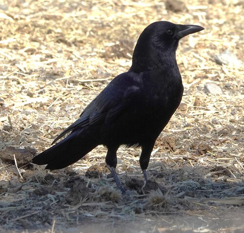
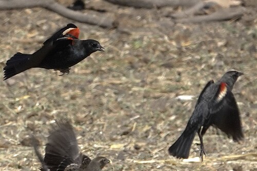
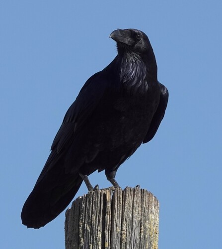
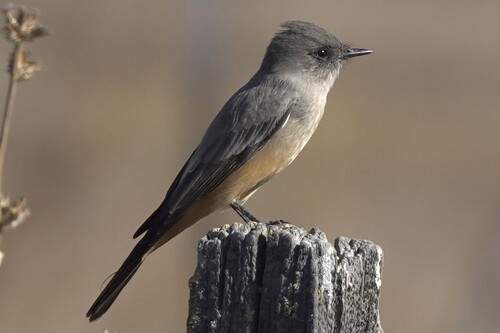
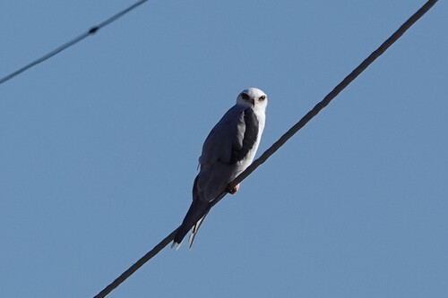
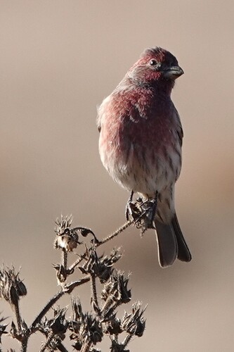
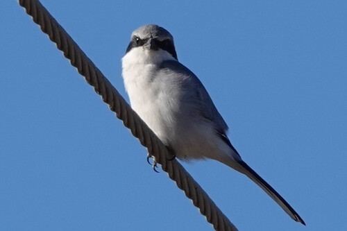
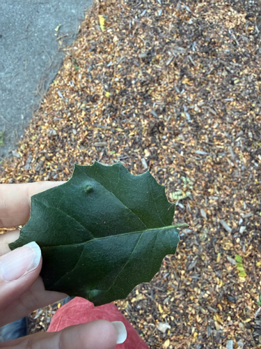
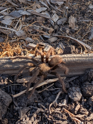
Research-grade observations from iNaturalist (within ~15 mi).
Nearest stream gauge
Live readings from USGS NWIS · measured 2026-09-16 23:45 UTC.
Events
Notable, recurring, and historical events associated with Morgan Hill, sourced from Wikidata.
Source: Wikidata (CC0).
Gallery
Sources
- • Wikipedia
- • US Census Bureau (ACS 5-year estimates)
- • NOAA National Weather Service
- • Wikidata
- • Open-Meteo Air Quality (CAMS)
- • USGS NWIS (water data)
- • NCES via Urban Institute Education Data Portal
- • GBIF (Global Biodiversity Information Facility)
- • iNaturalist
- • CDC PLACES
- • Open-Meteo / sunrise-sunset.org
- • Wikipedia Pageviews API
- • Open Library
- • NASA EONET