Browse / Canada / Ontario / Mount Carmel
Mount Carmel
Ontariovillage

Mount Carmel
Demographic figures from Statistics Canada. Overview below cites Wikipedia and may reference a different year.
City facts
Overview
Mount Carmel is a primarily residential hamlet located in southwestern Ontario, Canada.
Read more on WikipediaHistory & geography
History
The community of Mount Carmel was founded in the 1830s and 1840s with the arrival of Irish settlers who had initially resided in the vicinity of Pickering, Ontario, when they first arrived in Canada, but were drawn by advertisements for low cost Canada Company land available in the southern part of the Huron Tract for agricultural purposes. To meet the needs of the predominantly Roman Catholic population of the emerging community, in the late 1840s, a small frame church was constructed near the banks of Parkhill Creek, two kilometers (1.25 miles) east of the present site of the hamlet on Mount Carmel Drive. The church was located on donated land on the farm of Daniel Coughlin. By 1850, a small commercial core had begun to form at the site of the present intersection and the church building was relocated to a small hill at the northwest corner of the community. During this period, the name of the hamlet was in all likelihood Limerick. The community's growth continued in the 1850s with the arrival of the Grand Trunk Railway line in the region. Mount Carmel became a local stage coach stop, providing a means to transport farm products and passengers to both nearby Dashwood and the new railway station at nearby Parkhill. The first school used by the community was constructed in the early 1860s, approximately north of the hamlet near the present day intersection of Bronson Line and South Road. In the mid-1870s, a frame school was built near the corner of Bronson Line and Mount Carmel Drive in the centre of the community. Rural economic growth in the 1860s and 1870s, in the new province of Ontario, was reflected in Mount Carmel in an expansion of the number of businesses serving the hamlet and the surrounding rural community. At various times Mount Carmel supported, three…
Geography
Mount Carmel is located at the intersection of Mount Carmel Drive, Bronson Line and Lieury Road, on the boundary between the municipality of North Middlesex and the municipality of South Huron. Mount Carmel Drive constitutes the north-south boundary between Middlesex and Huron counties.
Excerpted from the corresponding Wikipedia article (CC BY-SA).
Geography
Coordinates & boundaries from the US Census TIGER/Line shapefiles.
Climate
Air quality
Walkability
Amenities nearby
Wildlife & biodiversity
Earthquake history
Photos
Sights & places nearby
Notable people from here
Nearby places in Ontario
Geography & sun
Nearby airports
Public attention
Books about this place
Recent natural events nearby
Ground air-quality sensors
Recently spotted species





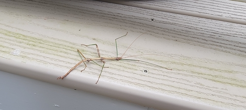


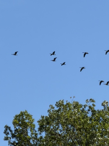
Research-grade observations from iNaturalist (within ~15 mi).
Events
Gallery
Sources
- • Wikipedia
- • iNaturalist