Browse / Canada / Ontario / Nipigon
Nipigon
Ontariotown

Nipigon
Demographic figures from Statistics Canada. Overview below cites Wikipedia and may reference a different year.
City facts
Facts from Wikidata (CC0).
Overview
Nipigon is a town in Nipigon township in Thunder Bay District, Northwestern Ontario, Canada, located along the west side of the Nipigon River and south of the small Helen Lake running between Lake Nipigon and Lake Superior. Lake Nipigon is located approximately 25 kilometres (16 mi) north of Nipigon. Located at latitude 49.0125° N, Nipigon is the northernmost community on the Great Lakes.
Read more on WikipediaHistory & geography
History
First Nations have lived in the Nipigon area for thousands of years, leaving behind rock paintings on the cliffs at the mouth of the Nipigon River. During the European colonization, the area was home to a succession of fur trading forts and posts. Starting in 1665, French explorers built several forts on Lake Nipigon. Circa 1717, Zacharie Robutel de La Noue built Fort Ste Anne, its exact location now uncertain but possibly in a shallow bay on the south-east shore of Helen Lake (at the site of today's Lake Helen 53A reserve). It operated until 1775. The North West Company had a post at the mouth of the Nipigon River from 1785 to 1821, which was likely taken over by the Hudson's Bay Company (HBC) when these two companies merged in 1821. In 1885, the Canadian Pacific Railway (CPR) tracks were completed across the north shore of Lake Superior, boosting trade at the HBC post. But since the post was along the river, trade gradually shifted to new businesses built closer to the railroad. In 1899, the HBC built a retail shop across from the railway station in order to compete. In 1937, the bridge for the Trans-Canada Highway was built over the Nipigon River. The mill was the main employer in the town. Less than a month earlier workers at the mill had purchased it from Columbia Forest Products of Portland, Oregon. At the time of the sale, a $4-million modernization plan for the mill was also announced. More than 100 people were employed at the plant, which produced hardwood underlayment for vinyl, plywood and laminate flooring.
Geography
Nipigon is located northeast of Thunder Bay, southwest of Geraldton and Beardmore (both in the municipality of Greenstone), west of Marathon, and northwest of Sault Ste. Marie. Nipigon is surrounded with pine and other varieties of forests.
Excerpted from the corresponding Wikipedia article (CC BY-SA).
Geography
Coordinates & boundaries from the US Census TIGER/Line shapefiles.
Climate
Air quality
Walkability
Amenities nearby
Wildlife & biodiversity
Earthquake history
Photos
Sights & places nearby
Notable people from here
Geography & sun
Elevation, sunrise/sunset and daylight from Open-Meteo. Solar climatology from NASA POWER.
Nearby airports
Public attention
Pageview totals from the Wikimedia Pageviews API.
Books about Nipigon
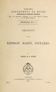
Search results from Open Library.
Recent natural events nearby
Ground air-quality sensors
Recently spotted species
Events
Gallery
Official Identifiers
StatCan — Statistics Canada
- SGC code
- 3558044
- Population (Wikidata)
- 1,473
- Wikidata
- Q1993247
Standard Geographical Classification (SGC) via Wikidata P3012
Sources
- • Wikipedia
- • Wikidata
- • Open-Meteo / sunrise-sunset.org
- • Wikipedia Pageviews API
- • Open Library
- • StatCan — Statistics Canada — Standard Geographical Classification (SGC) via Wikidata P3012