Browse / Canada / Newfoundland and Labrador / Northern Bay
Northern Bay
Newfoundland and Labradorvillage

Northern Bay
Demographic figures from Statistics Canada. Overview below cites Wikipedia and may reference a different year.
City facts
Overview
Northern Bay is a small community on the northern tip of Conception Bay on the Bay de Verde Peninsula, Subdivision 1G, Newfoundland and Labrador, Canada.
Read more on WikipediaHistory & geography
History
Fishing firms from England and Wales arrived at what is now Northern Bay as early as the mid-18th century. By 1768, immigrants from England and Ireland had settled the "North Shore" of Conception Bay, including Northern Bay. On September 17, 1775, a ship carrying 400 passengers crashed somewhere near present-day Northern Bay. The crash was undoubtedly the result of the Newfoundland Hurricane of 1775 which remains one of the worst – if not the worst – natural disasters to have hit Newfoundland and Labrador in history. In 1836, a Roman Catholic church (Corpus Christi Parish) was established in Northern Bay. A United Church also exists in the community. The population of the community in 1836 was 282. One of the communities first settlers was William Hogan, an Irish merchant. Since the 19th century, Northern Bay's population has remained relatively constant with some out-migration but a steady birthrate. The economy was mostly based on fishing and subsistence agriculture throughout the 19th and early 20th century. A horse named after the area took part in the 1987 English Grand National Steeplechase, finishing the race in ninth place. Myths, legends and folklore were once very important in rural Newfoundland, but today are little more than entertainment. One folk tale that continues in the culture of Northern Bay and the surrounding communities is that of "Hannah's Tolt". The following is from the old Newfoundland magazine Decks Wash (V.9, No.6, Dec.1980): :"The local word for a rocky hill is 'tolt' and there is an interesting story surrounding the origin of Hannah's Tolt, located inland from Northern Bay near Welsh's Pond. It occurred probably in the 1920s [or] 1930s. Late in the fall of the year when a crowd of women were in the woods berry-picking, Hannah Milley…
Excerpted from the corresponding Wikipedia article (CC BY-SA).
Geography
Coordinates & boundaries from the US Census TIGER/Line shapefiles.
Climate
Air quality
Walkability
Amenities nearby
Wildlife & biodiversity
Earthquake history
Photos
Sights & places nearby
Notable people from here

People born within ~10 km, from Wikidata (CC0). Click any name for their Wikipedia article.
Geography & sun
Elevation, sunrise/sunset and daylight from Open-Meteo. Solar climatology from NASA POWER.
Nearby airports
Public attention
Pageview totals from the Wikimedia Pageviews API.
Books about Northern Bay
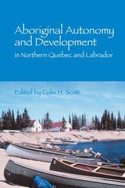
Search results from Open Library.
Recent natural events nearby
Ground air-quality sensors
Recently spotted species
Events
Gallery
Sources
- • Wikipedia
- • Wikidata
- • Open-Elevation
- • Open-Meteo / sunrise-sunset.org
- • Wikipedia Pageviews API
- • Open Library