Browse / Canada / Manitoba / Peguis
Peguis
Manitobavillage

Featured view
Peguis
Coordinates51.31°, -97.56°
Demographic figures from Statistics Canada. Overview below cites Wikipedia and may reference a different year.
Loading additional data from public sources…0 / 11
CensusWikipediaWeatherPlacesPeopleEnvironmentHealth & SchoolsRelatedGeography & CultureLive MonitoringEvents & Gallery
0% completeCity facts
Overview
Peguis was a Saulteaux chief, who moved from the Great Lakes area to Red Lake, then arriving in what is now southern Manitoba in the 1790s.
Read more on WikipediaHistory & geography
Geography
Latitude
51.3130
Longitude
-97.5596
Water area
—
Coordinates & boundaries from the US Census TIGER/Line shapefiles.
Climate
Air quality
Walkability
Amenities nearby
Wildlife & biodiversity
Earthquake history
Photos
Sights & places nearby
Notable people from here
Nearby places in Manitoba
- Dallas/Red Rose6.7 mi away
- Hodgson6.8 mi away
- Marble Ridge Hutterite Colony9.1 mi away
- ᐅᒉᑯ ᓰᐱᐩ Fisher River11.3 mi away
- Fisher Branch16.1 mi away
- Washow Bay24.7 mi away
- Broad Valley Hutterite Colony25.1 mi away
- Mennville27.8 mi away
- Poplarfield29.3 mi away
- Ashern34.6 mi away
- Silver35.5 mi away
- Mulvihill36.1 mi away
Geography & sun
Avg solar (kWh/m²/day)
3.37
Annual solar (kWh/m²)
1,231
Elevation, sunrise/sunset and daylight from Open-Meteo. Solar climatology from NASA POWER.
Nearby airports
Public attention
Wikipedia views (last 30 days)
275
Avg daily Wikipedia views
9
Attention level
Obscure
Pageview totals from the Wikimedia Pageviews API.
Books about Peguis
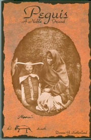
Peguis; A Noble Friend
Donna G. Sutherland · 2003

Chief Peguis
Manitoba. Historic Resources Branch · 1984
Chief Peguis.
1982
Red River of the North & other poems of Manitoba
Saunders, Thomas · 1969
Manitoba
Denise Dawes · 1971
Manitoba: past and present =
1971
Manitoba; past and present
Denise Dawes · 1971
Early buildings of Manitoba
1973
Search results from Open Library.
Recent natural events nearby
Ground air-quality sensors
Recently spotted species
Events
Gallery
Sources
- • Wikipedia
- • Wikidata
- • Open-Meteo / sunrise-sunset.org
- • Wikipedia Pageviews API
- • Open Library