Browse / Canada / Quebec / Vaudreuil-Dorion
Vaudreuil-Dorion
Quebectown

Vaudreuil-Dorion
Total population
43,268
Founded
1994
Air quality index
Demographic figures from Statistics Canada. Overview below cites Wikipedia and may reference a different year.
City facts
Facts from Wikidata (CC0).
Overview
Vaudreuil-Dorion is a suburb of Greater Montreal, in the Montérégie region of southwestern Quebec, Canada. The result of the merger of two towns, Vaudreuil and Dorion, it is located in the Vaudreuil-Soulanges Regional County Municipality.
Read more on WikipediaHistory & geography
History
On 23 November 1702, governor of New France Louis-Hector de Callière gave a seigneury to Philippe de Vaudreuil, who was governor of Montreal at the time. Rigaud de Vaudreuil later became governor of New France. In 1725, the region had only 38 inhabitants. Around 1742, people began to be interested in the region and Vaudreuil's population rose. 381 people lived in Vaudreuil in 1765. With the creation of the Grand Trunk Railway, people began to live in Dorion, which was called Vaudreuil Station. Dorion became a village in 1891. Dorion was bisected by Autoroute 20 which links Downtown Montreal and Toronto via Highway 401 in Ontario. The Canadian National Railway and Canadian Pacific Railway links between Toronto and Montreal are located in Dorion. Housing developments began in the 1950s and continued well into the 1970s. Throughout the 1980s and the 1990s, housing began sprouting north and east of Dorion. Vaudreuil and Dorion merged in 1994, becoming the City of Vaudreuil-Dorion.
Geography
Vaudreuil-Dorion is located on the south shores of the Lake of Two Mountains at the confluence of the Saint Lawrence and Ottawa Rivers, just off the western edge of Île Perrot. The city consists of two non-contiguous parts: its eastern part is the larger main area along Lake of Two Mountains where the population centres of Vaudreuil and Dorion are located; the western portion is a smaller rural area that borders Rigaud, and is separated from the eastern portion by Saint-Lazare and Hudson.
Excerpted from the corresponding Wikipedia article (CC BY-SA).
Geography
Coordinates & boundaries from the US Census TIGER/Line shapefiles.
Climate
Air quality
Current readings from Open-Meteo Air Quality API (Copernicus CAMS European reanalysis).
Walkability
Amenities nearby
Wildlife & biodiversity
Most-observed species
- Black-capped ChickadeePoecile atricapillus (Linnaeus, 1766) · Aves47,042
- Northern CardinalCardinalis cardinalis (Linnaeus, 1758) · Aves41,769
- American CrowCorvus brachyrhynchos C.L.Brehm, 1822 · Aves39,648
- American RobinTurdus migratorius Linnaeus, 1766 · Aves37,848
- American GoldfinchSpinus tristis (Linnaeus, 1758) · Aves33,930
- Blue JayCyanocitta cristata (Linnaeus, 1758) · Aves32,875
- Song SparrowMelospiza melodia (A.Wilson, 1810) · Aves32,870
- Downy WoodpeckerDryobates pubescens (Linnaeus, 1766) · Aves32,200
Citizen-science & research observations from the Global Biodiversity Information Facility (GBIF).
Earthquake history
Most recent
- M 2.5 — 2026-04-2123 km NE of Saint-André-Avellin, Canada
- M 2.7 — 2026-01-2026 km N of L'Orignal, Canada
- M 2.7 — 2025-10-144 km NNW of Chazy, New York
- M 2.5 — 2025-01-016 km SSE of Fort Covington Hamlet, New York
- M 2.6 — 2024-10-027 km ENE of Chertsey, Canada
- M 2.8 — 2024-07-2911 km SSW of Sainte-Martine, Canada
Events from the USGS Earthquake Catalog (global) (FDSN Event Web Service).
Photos
Sights & places nearby
Notable people from here
Geography & sun
Elevation, sunrise/sunset and daylight from Open-Meteo. Solar climatology from NASA POWER.
Nearby airports
Public attention
Pageview totals from the Wikimedia Pageviews API.
Books about Vaudreuil-Dorion
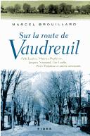
Search results from Open Library.
Recent natural events nearby
Ground air-quality sensors
Recently spotted species
Events
Gallery
Official Identifiers
StatCan — Statistics Canada
- SGC code
- 2471083
- Population (Wikidata)
- 43,268
- Wikidata
- Q141711
Standard Geographical Classification (SGC) via Wikidata P3012
Sources
- • Wikipedia
- • Wikidata
- • Open-Meteo Air Quality (CAMS)
- • USGS Earthquake Catalog (global feed)
- • GBIF (Global Biodiversity Information Facility)
- • Open-Meteo / sunrise-sunset.org
- • Wikipedia Pageviews API
- • Open Library
- • StatCan — Statistics Canada — Standard Geographical Classification (SGC) via Wikidata P3012