Browse / DR Congo / Kwilu / Kikwit
Kikwit
Kwilucity

Kikwit
Demographic figures from INS DRC. Overview below cites Wikipedia and may reference a different year.
City facts
Facts from Wikidata (CC0).
Overview
Kikwit is the largest city in Kwilu Province, in the southwest of the Democratic Republic of the Congo. Located at the furthest navigable point of the Kwilu River, the urban area of Kikwit is primarily on the river's left bank. With over half a million inhabitants, Kikwit is a secondary city of the country. It is divided into four communes: Kazamba, Lukemi, Lukolela, and Nzinda.
Read more on WikipediaHistory & geography
History
Kikwit was a small village prior to Belgian colonisation. Belgian colonists developed the town with the goal of exploiting plant and mineral resources in the region. As the smaller city of Bandundu was given preference for administrative functions, the economic importance of Kikwit declined. The national government continued to view Kikwit as dissident; it appointed pro-administration officials to positions in the city. The city's electricity and water supplies became overloaded, having relied on diesel power that had become scarce. In the 1980s, these utilities did not accept new connections, only one road was electrified, and 30% of inhabitants had water access. Education was also inadequate; in the early 1980s, six secondary schools and one primary school were shut for paperwork reasons, while no new schools opened. After Mobutu banned Belgian organisations in 1990, the city's education and healthcare systems became dysfunctional. The phenomenon of gangs known as spread to Kikwit from Kinshasa by 2015. In response, officials in Kikwit launched Operation Mbita Bango in May 2016, following an announcement by military officials. This month-long operation involved the arrest of many youths who refused to leave gangs. At a January 2019 protest led by supporters of opposition leader Martin Fayulu, protesting his loss in the 2018 presidential election, security forces killed at least twelve protestors.
Geography
Kikwit is located in southwestern Democratic Republic of the Congo, at the coordinates , and has an area of 92 square kilometres. Kikwit is on the Kwilu River, part of the Kwango River system within the Congo Basin. It is at the river's furthest navigable point; large ships cannot travel further south due to narrow rapids. The city is in a valley where the river flows north-northwest. At Kikwit, the river has a width of (), with a water level that varies seasonally. Downstream from Kikwit to Bulungu, the river's bed is rocky, and it is joined by the Kwenge River 24 km (15 mi) downstream of the city, near Lusanga. Kikwit is 320 km (200 mi) upstream from the river's confluence at Bandundu and 690 km (430 mi) upstream from the national capital, Kinshasa. The city drains to the Lukemi and Luimi tributaries of the Kwilu, both within the city. The elevation of Kikwit is about above sea level, with a minimum of and a maximum of . It is located on the Kwango Plateau and is mostly flat, though some areas have steep slopes. Geologically, the plateau's soil has a high clay content and consists primarily of sandstone and argillite, which cause the formation of regolith and ferralsols. Terraces of iron-heavy rocks were formed during semi-arid periods tens of thousands of years ago. The area is prone to erosion, made worse by urban expansion. The regolith and steep areas of the plateau contribute to the formation of gullies, the largest measuring 40 m deep and 60 m across. These often form parallel to roads, and countermeasures are often ineffective at preventing their formation. Vegetation on the plateau consists of savanna and steppes, with some forested areas, while vegetation in the valley includes forested savanna, rainforest, and…
Excerpted from the corresponding Wikipedia article (CC BY-SA).
Geography
Coordinates & boundaries from the US Census TIGER/Line shapefiles.
Climate
Air quality
Walkability
Amenities nearby
Wildlife & biodiversity
Most-observed species
- PawpawCarica papaya L. · Magnoliopsida1
Citizen-science & research observations from the Global Biodiversity Information Facility (GBIF).
Earthquake history
Events from the USGS Earthquake Catalog (global) (FDSN Event Web Service).
Photos
Sights & places nearby
Notable people from here


People born within ~10 km, from Wikidata (CC0). Click any name for their Wikipedia article.
Nearby places in Kwilu
- Manjeshwar4039.4 mi away
- Kumbala4041 mi away
- Kasaragod4042.6 mi away · pop. 54,172
- Kalanad4043.8 mi away
- Nileshwaram4047.4 mi away · pop. 10,000
- Cheruvathur4049 mi away · pop. 27,530
- Karivellur4050.5 mi away
- Pazhayangadi4052.8 mi away
- Cheemeni4054 mi away · pop. 9,000
- Dharmasala4059.4 mi away · pop. 40,000
- Kadachira4062.1 mi away
- Thalassery4063.3 mi away · pop. 92,558
Geography & sun
Elevation, sunrise/sunset and daylight from Open-Meteo. Solar climatology from NASA POWER.
Nearby airports
Public attention
Pageview totals from the Wikimedia Pageviews API.
Books about Kikwit
Search results from Open Library.
Recent natural events nearby
Ground air-quality sensors
Recently spotted species
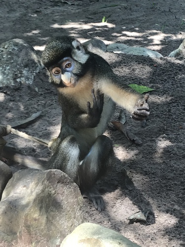
Research-grade observations from iNaturalist (within ~15 mi).
Events
Gallery
Sources
- • Wikipedia
- • Wikidata
- • USGS Earthquake Catalog (global feed)
- • GBIF (Global Biodiversity Information Facility)
- • iNaturalist
- • Open-Meteo / sunrise-sunset.org
- • Wikipedia Pageviews API
- • Open Library