Browse / Cameroon / Northwest / Bamenda
Bamenda
Northwestcity

Bamenda
Total population
1,735,000
Demographic figures from Institut National de la Statistique (Cameroon). Overview below cites Wikipedia and may reference a different year.
City facts
Sister cities
Facts from Wikidata (CC0).
Overview
Bamenda, also known as Abakwa and Mankon Town, is a city in northwestern Cameroon and capital of the Northwest Region. The city has a population of about six hundred thousand people and is located 366 km (227 mi) north-west of the Cameroonian capital, Yaoundé. Bamenda is known for its cool climate and scenic hilly location.
Read more on WikipediaHistory & geography
History
The origins of the city are related to the settlement of the Tikar people who culturally forged and maintained relations with the Kingdom of Bamum in the 1700s. In 1884, the city was colonized by Germany until 1916 when it became a colony administered by Great Britain and France. In 1919, the administration of Northwest Region and thus the city of Bamenda became only British. In 1961, the region joined the Cameroon. Many of the city's inhabitants are English-speaking, and Cameroonian Pidgin English is the main language spoken in the shops and on the streets of Bamenda. The Southern Cameroons Liberation Council is a united front consisting of multiple groups of separatists aiming for an independent Ambazonian state, which would include Bamenda. Protests started in 2016 in the city in reaction to the appointment of French-speaking judges in the area. Starting in 2017 as a continuation of the protests, the ongoing Anglophone crisis has heavily impacted the city, both through the actions of separatists and responses from the government. In September 2020, Cameroon launched Operation Bamenda Clean to expel separatist militias from the city. The operation has resulted in civilian deaths.
Geography
North of the city is the Bamenda Ring Road, a circular route through Cameroon Highlands. Along this road is Mount Oku , the Kimbi River Game Reserve, the Menchum River waterfalls, a huge Fon's palace at Bafut, and a pyramidal thatched shrine at Akum (also known as Bagangu). Bamenda sits approximately 68 kilometres (42 mi) south of Ajuh-Mbuh.
Excerpted from the corresponding Wikipedia article (CC BY-SA).
Geography
Coordinates & boundaries from the US Census TIGER/Line shapefiles.
Climate
Air quality
Walkability
Amenities nearby
Wildlife & biodiversity
Earthquake history
Photos
Sights & places nearby
Notable people from here


People born within ~10 km, from Wikidata (CC0). Click any name for their Wikipedia article.
Nearby places in Northwest
Geography & sun
Elevation, sunrise/sunset and daylight from Open-Meteo. Solar climatology from NASA POWER.
Nearby airports
Public attention
Pageview totals from the Wikimedia Pageviews API.
Books about Bamenda

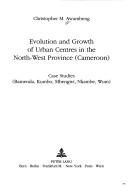
Search results from Open Library.
Recent natural events nearby
Ground air-quality sensors
Recently spotted species
Events
Notable, recurring, and historical events associated with Bamenda, sourced from Wikidata.
- North West Festival For Peacefestival
- Q139824804festival
Source: Wikidata (CC0).
Gallery
Sources
- • Wikipedia
- • Wikidata
- • Open-Meteo / sunrise-sunset.org
- • Wikipedia Pageviews API
- • Open Library
- • Wikidata SPARQL (CC0) — population, area, elevation, inception, head of government, Commons image