Browse / Cameroon / Far North / Goulfey
Goulfey
Far Northtown
Total population
58,117
Demographic figures from Institut National de la Statistique (Cameroon). Overview below cites Wikipedia and may reference a different year.
City facts
Overview
Goulfey is a town and commune in the Logone-et-Chari department of Cameroon, close to the border of Chad.
Read more on WikipediaHistory & geography
History
Goulfey is infamous for its practice and techniques of warfare. It was believed to have been founded by Rabat after Djagara led a victory over him with the help of the French. The history of Goulfey has its from the 16th to 18th centuries during its Arab invasions. The Arabs found people embedded in ancestral traditions, locally known as the cult of the Varan, which is considered the symbol of Goulfey and a spiritual element of protection and divination. It plays an important political and religious role in the community. It was often believed that the spirits were known as the Gbwéi-gbwéi, who collaborated with the people through the traditional priest to offer household food, such as honey and milk to the Varans, housed in the tower. The famous military emperor was Rabah, who came from Egypt to Goulfey in an aim to convert locals to Islam and taking slaves. Its weapons used in battles are still present here.
Geography
Goulfey is located about 50 kilometres north of Kousséri and is separated by the Logone River.
Excerpted from the corresponding Wikipedia article (CC BY-SA).
Geography
Coordinates & boundaries from the US Census TIGER/Line shapefiles.
Climate
Air quality
Walkability
Amenities nearby
Wildlife & biodiversity
Earthquake history
Photos
Sights & places nearby
Notable people from here
People born within ~10 km, from Wikidata (CC0). Click any name for their Wikipedia article.
Geography & sun
Elevation, sunrise/sunset and daylight from Open-Meteo. Solar climatology from NASA POWER.
Nearby airports
Public attention
Pageview totals from the Wikimedia Pageviews API.
Books about this place
Recent natural events nearby
Ground air-quality sensors
Recently spotted species
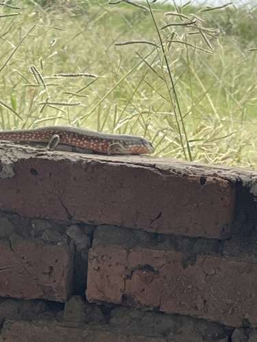
Research-grade observations from iNaturalist (within ~15 mi).
Events
Gallery
Sources
- • Wikipedia
- • Wikidata
- • iNaturalist
- • Open-Meteo / sunrise-sunset.org
- • Wikipedia Pageviews API
- • Wikidata SPARQL (CC0) — population, area, elevation, inception, head of government, Commons image