Browse / China / Tibet / Anini
Anini
Tibettown

Anini
Demographic figures from National Bureau of Statistics of China. Overview below cites Wikipedia and may reference a different year.
City facts
Facts from Wikidata (CC0).
Overview
Anini is the headquarters of the Dibang Valley district in the state of Arunachal Pradesh in Northeast India. Anini was also the district headquarters of the undivided Dibang Valley district. Most of this location's population consists of the Idu Mishmi tribal people. Due to its remote location, Anini remains a small and underdeveloped town. However, it has basic road and air links to the rest of India. For most commercial needs, the town is fully dependent on the nearest major settlement, Roing, which is in the Lower Dibang Valley District.
Read more on WikipediaHistory & geography
History
Like the history of Arunachal Pradesh, Anini's history is cloudy. The native Idu Mishmi and other tribes were said to have migrated from ancient Tibet in the 1st or 1st millennium BC. They have been believed to have stopped in Lhoyu. Lhoyu became under Tibetan control around the 7th century. Although inhabited by Idu Mishmis in all that time, it took until the times of NEFA and the British Raj for Anini to be officially established. Anini's importance grew during World War II, when supplies and troops needed to be sent to China through the Ledo Road in Assam. In 1947, Anini became a part of India. At this point the Republic of China was free to claim most of Arunachal, making it and Aksai Chin under dispute. The People's Republic of China emerged in 1949, and once the British left in 1950, Arunachal and Aksai Chin were under dispute. Since then, they have remained disputed. In June 1980, the Dibang Valley district was finally carved out of the Lohit District, and Anini was pronounced its capital. Since then, Anini has been the only district headquarters without proper road links to the rest of India.
Geography
Most of Anini is located on a miniature plateau between two tributaries of the Dibang river, the Dri river and the Mathun river. The town has a subdistrict of its own: Anini Circle. Its location just south of the Dibang Wildlife Sanctuary makes Anini the northernmost district headquarters in Northeast India. The small settlement of Anini is located at an elevation of above sea level. but the average elevation of the town is 2,068 meters. According to Google Maps' terrain feature, Anini is around 1,600–1,800 meters above sea level and up north of Anini, the elevation can go up to 3,800 meters above sea level. According to the official website of the Dibang Valley District, Anini's altitude is at 1,968 meters above sea level. Anini is located on the Eurasian Plate, about 420 miles north of the junction of the Indian Plate and the Eurasian Plate, which makes Anini earthquake-prone. The 1950 Assam–Tibet earthquake badly affected both the Dibang and Lower Dibang Valleys. 70% of the residents of the area died in this earthquake.
Excerpted from the corresponding Wikipedia article (CC BY-SA).
Geography
Coordinates & boundaries from the US Census TIGER/Line shapefiles.
Climate
Air quality
Walkability
Amenities nearby
Wildlife & biodiversity
Most-observed species
- Brownish-flanked Bush WarblerHorornis fortipes Hodgson, 1845 · Aves274
- Black BulbulHypsipetes leucocephalus (Gmelin, 1789) · Aves266
- Gray BushchatSaxicola ferreus J.E.Gray & G.R.Gray, 1847 · Aves194
- Oriental White-eyeZosterops palpebrosus (Temminck, 1824) · Aves147
- Verditer FlycatcherEumyias thalassinus (Swainson, 1838) · Aves139
- Lesser CuckooCuculus poliocephalus Latham, 1790 · Aves133
- Short-billed MinivetPericrocotus brevirostris (Vigors, 1831) · Aves124
- Red-billed LeiothrixLeiothrix lutea (Scopoli, 1786) · Aves113
Citizen-science & research observations from the Global Biodiversity Information Facility (GBIF).
Earthquake history
Most recent
- M 4.6 — 2026-05-06100 km NW of Hayuliang, India
- M 4 — 2024-12-22107 km NE of Shi Yomi, India
- M 4.5 — 2024-03-3182 km NNW of Tezu, India
- M 4.5 — 2022-09-18105 km NNE of P?sigh?t, India
- M 4.2 — 2022-08-29113 km NNW of Hayuliang, India
- M 4.7 — 2021-09-1974 km N of Hayuliang, India
Events from the USGS Earthquake Catalog (global) (FDSN Event Web Service).
Photos
Sights & places nearby
Notable people from here
Nearby places in Tibet
Geography & sun
Elevation, sunrise/sunset and daylight from Open-Meteo. Solar climatology from NASA POWER.
Nearby airports
Public attention
Pageview totals from the Wikimedia Pageviews API.
Books about this place
Recent natural events nearby
Ground air-quality sensors
Recently spotted species



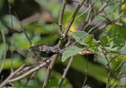


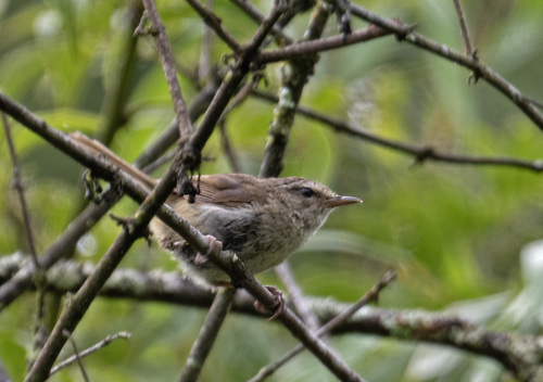


Research-grade observations from iNaturalist (within ~15 mi).
Events
Gallery
Sources
- • Wikipedia
- • Wikidata
- • USGS Earthquake Catalog (global feed)
- • GBIF (Global Biodiversity Information Facility)
- • iNaturalist
- • Open-Meteo / sunrise-sunset.org
- • Wikipedia Pageviews API