Browse / United States / Colorado / Gunnison
Gunnison
Coloradocity

Gunnison
Total population
6,766
Median home value
$461,000
Bachelor's+
Median income
$62,189
Demographic figures from US Census Bureau · ACS 5-year estimates. Overview below cites Wikipedia and may reference a different year.
City facts
Facts from Wikidata (CC0).
Overview
Gunnison is a home rule municipality that is the county seat of and the most populous municipality in Gunnison County, Colorado, United States. The city population was 6,560 at the 2020 United States census. The city was named in honor of John W. Gunnison, a United States Army officer who surveyed for a transcontinental railroad in 1853. Gunnison is a college town, home to Western Colorado University.
Read more on WikipediaHistory & geography
History
The City of Gunnison got its name from the first known European-American explorer of the area, John W. Gunnison. He was searching for a route for the transcontinental railroad in 1853 and only stayed for three days before traveling west to Utah. Gunnison saw its first population increase in the 1870s, due to the mining surge throughout the state. The railroad arrived soon after in 1880 to appreciative miners, ranchers, and farmers. In the early 1800s, the groups moving into the Gunnison area were mainly fur trappers and mountain men, trying to make a living for themselves in the rocky mountain terrain. But a drop in fur prices in the 1840s essentially cut out the need for their jobs. The late 1850s saw the start of people joining the hunt for gold in Gunnison county. Miners were in search of placer gold, but with the growing numbers of white men in the area, this brought conflict between the Ute tribes still around the county. At least several miners were killed by these tribes and this caused some of the miners to flee the area, caring more for their lives than potential gold bonanzas. With the mining boom, Gunnison began to see an increase of people around the 1870s. Along with the miners coming in, ranchers and farmers were among the others that led to the Ute people becoming forced out of the area. The mining camps in Gunnison and around the county reportedly produced about 130,000 ounces of gold from the beginning of the gold rush through 1959. At the start this was mostly from placer deposits, but the largest amounts were from a by-product of silver-lead ore. The largest deposits were found along the Taylor River, as well as the Tincup and the Washington Gulch districts. Both lines ended up coming through town anyway, although the DSP&P shortly discontinued…
Geography
At the 2020 United States census, the town had a total area of , all of it land. |source 2 = National Weather Service }}
Excerpted from the corresponding Wikipedia article (CC BY-SA).
Demographics & economy
Race & ethnicity
Source: US Census Bureau — American Community Survey, 5-year estimates.
Geography
Coordinates & boundaries from the US Census TIGER/Line shapefiles.
Climate
Air quality
Industrial & pollution facilities
Natural hazard risk
Health (adults)
Age-adjusted prevalence estimates from CDC PLACES (latest release).
Walkability
Amenities nearby
Wildlife & biodiversity
Schools
Largest nearby schools
- Gunnison Elementary SchoolElementary · GUNNISON · 521 students · 12.4:1 ratio
- Gunnison High SchoolHigh · GUNNISON · 396 students · 16.5:1 ratio
- Gunnison Middle SchoolMiddle · GUNNISON · 288 students · 13.7:1 ratio
- Lake PreschoolOther · GUNNISON · 73 students
Public K–12 schools within ~10 mi from Urban Institute Education Data Portal (NCES Common Core of Data, 2022).
Earthquake history
Photos
Sights & places nearby
Notable people from here
Nearby places in Colorado
Geography & sun
Elevation, sunrise/sunset and daylight from Open-Meteo. Solar climatology from NASA POWER.
Nearby airports
Public attention
Pageview totals from the Wikimedia Pageviews API.
Books about Gunnison
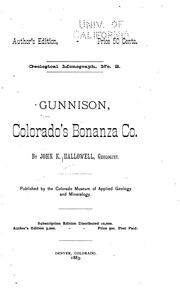
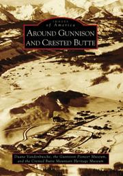

Search results from Open Library.
Recent natural events nearby
Ground air-quality sensors
Recently spotted species
Nearest stream gauge
Events
Gallery
Sources
- • Wikipedia
- • US Census Bureau (ACS 5-year estimates)
- • Wikidata
- • NCES via Urban Institute Education Data Portal
- • CDC PLACES
- • Open-Meteo / sunrise-sunset.org
- • Wikipedia Pageviews API
- • Open Library