Browse / United States / Colorado / Leadville
Leadville
Coloradocity

Leadville
Total population
2,620
Median home value
$447,600
Bachelor's+
Median income
$86,350
Founded
1877
Demographic figures from US Census Bureau · ACS 5-year estimates. Overview below cites Wikipedia and may reference a different year.
City facts
Facts from Wikidata (CC0).
Overview
Leadville is a statutory city that is the county seat of, the most populous community in, and the only incorporated municipality in Lake County, Colorado, United States. The city population was 2,633 at the 2020 United States census. It is situated at an elevation of 10,119 feet (3,084 m). Leadville is the highest incorporated city in the United States and is surrounded by the two tallest peaks in the state, Mount Elbert and Mount Massive.
Read more on WikipediaHistory & geography
History
The Leadville area was first settled in 1859 when placer gold was discovered by A. G. Kelley in California Gulch, and by Abe Lee in April (25/26) 1860, during the Pikes Peak Gold Rush. Horace Tabor, who became known as the "Leadville Silver King", and his wife Augusta were among the first prospectors to arrive in Oro City. Horace was appointed as the postmaster of Oro City on November 30, 1868. The early miners had noted that mining for placer gold was hampered by heavy black sand in the sluice boxes, and in 1874 it was discovered that the heavy sand that impeded gold recovery was the lead mineral cerussite, which has a high silver content. Prospectors traced the cerussite to its source, present day Leadville, and by 1876 had discovered several silver-lead lode deposits. By this time, most of the placer gold had been extracted from the gulch; attention shifted to nearby Leadville, and Oro City became a ghost town. The town was built on desolate flat land below the tree line. The first miners lived in a rough tented camp near the silver deposits in California Gulch. Initially, the settlement was called "Slabtown", but when the residents petitioned for a post office, the name "Leadville" was chosen. By 1880, Tabor and Meyer's new town had gas lighting, water mains, of streets, 5 churches, 3 hospitals, 6 banks, and a school for 1,100 students. Many business buildings were constructed with bricks hauled in by wagons. In early 1878, Meyer, along with Leadville's pioneer smelter entrepreneur, Edwin Harrison, after whom the famed Harrison Avenue is named, and Tabor established a post office in Leadville, with George L. Henderson designated as postmaster on July 16, 1877. Swindles were not uncommon in the mining community. When the Little Pittsburg mine was exhausted of…
Geography
At an elevation of , Leadville lies close to timberline, which in Colorado is from . The surrounding peaks are all well above 12,000 feet, and are thus bare of trees. Leadville has the highest elevation of any city in the United States. Leadville lies in a valley at the headwaters of the Arkansas River, situated between two mountain ranges, the Mosquito Range to the east and the Sawatch Range to the west, both of which include several nearby peaks with elevations above , the so-called fourteeners. According to the U.S. Census Bureau, the city of Leadville has an area of , all land. The lower part of California Gulch runs past the southern edge of the city, flowing west to the Arkansas River. Leadville has an alpine subarctic climate (Dfc) with cold winters and mild summers, bordering on a cold semi-arid climate (Bsk). The average January temperatures are a maximum of and a minimum of . The average July temperatures are a maximum of and a minimum of . There are an average of 271.7 mornings annually with freezing temperatures, which can occur in any month of the year. The record high temperature was on July 17, 2023. The record low temperature was on February 1, 1985. Average annual precipitation is . The wettest calendar year was 2014 with and the driest 1994 with . The most precipitation in one month was in January 1996. The most precipitation in 24 hours was on February 13, 1986. Average annual snowfall is . The most snowfall in one year was in 1995. The most snowfall in one month was in May 1995. |source 2 = National Weather Service }}
Excerpted from the corresponding Wikipedia article (CC BY-SA).
Demographics & economy
Race & ethnicity
Source: US Census Bureau — American Community Survey, 5-year estimates.
Geography
Coordinates & boundaries from the US Census TIGER/Line shapefiles.
Climate
Current forecast
Forecast for Leadville, CO from NOAA NWS API.
Air quality
Industrial & pollution facilities
Natural hazard risk
Health (adults)
Age-adjusted prevalence estimates from CDC PLACES (latest release).
Walkability
Amenities nearby
Wildlife & biodiversity
Most-observed species
- Mountain ChickadeePoecile gambeli (Ridgway, 1886) · Aves1,417
- Common RavenCorvus corax Linnaeus, 1758 · Aves1,010
- Gray JayPerisoreus canadensis (Linnaeus, 1766) · Aves952
- American RobinTurdus migratorius Linnaeus, 1766 · Aves917
- White-crowned SparrowZonotrichia leucophrys (J.R.Forster, 1772) · Aves869
- Dark-eyed JuncoJunco hyemalis (Linnaeus, 1758) · Aves842
- Steller's JayCyanocitta stelleri (Gmelin, 1788) · Aves797
- Broad-tailed HummingbirdSelasphorus platycercus (Swainson, 1827) · Aves743
Citizen-science & research observations from the Global Biodiversity Information Facility (GBIF).
Schools
Largest nearby schools
- Lake County High SchoolHigh · LEADVILLE · 414 students · 14.3:1 ratio
- Lake County Elementary SchoolElementary · LEADVILLE · 268 students · 17.9:1 ratio
- Lake County Intermediate SchoolElementary · LEADVILLE · 262 students · 15.4:1 ratio
- Cloud City High SchoolHigh · LEADVILLE · 35 students · 11.7:1 ratio
Public K–12 schools within ~10 mi from Urban Institute Education Data Portal (NCES Common Core of Data, 2022).
Earthquake history
Most recent
- M 2.8 — 2026-06-0610 km NE of Redstone, Colorado
- M 2.6 — 2026-02-0612 km S of Mulford, Colorado
- M 2.5 — 2022-06-236 km NNW of Gypsum, Colorado
- M 2.8 — 2021-04-119 km E of Woody Creek, Colorado
- M 2.5 — 2020-10-242 km ESE of Georgetown, Colorado
- M 2.6 — 2019-05-281 km ENE of Gypsum, Colorado
Events from the USGS Earthquake Catalog (global) (FDSN Event Web Service).
Photos
Sights & places nearby
Notable people from here


People born within ~10 km, from Wikidata (CC0). Click any name for their Wikipedia article.
Nearby places in Colorado
Geography & sun
Elevation, sunrise/sunset and daylight from Open-Meteo. Solar climatology from NASA POWER.
Nearby airports
Public attention
Pageview totals from the Wikimedia Pageviews API.
Books about Leadville


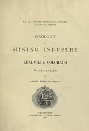


Search results from Open Library.
Recent natural events nearby
- Wildfire 310, Garfield, ColoradoWildfires · 2026-08-06 · 91 mi
- Wildfire Swiss Roll, Archuleta, ColoradoWildfires · 2026-08-20 · 131 mi
- Wildfire Post, Las Animas, ColoradoWildfires · 2026-08-11 · 181 mi
- Wildfire Moonshine, Albany, WyomingWildfires · 2026-09-07 · 194 mi
- Wildfire Slough Canyon, Grand, UtahWildfires · 2026-08-15 · 194 mi
- Wildfire LAUGHLIN, Colfax, New MexicoWildfires · 2026-08-25 · 213 mi
- Wildfire Sheep Pen, Las Animas, ColoradoWildfires · 2026-08-12 · 222 mi
- Wildfire Frijoles, Santa Fe, New MexicoWildfires · 2026-08-05 · 232 mi
Wildfires, storms and other events from NASA EONET (last 12 months, within 250 mi).
Ground air-quality sensors
Recently spotted species
Nearest stream gauge
Events
Gallery
Sources
- • Wikipedia
- • US Census Bureau (ACS 5-year estimates)
- • NOAA National Weather Service
- • Wikidata
- • USGS Earthquake Catalog (global feed)
- • NCES via Urban Institute Education Data Portal
- • GBIF (Global Biodiversity Information Facility)
- • CDC PLACES
- • Open-Meteo / sunrise-sunset.org
- • Wikipedia Pageviews API
- • Open Library
- • NASA EONET